150 Years of the Tricolor in the Antipodes
The opening of the Suez Canal on 18th November 1869, designed by the French engineer Vicomte Ferdinand de Lesseps, cut over two thousand miles off a voyage by French vessels owned by Messageries Maritimes, established in 1851, on their voyages to the French colonies in the Far East and the South Pacific. The opening ceremony convoy through the Suez Canal was headed by the French Royal yacht Aigle, with the Messageries Maritimes mail steamer Peluse as second in the line with the company steamers Thabor and Godavery also in the same convoy. A regular service to the colonies demanded organisation and communication, with French submarine telegraph cables laid across the Mediterranean in 1864 connecting within a few years with the 1873 cables of the Eastern Extension, Australasian and China Telegraph Company, and the 1876 cable connecting Australia with New Zealand. Nine new passenger and cargo steamers for the Far Eastern service, and eight new passenger and cargo steamers for the Noumea service via Australian ports, were then completed for Messageries Maritimes between 1869 and 1884.
French Influence In The South Pacific
French influence in the South Pacific is still very strong over 250 years after Capitaine Louis-Antoine Bougainville (1729-1811), a French admiral and explorer, made several important discoveries in the Pacific. He was a contemporary of Capt. James Cook and also circumnavigated the globe just before that of Cook. He sailed from Nantes with two ships in November 1766 and set up a small settlement on the Falklands before moving into the Pacific. He made several island discoveries in the Tuamotu Group before arriving in Tahiti, narrowly missing becoming their discoverer, as the British Capt. Wallis had arrived only a few months previously. By June 1767, he had discovered Samoa, the New Hebrides, Espiritu Santo, the Solomon Islands, naming Bougainville Island after himself. Bougainville Strait separates this island from Choiseul in the Solomons, and the name is also applied to the strait between Mallicollo and Espiritu Santo islands of the New Hebrides. He sailed past the many outer islands of present day Papua New Guinea, and arrived back via the Cape of Good Hope at St. Malo on 16th March 1769, losing only seven men from the 330 crew of two ships.
This enlightening voyage of exploration is the reason behind the strong French present day influence in French Polynesia and the South West Pacific. Capitaine Dumont d’Urville in 1827 sailed the Pacific searching for his lost countryman, Comte de la Perouse, whose ship had sunk near the Solomons in 1788. The writings of d’Urville on this voyage and another ten years later established the concept of three great subdivisions of the Pacific into Melanesia, Micronesia and Polynesia.
French Polynesia comprises several scattered and widely spread out groups of islands lying two thirds of the way between Panama and New Zealand. The Windward Islands of Tahiti and Moorea, and the Leeward Islands (Iles Sous le Vent) lying 160 kilometres to NW of Tahiti, form the main Society Islands group, along with the Tuamotu Archipelago of eighty atolls, the Marquesas Archipelago lying 1,450 kilometres to north east of Tahiti, and the Gambier Islands lying 1,600 kilometres to south east of Tahiti. In total, there are 35 islands and 83 atolls in French Polynesia, of which 76 are inhabited. The total land area of French Polynesia is 1,500 square miles, not much compared to the 64 million square miles of the Pacific Ocean. The highest point on Tahiti is Mount Orahena, but most of the population of 78,000 live in Papeete. The native population when the French and British first arrived was actually higher at 100,000, but disease carried by the white man soon decimated this figure to only six thousand.
The main port of Port Autonome de Papeete on Tahiti is where the CMA CGM and Marfret vessels call on their service to Noumea on New Caledonia and onward to Australian and New Zealand ports. The last Bank Line vessels called here in September 2009 and used the same berths as the chartered CMA CGM and Marfret vessels use today to load copra, sugar cane, mother of pearl, coffee and vanilla. The Passenger Terminal (Gare Maritime) is used by 1.6 million inter-island passengers from Moorea (25 kilometres across the Sea of the Moon), Bora Bora, Tahaa and Raiatea, and by fifteen inter-island ferries including a car ferry and a high speed catamaran of Aremiti Ferries. There are around ten thousand international cruise passengers annually. A total of 1.9 million tonnes of cargo and 70,000 TEU of containers are handled annually at the cargo port zone of Motu Uta. Papeete lies at the north west corner of Tahiti Nui, which has a narrow connection to the smaller island of Tahiti Iti. Tahiti has white beaches, turquoise lagoons and many vertical waterfalls and is a gorgeous cruise and holiday destination.
Tahiti is the largest island and was annexed by France in the late 19th century. However, a confrontation had taken place between the French and the British in November 1843 in the exotic setting of Tahiti. Admiral Dupetit-Thouars acted beyond his instructions and annexed Tahiti for France. The British consul was imprisoned with all of the British residents enraged. A sensible compromise led Tahiti becoming not a French possession for the time being but a protectorate of both nations. The islands were governed by France under the decree of 1885 until 1946 when French Polynesia became an Overseas Territory administered from Papeete. A new constitution was agreed in 1977 whereby France kept responsibility for defence, foreign affairs, and financial and judicial matters, but political and commercial powers were introduced for local people. The French Polynesia economic zone was extended at the same time to 200 nautical miles from the Tahiti coastline.
The French island of New Caledonia lies 930 miles east of Queensland and is very long and narrow with a mountainous spine running down the middle of the island. The area is 16,372 square kilometres with another 1,981 square kilometres on the nearby Loyalty Islands, and also the small Chesterfield Islands lying 400 kilometres north west of New Caledonia. In 1853, Napoleon III sent a small naval force to take New Caledonia, which was achieved with only token resistance from the British including one irate Scottish missionary. Noumea, the capital, has a very French, very colonial atmosphere, with all residents having full French citizenship. The Place des Cocotiers (Coconut Square) is the main plaza in central Noumea. There are numerous nickel mines in the interior of the island owned by the Societe Le Nickel, reached by 28 private airstrips.
The main port with several quays is Noumea, with passenger and cargo services linking to other nearby islands, especially to Port Vila on Efate Island in the former jointly administered French and British condominium of New Hebrides, now called Vanuatu after independence in 1980. The ferry terminal at Noumea is adjacent to the Cruise Terminal and the Musee de Histoire Maritime, and is situated in a small natural harbour protected by an island on its west flank. The maximum vessel length is 500 feet, and the port cranes have a maximum heavy lift of one hundred tonnes. Noumea has a charming mix of French and Melanesian character, with dazzling beaches, surrounding lagoons in many shades of blue, and a sunny climate.
Messageries Maritimes South Pacific Services
Eight steamers were ordered from a yard at La Ciotat on the south of France in the late 1870s to serve Noumea on New Caledonia and Australian ports. Saghalien was launched at La Ciotat on 25th July 1880 but was transferred on completion to the Far East colonies service until 1883. This allowed the second ship, the twin funnelled Natal of 4,106 grt, to inaugurate the Marseille via Reunion and Mauritius to Sydney (NSW) on 23rd November 1882, with a feeder ship linking to Noumea. The sisters Melbourne, Caledonien, Sydney, Salazie, Yarra and Oceanien had also entered service to Sydney (NSW) and Noumea by July 1884. The eight near sisters had accommodation for 200 passengers in three classes with a crew of 196. The conference system was extended to Australia and the South Pacific in 1886 when Messageries Maritimes joined Blue Funnel, P. & O. and other British shipping companies in the cartel system.
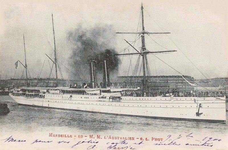
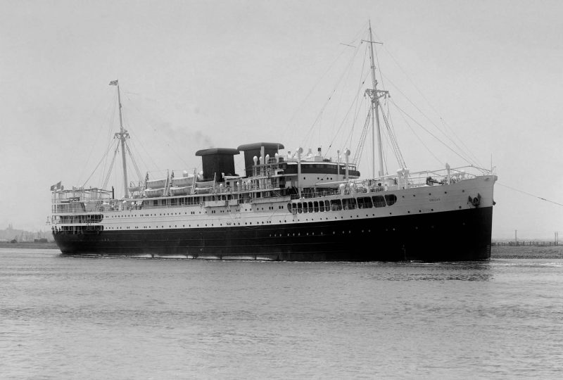
Larger passenger and cargo steamers to Noumea followed with the twin funnelled class of four in 1890 of Australien, Polynesien, Tasmanien and Malaisien of 6,630 grt with accommodation for 170 First Class passengers, 70 in Second Class and 112 in Third Class and a crew of 170. Tasmanien, renamed Armand Behic, was the last of this class in service to the South Pacific when she was sent for breaking up at Marseille in October 1924. In 1903, Nera (ex La Plata) and Dumbea (ex Bresil) were transferred to the Pacific route from the South American service, as they had good passenger accommodation of 132 in First Class, ninety in Second Class, plus a large number of steerage passengers. The feeder vessel Pacifique of 1,938 grt spent all of her life as the Sydney to Noumea feeder vessel from April 1899 to March 1925 when she was sold for demolition in Japan, with Dupleix of 2,394 grt then continuing the feeder service from 1925 to the end of 1928. The new twin funnelled Eridan of 9,927 grt entered Pacific service in November 1929 from the La Ciotat yard with accommodation for 151 passengers in two classes and 1,200 troops in dormitories erected in the holds. She was the first of the famous Messageries Maritimes passenger liners with twin square mushroom topped ‘nautonaphtes’ funnels. She ran the South Pacific services via the Suez Canal from 1930 until requisitioned for war service in July 1940.
El Kantara of 6,879 grt, completed in 1904 at La Ciotat, became the first Messageries Maritimes vessel to transit the Panama Canal in November 1914, but plans for a Direct Panama Line to the South Pacific had to be delayed due to the onset of World War I. She repatriated the Tahitian Army contingent of the French Army in 1919 via the Panama Canal, and then with her sister Louqsor, inaugurated the Direct Panama Line to Tahiti and New Caledonia in 1920, serving until they were broken up in December 1926 and March 1930 respectively. They carried 94 passengers in two classes with 1,200 troops in dormitories in the holds with a crew of 102.
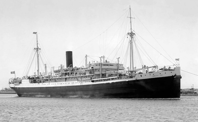
The passenger and cargo ship Commissaire Ramel of 10,061 grt began on the Marseille to Australia service via Suez in 1927, but was re-routed via Panama and the French Pacific islands in 1935. She was requisitioned for war service at Fiji in July 1940, managed by Shaw, Savill & Albion Co. Ltd., and was sunk by the raider Atlantis in the Indian Ocean on 20th September 1940. The crew were interned at Mogadiscio until released by the British. Cargo ships of between 7,500 dwt and 10,000 dwt such as Antinous, Andromede, Astrolabe, Boussole, Esperance, Recherche, Ville de Strasbourg, Ville d’Amiens and Ville de Verdun were also used by Messageries Maritimes during the inter-war years, but sailings were suspended in 1933 due to unsustainable levels of trade during the Depression.
After the destruction of World War II, Messageries Maritimes rebuilt their South Pacific services in 1946 with the passenger/cargo-liner Sagittaire of 7,707 grt, and the chartered sisters Chungking and Changchow of 9,400 grt from Swire of Hong Kong between 1950 and 1952. The new ‘ME’ type sisters Caledonien and Tahitien of 12,712 grt were then delivered in 1952 for the Direct Panama Line service with accommodation for 240 passengers in three classes, 122 troops and a crew of 138. They ran uninterrupted to the South Pacific for the next twenty years, assisted by the cargo only motor vessels of the ‘G’, ‘H’, ‘I’, ‘V’ and ‘Z’ classes, and the five year charter of the passenger and cargo vessel Melasien of 10,825 grt between 1958 and 1963, and the four year charter of the passenger and cargo Oceanien of 10,726 grt between 1963 and 1967. The passenger liner Viet Nam, dating from 1953, was transferred to the South Pacific service in 1967 from the Far East service, as a new liner that had been laid down at Bordeaux as Australien for the Pacific service had been completed instead as Pasteur of 17,986 grt in November 1966 for the South American service. However, all passenger carrying by Messageries Maritimes ended in September 1972, with Pasteur sold to The Shipping Corporation of India for further service.
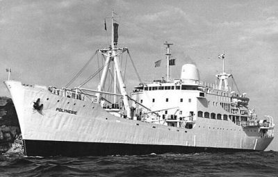
The inter-island motor vessel for the many South Pacific islands in post-war years was Polynesie of 3,709 grt equipped with bipod masts to serve her three holds and with accommodation ‘midships for 36 passengers. She was built at Nantes in 1954 by Chantiers Dubigeon and had a service speed of fourteen knots on her long distance Pacific services. She acted as host ship in 1956 during the fiftieth anniversary of the Franco-British-Australian condominium of the New Caledonia and Fiji group of islands. She sailed from Port Vila for the last time on 30th October 1975, and was sold on 20th December 1976 to Guan Guan Shipping of Singapore and renamed Golden Glory and was broken up at Kaohsiung in 1979. She was assisted by the engines aft motor vessel Marania of 2,063 grt for local island services out of Papeete (Tahiti).
CGM and Marfret Joint South Pacific Service
The French State owned Compagnie Generale Maritime (CGM) had been formed on 1st March 1977 by the fusion of Messageries Maritimes and Compagnie Generale Transatlantique (CGT), and became the privately owned CMA CGM in 1999. CGM used conventional cargo ships and ro-ro vessels in the South Pacific from 1977, and then ten years later purchased the ro-ro and container operation of Pacific Australia Direct (PAD) of Australian National Line (ANL). This route from Australia and New Zealand to the West Coast of the U.S.A. was purchased from ACT (Australia) and Transatlantic A/B of Sweden. Three big ro-ros joined the CGM fleet as CGM Rimbaud (ex Elgaren), CGM Racine (ex Kolsnaren), with the chartered German owned Lillooet becoming CGM Rabelais, and the trio were transferred to the North Europe to South Pacific route. The CGM 1975/76 built ro-ro trio of CGM Rostand, CGM Rodin and CGM Rousseau replaced them on the PAD service, renamed as PAD Australia, PAD America and PAD Canada respectively.
An opportunity was taken in 1995 by Marfret of Marseille, founded in 1951, to run a long distance service to the South Pacific with fortnightly services from Northern Europe to Papeete, Noumea, Australian and New Zealand ports. On 15th July 1995, Marfret took over the South Pacific sailings from Dunkirk of Europac, which handled the ConRo vessels of the Baltic Shipping Company, a former Soviet conglomerate. Europac was bankrupt and Marfret were acting as sub-agents for the service, and decided to keep the service running and took over a fleet of three thousand containers and four ‘Astrakhan’ type vessels. The following month of August 1995 saw a vessel and space sharing agreement with CGM of France to the South Pacific. The multi-purpose Providence (ex Nordcloud) of 22,420 dwt and 1,654 TEU capacity was purchased in 1996 to maintain the CGM/Marfret service from Antwerp and French ports to Papeete, Noumea, and Australian and New Zealand ports. Marfret Provence (ex CGM Matisse and Andre Rickmers) of 30,725 dwt and 2,335 TEU capacity was then chartered from Rickmers in 1998 for the South Pacific service to French Polynesia and Noumea in New Caledonia, which became a joint Round the World service in Millennium year with CMA CGM of France and Contship Lines.
The former French possessions of Algeria and Tunisia in the Western Mediterranean had seen the first Marfret services in 1951, and these have since encompassed several of the present French overseas possessions of French Guiana, Guadeloupe, Martinique, Reunion, French Polynesia, Mayotte, St. Martin, and New Caledonia. In 1951, Claude Vidil (1925-2014), a shipbroker, joined his lifelong associate of Pierre Giraud in forming the company Marseille-Fret in Marseille. They chartered an old Icelandic three masted fishing boat named Douce France (Sweet France) and carried general cargo to Algerian and Tunisian ports. They also chartered other coasters for tramp cargoes that no other shipowners would touch in the Western Mediterranean e.g. explosives, cement, clinker and butane.
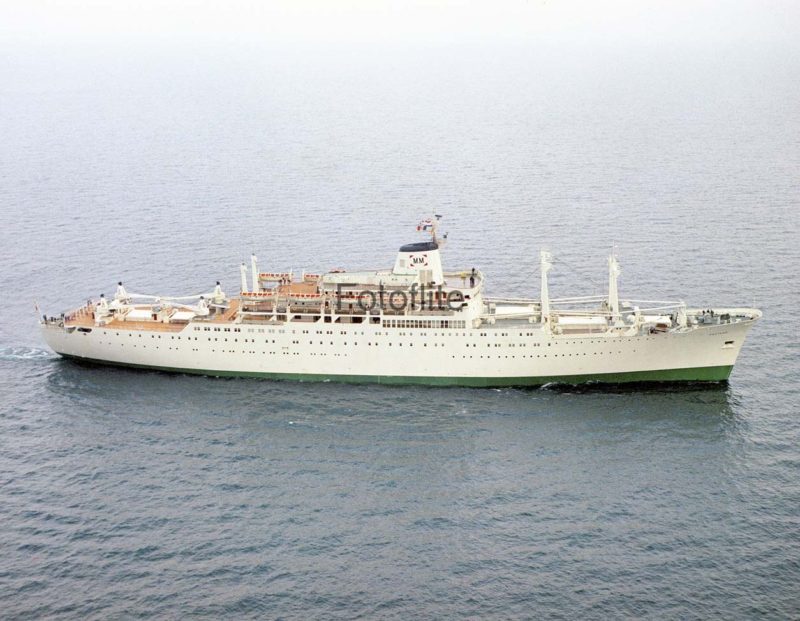
In 1955, the partners purchased their first ship, Cotes des Legendes of 375 dwt built in 1951 at Zaltbommel in Holland by N.V. Scheeps ‘De Waal’. A top speed of only nine knots was all that its Paris built six cylinder diesel engine could make, and she was mostly used for the redistribution of military material to the smaller ports of the Algerian coastline. Profits were made and two more motor coasters followed in Douce France 300/55 and Mejean 499/56, the latter being abandoned in a heavy Mistral wind off Cape Sicie near Toulon on 24th December 1964, following a blaze caused by an explosion of cargo in a hold.
In 1970, Douce France of 2,150 dwt was purchased from German owners as Hanseat. She had been built in 1965 by the Neptun yard at Rostock and had a service speed of twelve knots from a Klockner Humboldt Deutz diesel of 1,300 bhp. The fleet also included the motor coasters Niolon 499/66, Saumaty 778/67 and Mejean II 499/60, the latter being used as a floating zoo in 1972 for the quarantine of wild animals imported from Kenya. Niolon was sold in 1974 and renamed Lucona under the Panamanian flag and sank off the coast of India on 23rd January 1977 as a result of criminal action, a book and a film called ‘The Lucona Case’ followed. Tamaris of 2,680 dwt was purchased in 1973, having been completed ten years earlier at Langesund as Nina, and was purchased as Finnrover. She had twin holds, twin hatches served by four derricks, and had a service speed of fourteen knots from a six cylinder two stroke single acting Sulzer diesel of 2,300 bhp.
Marseille-Fret was operating seven vessels in 1975 with a flagship of 6,100 dwt completed in 1968 as Atlanta but purchased as Scol Independent and renamed as Le Rove. She was another product of the ‘Neptun’ yard in Rostock, with her single hold served by four derricks including a heavy lift of fifty tonnes capacity through two hatches. She carried grain and other bulk cargoes around the Mediterranean, particularly to Libya, at a service speed of 15.5 knots from a nine cylinder two stroke single acting Werkspoor diesel of 3,000 bhp manufactured in Amsterdam. Unfortunately, Le Rove was dramatically seized and held in Benghazi from 1979 for six years until 1985 by the Libyan authorities, and was only released by an ‘exchange’ with the Libyan owned Ghat, held at Marseille. However, Le Rove was in such a bad state from her long detention that she was fit only for the scrapyard.
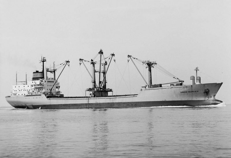
After this debacle, Claude Vidil sought out new areas of trading to French island possessions in the Caribbean and the South Pacific. The ‘Neptun’ type cargo ship, the former Claudia Maria of 13,240 dwt was purchased in 1980 and renamed Douce France III, and sailed from Rouen with 10,000 tonnes of wheat for Pointe a Pitre on Guadeloupe on her maiden Marfret voyage. This service was later extended to Degrad des Cannes in French Guyana, topped up homewards with island produce cargoes from Guadeloupe and Martinique, with Douce France III replaced in 1986 by Antilles of 11,590 dwt operating a regular liner service from Rouen.
Current Panama Direct Line And South Pacific Service
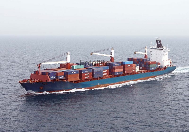
This joint CMA CGM and Marfret service today operates from Rotterdam, Tilbury, Dunkirk, Le Havre, New York, Savannah, Kingston (Jamaica) and Cartagena to Panama, Papeete, Noumea, Sydney (NSW), Melbourne, Tauranga, Napier, Lyttelton, Manzanillo (Mexico), Savannah, Philadelphia and North European ports. A fortnightly South Pacific service is maintained by six vessels, with a regular river service to Paris and Rouen to bring South Pacific and other cargo from Le Havre to the French capital. Five of these vessels are owned by CMA CGM, and one vessel by Marfret. The Marfret vessel on the South Pacific service via Panama is Rossini of 33,900 dwt and 2,478 TEU capacity with four hundred reefer plugs. She was built in 2005 by Aker at Wismar as Julia Schulte for charter work with a length of 208 metres and beam of 30 metres and with three deck cranes of 45 tonne capacity, and was taken on charter by Marfret in February 2014 and renamed as Rossini. CMA CGM operates the other five similar vessels of CMA CGM Auckland, CMA CGM L’Etoile, CMA CGM Lavender, CMA CGM Utrillo and CMA CGM Mozart of between 2,500 to 2,850 TEU capacity.
Sofrana Services In The South Pacific
A number of French South Pacific businesses were begun in the late 1960s under the name of ‘Sofrana’ (SOciete FRAncaise de NAvigation) on the French Pacific island of New Caledonia. Sofrana Unilines was formed in 1968 with the small motor coaster Moana of 499 grt chartered to the French Government to trade from Noumea, the capital and port of New Caledonia, to the Wallis and Futuna Islands via Suva (Fiji) and Port Vila (New Hebrides later Vanuatu). The company logo incorporated the white Maltese Cross of the Wallis and Futuna Islands and has been used ever since on a blue funnel. Another sister company was founded by Marcel Leroux, who arrived in Noumea in 1970. He purchased the Office Caledonien de Distribution Pharmaceutique (OCDP) and developed this wholesale pharmaceutical business for the island, selling to retail pharmacists, but unfortunately died as a result of an automobile racing accident in 1974 with his son Didier Leroux (born in 1946) taking over this company. It was later renamed as Sofrana (Nouvelle Caledonien), and offered logistics, trucking and barging solutions for the booming New Caledonia mines. Didier Leroux later in 1997 purchased the entire shareholding of the Sofrana Group, and today is a leading politician on the island, leaving the running of his two companies to his son Jean-Baptiste Leroux and his managing directors.
The Wallis and Futuna Islands comprise two island groups, Wallis Island (Uvea) and twenty islets, and the beautifully forested Futuna Island (Hooru) 230 kilometres to the south west, comprising the two islands of Futuna and Alofi. The islands are located to the north east of Fiji and 250 miles to the west of Samoa, with the capital of Mata’utu on Wallis. The Dutch discovered the southern group of islands in 1617 and named them as the Hoorn Islands. The French occupied the Wallis group in 1842, and a French protectorate was established in the 19th century and subsequently became a dependency of New Caledonia in 1887. Wallis Island was used as an important forward air base for American troops fighting the Japanese through the islands. The islands became a French Overseas Territory in July 1961 when the chiefs of the local population requested integration into the French Republic. In November 1983, two separate French Overseas Territories were declared after their affairs had been excessively concentrated on Wallis Island. Wallis and Futuna are quite different to each other, with the natives speaking different languages, as Wallis has ancestral links with Tonga while Futuna traces its roots to Samoa. Wallis has a beautiful clear blue lagoon and is flat in nature, with the small port of Mata’Utu exporting taro and vegetables.
During the decade of the 1970s, several Sofrana motor vessels of up to 5,000 dwt were operated to Noumea, the Wallis and Futuna Islands, Papua New Guinea and other South Pacific islands including Capitaine Cook 1,331/48, Capitaine Bougainville 3,614/55, Capitaine Tasman 1,674/57 and Capitaine Scott 1,765/61. In 1987, Sofrana and CGM of France took over the PAD ro-ro service of Australian National Lines (ANL) to North America with calls at Noumea, Suva and Honolulu to west coast American and Canadian ports. Consequently, larger vessels were required including two ‘stretched’ SD14s of 17,690 dwt in Capitaine Cook III and Capitaine Kermadec III, as well as Capitaine Tasman of 13,510 dwt, Capitaine Wallis of 13,850 dwt and Capitaine La Perouse (ex Nedlloyd Chatham) of 11,250 dwt.

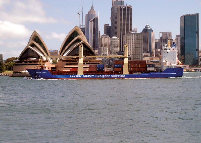
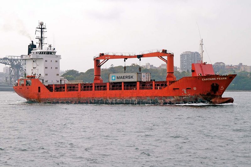
During the decade of the 1990s, a series of multi-purpose vessels and feeder container ships were chartered or owned including Capitaine La Perouse III of 7,410 dwt, Capitaine Cook of 9,600 dwt, Capitaine Fearn (ex Moana IV) of 3,500 dwt, Capitaine Kermadec of 12,700 dwt, Capitaine Magellan of 8,625 dwt, Capitaine Tasman of 10,683 dwt completed in 1991 as Papuan Chief and chartered from Swire in 1999, Capitaine Wallis (ex Penhir) of 4,380 dwt, and Capitaine d’Urville of 9,750 dwt. Capitaine La Perouse III, built at Durban in 1973, was immobilised by an explosion in the engine room on 31st July 1996 off Matangi Island while on a voyage between Auckland and Tauranga, injuring one crew member, and was towed back to Auckland. Capitaine Magellan entered service in September 1996 on the Papua New Guinea trade and also serviced Noumea, Port Vila in Vanuatu, and the Solomon Islands. She worked alongside the Russian chartered ship Socofl Stream of 430 TEU, and replaced Capitaine La Perouse III on the Papua New Guinea trade. She was towed into Auckland harbour on 20th September 2000 by the local tug Waipawa while on a voyage from the islands with a perishable cargo after sustaining main engine damage with her cargo discharged and a general average declared for the loss.
Calls are made frequently at Tauranga on the east coast of North Island of New Zealand on their South Pacific network, and cargoes include lime for Papua New Guinea mines, newsprint, steel, timber, dry and reefer containers, breakbulk and project cargoes e.g. yachts. A helicopter valued at $1 million was shipped as deck cargo from Auckland to Noumea in 2011 for use in the nickel mining industry. In 2001, the Sofrana fleet with ‘Capitaine’ names calling at Tauranga was joined by vessels with ‘Southern’ and ‘Sofrana’ prefixes.
Sofrana South Pacific Operations 2005 To 2015
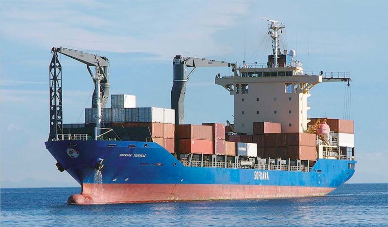
The Sofrana fleet of multi-purpose feeder container ships have during this decade been in the range from 6,000 dwt to 18,870 dwt, and from 500 TEU to 1,080 TEU capacity. These have included Sofrana Magellan of 9,725 dwt and 618 TEU capacity (chartered for seven years from 2001), Sofrana Kermadec of 9,590 dwt and 565 TEU capacity (chartered for two years to 2005), the sisters Sofrana Bligh and Sofrana Pasifika of 250 TEU capacity (chartered for four years), Sofrana d’Urville of 6,025 dwt and 422 TEU capacity (chartered for two years to 2005), and Sofrana Tourville of 10,734 dwt and 845 TEU capacity (chartered for two years to 2010), and replaced by a larger vessel of the same name.
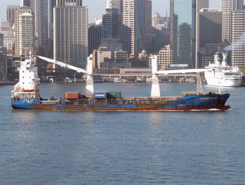
The sisters Southern Moana and Southern Cross of 5,350 dwt and 512 TEU capacity were chartered from Beluga Shipping Gmbh, with Southern Moana replacing Southern Cross on her Australian ports to Noumea rotation in 2007 when Southern Cross was redelivered from charter back to her owners in Europe. They were very useful vessels with twin port side eighty tonne cranes for container and heavy lifts, and the pair were well tested to their limits in extensive South Pacific Islands service.
Sofrana Pasifika suffered an engine breakdown and broken crankshaft on 14th January 2009 on a voyage to New Caledonia but arrived safely at Noumea, which was repaired with spare parts in ten days. Unfortunately, she suffered another broken crankshaft two months later with a very long delay in getting her back into service. Southern Lily II suffered a flooded fo’c’stle on 14th August 2009 in very heavy seas en route to Pago Pago and returned to Auckland for repairs with her cargo transhipped on to Southern Phoenix, Southern Tiare and Thor Pacific. Capitaine Wallis of 520 TEU capacity with twin 45 tonne deck cranes replaced the short term charter of Egersund on the Fiji to Wallis and Futuna Islands service in July 2011. Southern Cross was badly damaged at her stern by another vessel berthing at Suva on 8th January 2013, but after repairs in the port was able to sail to Lautoka on Fiji to complete her island cargo. Sofrana Surville entered Sofrana service in 2007 as a newbuild, and underwent her first special survey and dry-docking at the Cairncross yard in Brisbane in June 2012. In April 2014, Sofrana Unilines and Neptune Pacific Line entered into slot charter agreements with Maersk Line for the South Pacific region.
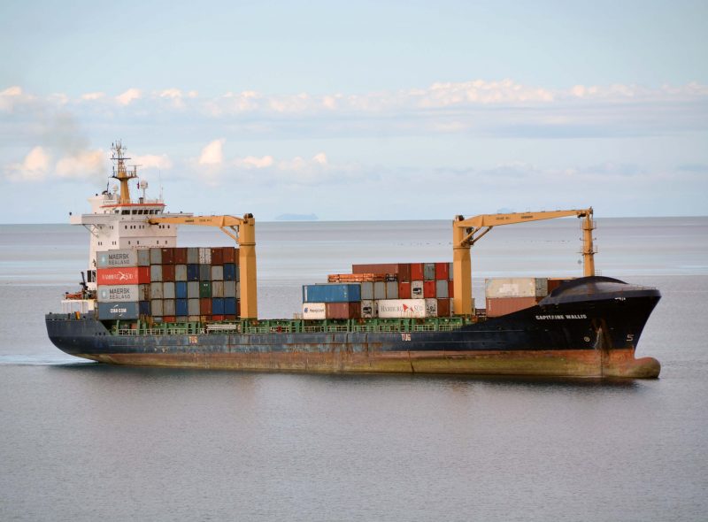
The Sofrana vessel heavy lift cranes are used to full capacity on the island trades, an example in May 2015 was the loading at Townsville in Queensland of an offshore work barge twelve metres long and five metres wide bound for Lihir Island, an extinct volcanic caldera, on Papua New Guinea, together with thirteen separate components of a ready mix concrete batching plant bound for Port Moresby. Sofrana Unilines currently run the following services to the Southern Pacific islands:-
Australia to West Pacific Islands (Melbourne, Sydney, Brisbane and Townsville to Port Moresby, Lae, Rabaul, Lihir and Honiara in the Solomons)
Australia to New Caledonia (Melbourne, Sydney and Brisbane to Noumea)
Australia to Wallis and Futuna Islands (Melbourne, Sydney, Brisbane to Suva with cargo transhipped to Wallis and Futuna Islands)
Australia to Tonga, Samoa and American Samoa (Melbourne, Sydney and Brisbane to Suva, Apia, Pago Pago and Nukualofa in Tonga)
New Zealand to West Pacific Islands (Lyttelton, Napier, Tauranga and Auckland to Port Moresby, Lae, Rabaul, Lihir and Honiara in the Solomons)
New Zealand to New Caledonia (Lytttelton, Napier, Tauranga and Auckland to Noumea)
New Zealand to Wallis and Futuna Islands (Lyttelton, Napier and Auckland to Suva with cargo transhipped to Wallis and Futuna Islands)
New Zealand to East Pacific Islands (Lyttelton, Napier and Auckland to Suva, Apia, Pago Pago and Nukualofa in Tonga)
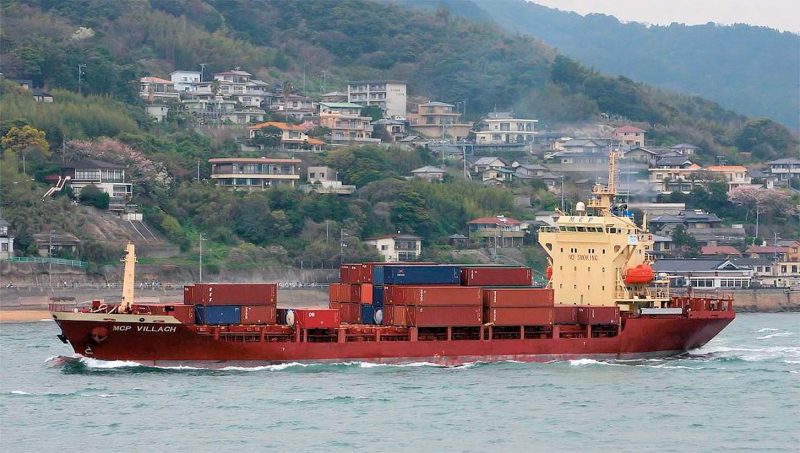
The following ten owned and chartered vessels were used in 2015 on voyages to ten countries and territories of the South Pacific, calling at eighteen ports:-
SOFRANA SURVILLE of 12,345 dwt, 887 TEU, 140.7 x 23.6 metres with a draft of 8.7 metres, two 45 tonne capacity cranes, service speed of 18.5 knots, launched as Monia in 2007 at Jiangsu in China and completed as Sofrana Surville.
SOFRANA TOURVILLE of 12,480 dwt, 1037 TEU, 142.7 x 22.6 metres with a draft of 8.2 metres, two 40 tonne capacity cranes, service speed of 18 knots, launched as Avra in 2009 in Busan and joined the fleet as Sofrana Tourville in 2010.
SOUTHERN FLEUR of 10,727 dwt, 756 TEU, length 130.0 metres, two 40 tonne cranes and completed in 2004.
FORUM FIJI of 13,017 dwt, 907 TEU, length 145.93 metres, two 40 tonne cranes and completed in 2006.
CAPITAINE TASMAN of 12,985 dwt, 907 TEU, length 145.93 metres, two 40 tonne cranes and completed in 2008 as a sister to Forum Fiji.
CAPITAINE COOK of 12,917 dwt, 950 TEU, length 145.9 metres, twin 40 tonne cranes, built in 2008 as Kota Rakan.
SOUTHERN PEARL of 5,945 dwt, 501 TEU, length 109.0 metres, two 45 tonne cranes and completed in 2003.
SOUTHERN LILY II of 18,870 dwt, 1080 TEU, length 159.93 metres, two 40 tonne cranes and completed in 2003.
MCP VILLACH of 7,665 dwt, 618 TEU, length 117.0 metres, two 40 tonne cranes and completed in 2008.
SOFRANA JOINVILLE of 7,664 dwt, 618 TEU, length 117.0 metres, two 40 tonne cranes and completed in 2008.
The Sofrana Group is also heavily involved in land based logistics with agency, stevedoring, freight forwarding, distribution and fish farming enterprises, and employs four hundred staff. There are main agencies in all of the Pacific Islands groups served by the fleet, with also an agency in Honiara in the Solomon Islands. Benoit Marcenac is Managing Director of Sofrana Unilines at its Head Office in Ponsonby in Auckland.
Postscript
The French shipping companies of Messageries Maritimes, CGM, CMA CGM, and Marfret, as well as Sofrana of New Caledonia, have proudly served the South Pacific islands for a total of a century and a half. Immense distances have been covered by their vessels in the South Pacific e.g. Sydney (NSW) to Noumea is 1,058 nautical miles, Auckland to Suva is 1,140 nautical miles, and Port Vila (Vanuatu) to Papeete (Tahiti) is a huge 2,417 nautical miles. The founder of Marfret, Claude Vidil, lived to the age of 89 years until he sadly passed away on 12th August 2014. The Marfret Group is now directed by his two sons, Raymond Vidil and Bernard Vidil.

Comments
Sorry, comments are closed for this item