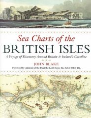
A Voyage of Discovery around Britain & Ireland’s Coastline
by John Blake
Sea Charts of the British Isles explores, through a series of historic charts, the multitude of sea ports, fishing and commercial harbours, naval bases, dockyards and seaside havens that have supported local life, and defended and imported for the nation.
The charts included are by many great names in British chartmaking, such as Captain Greenvile Collins, Lewis Morris, Professor Murdoch Mackenzie and his nephew of the same name, Graeme Spence and the surveyors of Sir Francis Beaufort’s ‘Grand Survey of the British Isles’.
The charts are complemented by navigational views that illustrate the approach to sounds and villages from the sea. Through the stories of chartmakers and publishers, coastal defence and trade, the development of navigation and the production of ever more accurate surveys, these charts also highlight the rich historical and cultural diversity in the British Isles.
This is an extremely well researched book which makes fascinating reading and I would very highly recommend it.
Published by:

Adlard Coles Nautical,
Bloomsbury Publishing, 50 Bedford Square, London WC1B 3DP
www.adlardcoles.com
Paperback: 280mm x 241mm, 128 pp illustrated

Price: £18.99


Comments
Sorry, comments are closed for this item