The Harbour Master’s Dream Or Nightmare?
The principle of Vessel Traffic Services (VTS) is not a new concept. Original systems were implemented shortly after the end of World War II, when radar control systems were established on the Isle of Man and at the Port of Liverpool in 1948. However, the concept of vessel traffic control has become a major part in the control of shipping, especially in restricted waters, and most major international harbour authorities handling large numbers of daily vessel traffic movements use electronic vessel traffic control to ensure the smooth and safe movement of vessels into and out of port, as well as through restricted international waterways such as the Strait of Dover or the Storebaelt, in Danish waters.
The practice of following predetermined routes for shipping originated in 1898 and was adopted, for reasons of safety, by shipping companies operating passenger ships across the North Atlantic. Related provisions were subsequently incorporated into the original SOLAS (Safety of Lives at Sea) Convention. The 1960 SOLAS Convention referred to ships’ measures in busy shipping areas on both sides of the North Atlantic, and contracting governments undertook the responsibility of using their influence to induce the owners of all ships crossing the Atlantic to follow recognized routes and to ensure adherence to such routes in converging areas by all ships, so far as circumstances permitted.
Meanwhile, the analysis of casualty statistics was showing that collisions between ships were becoming a worrying cause of accidents, especially in congested waterways. In 1963, the Liverpool Underwriters Association reported 21 collisions responsible for total losses of ships, compared with a five-year average of 13.8. A report on tanker hazards presented late in 1963 to the United States Treasury concluded that most accidents were due to human error, with speed in congested waters a principal cause. The report stated that there were too many diverse “rules of the road”, the width of navigable channels had generally not kept pace with the increase in sizes and tonnages of vessels, and not enough was being done to use modern communications.
At the same time, the Institutes of Navigation of the Federal Republic of Germany, France and the United Kingdom had begun a study on improving safety measures in congested areas, such as the English Channel. The group came up with a series of proposals, including the idea that ships using congested areas should follow a system of one-way traffic schemes, like those being used on land. Traffic lanes of this type were already in use on the Great Lakes of North America. The proposals were favourably received by the Maritime Safety Committee of IMO (then IMCO) in 1964 and governments were urged to advise their ships to follow the routes suggested by the group.
The IMO’s responsibility for ships is also enshrined in SOLAS Chapter V, Regulation 8, which recognizes the Organization as the only international body for establishing such systems, while Rule 10 of the COLREGs (Collision Regulations) prescribes the conduct of vessels when navigating through traffic separation schemes adopted by IMO. The responsibilities of the IMO are also determined under the United Nations Convention on the Law of The Sea (UNCLOS), which designates the IMO as “the competent international organization” in matters of navigational safety, safety of shipping traffic and marine environmental protection. In 1977 the Assembly authorized the Maritime Safety Committee (MSC) to adopt Traffic Separation Schemes (TSS) on the Organization’s behalf, in order to speed up the procedure (the MSC normally meets twice a year, the Assembly only once every two years).
Governments of coastal States intending to establish a new vessel routeing system, or amend an existing one, must submit proposed routeing measures to the IMO Sub-Committee on the Safety of Navigation (NAV), which will then evaluate the proposal and make a recommendation regarding its adoption. The recommendation is subsequently passed to the MSC for adoption. As well as traffic separation schemes, other measures adopted by IMO to improve safety at sea include two-way routes, recommended tracks, deep water routes (for the benefit primarily of ships whose ability to manoeuvre is constrained by their draught), precautionary areas (where ships must navigate with particular caution), and areas to be avoided (for reasons of exceptional danger or especially sensitive ecological and environmental factors). Ships’ systems and traffic separation schemes that have been approved by IMO, are contained in the IMO Publication, Ships’ Routeing, a thick volume, which is updated when schemes are amended or new ones added.
The publication includes General Provisions on Ships’ Routeing, first adopted by IMO in 1973, and subsequently amended over the years, which are aimed at standardizing the design, development, charted presentation and use of routeing measures adopted by IMO. The provisions state that the objective of the principle of ships’ routeing is to improve the safety of navigation in converging areas and in areas where the density of traffic is great or where freedom of movement of shipping is inhibited by restricted sea room, the existence of obstructions to navigation, limited depths or unfavourable meteorological conditions.
The following definitions summarise how a Traffic Separations Scheme is designed to function:
The Traffic Separation Scheme (TSS) is a measure aimed at the separation of opposing streams of maritime traffic by appropriate means and by the establishment of traffic lanes.
A traffic lane is an area within defined limits in which one-way traffic is established. Natural obstacles, including those forming separation zones, may constitute a boundary separation zone or line, which is a zone or line separating traffic lanes in which ships are proceeding in opposite or nearly opposite directions, or separating a traffic lane from the adjacent sea area, or separating traffic lanes designated for particular classes of ship proceeding in the same direction.
A roundabout is a separation point or circular separation zone and a circular traffic lane within defined limits.
An inshore traffic zone is a designated area between the landward boundary of a traffic separation scheme and the adjacent coast.
A recommended route is a route of undefined width, for the convenience of ships in transit, which is often marked by centreline buoys along a deep-water route.
The deep-water route is a route within defined limits which has been accurately surveyed for clearance of sea bottom and submerged articles.
A precautionary area is an area within defined limits where ships must navigate with particular caution and within which the direction of flow of traffic may be recommended.
An area to be avoided is an area within defined limits in which either navigation is particularly hazardous or it is exceptionally important to avoid casualties and which should be avoided by all ships, or by certain classes of ships.
Traffic separation schemes and other ship routeing systems have now been established in most of the major congested shipping areas of the world such as the Strait of Dover, the Malacca Straits, the Strait of Gibraltar, the Storebaelt and the Öresund, and the number of collisions and groundings in these areas has been dramatically reduced.
At the point of entering a traffic separation scheme in a limited waterway such as an international Strait, vessels passing through the Strait are assigned shipping lanes according to their size, speed and type, so as to ensure that vessels containing hazardous or dangerous cargoes are kept separate from those carrying conventional, non-hazardous loads. They must maintain that lane throughout their passage of the Strait, and must not deviate from their course. They are monitored by the national authority of the coastal State overlooking the Strait throughout their transit, and must ensure that all relevant information concerning their identity and cargo is communicated to the national authority concerned at the time of transit.
Weather conditions can also affect a ship’s navigation, and in 1983 IMO adopted resolution A.528(13), Recommendation on Weather Routeing, which recognizes that weather routeing, the principle by which ships are provided with “optimum routes” to avoid bad weather, can aid safety. It recommends Governments to advise ships flying their flags of the availability of weather routeing information, particularly that provided by services listed by the World Meteorological Organization.
In 1966, the Institutes of Navigation in the UK and West Germany published a report proposing maritime traffic separation schemes in a number of geographical areas, and in June 1967 a Traffic Separation Scheme, the first of its kind in the world, was established and implemented in the Straits of Dover, between the UK and France. This pioneering initiative, based on the principle of separate designated shipping lanes for both directions of passage, led to a significant reduction in the number of collisions between vessels on opposing courses through the Strait. However, at the time, observance of the scheme was purely voluntary, but in 1971 a series of accidents in the Channel led to calls for immediate action. In the most serious incidents, the tanker Texaco Caribbean collided with a freighter off the Varne shoals, and during the following night, the wreck of one of the vessels was struck by the freighter Brandenburg, which also sank. Some six weeks later, the freighter Niki struck the wreckage and sank with the loss of all 21 people on board at the time. As a result, the IMO’s Maritime Safety Committee meeting of March 1971 recommended that the observance of all Traffic Separation Schemes in operation should be made mandatory, and this recommendation was adopted by the IMO Assembly later the same year. The Traffic Separation Scheme in the Straits of Dover thus became the first mandatory traffic scheme from 1971. The following year, in 1972, the Conference which adopted the Collision Regulations also made the observance of traffic separation schemes mandatory.
The Strait of Dover became the world’s first IMO approved Traffic Separation Scheme in the 1970s, and was the first scheme to implement full radar surveillance. The Channel Navigation Information Service (CNIS) was introduced in 1972 to provide a full radio and radar safety service for all shipping in the Dover Strait, and is jointly operated by the UK and French Authorities from the Dover Maritime Rescue Co-ordination Centre (MRCC) and CROSS Gris Nez in France.
The Strait of Dover is one of the busiest shipping lanes in the world today. It handles a wide variety of ships passing each way through the Strait each day, as well as the frequent sailings of passenger and vehicle ferries across the Channel from the European Continent to the UK and vice versa. All maritime traffic passing through the Strait is directed into a series of tightlycontrolled shipping lanes under the Traffic Separation Scheme for both directions, with eastbound shipping traversing the French side of the Strait, and westbound traffic traversing the English side of the Strait. The means of controlling these maritime movements is undertaken by the English and French Coastguards within the scope of the CNIS maritime reporting mechanism, and this system is maintained by both authorities from each side of the Channel, with, in principle, information on vessel movements passed from each authority to the other where appropriate.
Unlike other areas of the UK coastline, the Strait of Dover is an area which limits the expanse of water between UK and Continental shores. Because of the limited distances between the UK and France (some 19 miles between the Foreland and Cap Gris Nez), it is impossible to enforce the normal limits imposed by the provision of the Territorial Sea, i.e. the 12 mile limit. At this point, only the 3 mile Limit applies insofar as national Territorial waters are concerned, and the waters within the Strait are monitored by both the UK and French Coastguards.
All ships passing eastwards through the Strait, on the French side of the Channel, must report to the French Coastguards at the CROSS Gris Nez location, and ships passing westwards, on the UK side, must report to CNIS Section of the Maritime and Coastguard Agency at the Foreland, overlooking the Port of Dover.
Mandatory Reporting in the Channel itself has only existed since 1999, mainly as a result of the need to monitor maritime traffic following the disaster resulting from the grounding and destruction of the tanker Erika off the French Coast. Prior to this, the MAREPS (Marine Reporting System) existed as a voluntary regime, but following a series of marine accidents it was decided to implement a mandatory Marine Reporting System to ensure that every vessel passing through the Strait of Dover reported to either of the national Authorities, depending upon its direction of sailing. The IMO Sub- Committee on the Safety of Navigation at its 46th Session in July 2000 approved a mandatory ship reporting system for the whole of the Channel from the Western Approaches opposite the French Lighthouse at Ouessant (Ushant) up to the existing controls at the Strait of Dover. The system, called MANCHEREP (Channel Reporting), would oblige ships above 300grt to give all information about themselves, including their identity and cargo, to coastal authorities. This system would complement the existing systems of the ship-reporting systems at Ouessant (OUESSREP), implemented in 1996, and the Pas-de-Calais Reporting system at Cap Gris Nez (CALDOVREP), implemented in 1999.

Alongside the mandatory reporting regimes in place, the regime of Traffic Separation Systems, regulating the distances separating ships sailing in line up or down the Strait, has existed since 1977. Alongside the CNIS regimes using the VTS technology, the AIS (Automatic Identification System) is also used to track and monitor the movements of vessels through the Strait subject to and adhering to the Traffic Separation Scheme, which can be viewed on internet AIS websites such as www.miu.com/ais, www.aislive.com, www.shipais.com or www.marinetraffic.com /ais portals. However, although AIS was made mandatory for all vessels by the end of 2004, it is still to a degree in its development stage concerning its use by many seaports.
Because of the nature of the International Collision Regulations concerning Traffic Separation Schemes (specifically Rule 10 of the COLREGS) in limited international waters such as the Strait of Dover, the CNIS Reporting System as applied over Maritime Traffic in the Strait is not only mandatory, but is also enforceable by law. Rule 10 of the COLREGS expressly states that vessels entering into TSS regimes must obey the Rules by maintaining their course and position within the Traffic Separation Scheme throughout the geographical area where it is enforced, and must not deviate from that course governed by the Scheme under any circumstances unless calling at a Port located within the area concerned. Instances have arisen where ships have failed to obey the Traffic Separation Scheme rules, and their details have been intercepted by the CNIS office at Dover. A report is then sent to the MCGA Enforcement Unit located at Southampton. Details of the rogue vessel concerned and the manner of breach of Rule 10 of the COLREGS are passed to the maritime administration of the vessel’s flag state for appropriate action in cases where the vessel is not bound for either a French or UK port, and is simply passing through the Strait. The result is often that the master of the vessel concerned has been prosecuted by the appropriate court of law. Where the vessel is bound for a UK Port, the master may be arrested by the UK authorities and prosecuted under the terms of Rule 10 by a UK Court of Law, with the sentence often being a substantial fine.
The subject of VTS itself is equally complex, yet it is a major part of international vessel reporting requirements, as it affects not only international straits but also entrances to major seaports, where maritime traffic is frequent and often congested.
In the summer of 1946, the British Admiralty, in conjunction with the Mersey Docks and Harbour Board, carried out experiments with naval radar equipment set up ashore at Liverpool. The demonstration confirmed the potential usefulness of shorebased radar. Similar experiments were carried out at Southampton, Halifax (Nova Scotia), Le Havre and Long Beach.
It is, perhaps, little known that the world’s first harbour control radar was actually installed at the end of Victoria Pier, Douglas, Isle of Man, and was inaugurated on 27th February 1948. Five months later, in July 1948, a more sophisticated port radar system was installed at the Port of Liverpool. In 1951, Long Beach in California established a radar and VHF to facilitate port operations. Le Havre also established a system and so gradually, other ports followed. At this time commercial radar, which made it possible under almost all weather conditions to observe vessel traffic from the shore, was comparatively new. In combination with VHF radio, a traffic surveillance system was achieved and real time information exchange between the shore and ships became possible. In more recent years, the system has been developed to include a more graphic and accurate display of vessels within the scope of the VTS system which appears on the monitors of the control system’s computers.
It was not until 1968, however, that the IMO adopted Resolution, A.158(ES.IV), Recommendation On Port Advisory Services, subsequently followed by Resolution A.587(14) in 1985, entitled Guidelines for Vessel Traffic Services. On 27th November 1997, IMO adopted Resolution A.857 (20), “Guidelines for Vessel Traffic Services” and its associated Annexes 1 and 2, “Guidelines and Criteria for VTS” and “Guidelines on Recruitment, Qualifications and Training of VTS Operators”. These Guidelines now set out the objectives of a VTS, outline the responsibilities and liability of the Governments involved and give guidance for planning and implementing a VTS as well as recruiting and training of VTS Operators.
In December 1998, the IALA Council adopted Recommendation (V-103) on “Standards for Training and Certification of VTS Personnel”. It recommends that, “National Members and other appropriate Authorities providing, or intending to provide, Vessel Traffic Services, to use the standards given in the Annex and their related model courses as the basis for the training and certification of VTS personnel”. In 2002, the amendments for SOLAS Chapter V came into force, of which Regulation 12 relates directly to Vessel Traffic Services. Recommendation V-103 was submitted to IMO and in May 2000 the Maritime Safety Committee issued Circular 952, in which they have “invited Member Governments to bring the IALA Recommendation and model courses to the attention of their VTS authorities when considering training and certification of VTS personnel”.
Recommendation V-103, together with its associated Model Courses, lays the foundation for training and qualification standards for the VTS personnel. Having such standards should ensure an efficient career structure and enhance the quality and determination of the VTS personnel concerned. By ensuring their VTS personnel are well qualified, the various VTS Authorities would likewise enhance the quality and professionalism of the Port itself. Such qualifications mean that a common performance standard can be achieved nationally and internationally. On 13th December 2002, the MSC issued Circular 1065, “IALA STANDARDS FOR TRAINING AND CERTIFICATION OF VESSEL TRAFFIC SERVICE (VTS) PERSONNEL”, in which Member Governments were invited to bring the IALA model courses to the attention of their VTS authorities, training institutes responsible for the training of VTS personnel and any other parties concerned.
From the early days of port radar in Gladstone Docks, Liverpool, in 1948, VTS has evolved as a service available in ports and countries around the world with the IMO guidelines. Today, VTS operators are trained to International Association of Marine Aids to Navigation and Lighthouse Authorities (IALA) standards and have the use of sophisticated radars, Automatic Identification Systems and Closed-Circuit Television (CCTV). Information provided to mariners onboard vessels is result-orientated and at no time is VTS considered as remote pilotage.
There are two types of VTS, these being Coastal VTS and Port VTS, whilst the type of services provided range from vessel traffic information, traffic organisation to navigational assistance. Coastal VTS primarily provides traffic information and are often utilised in supervising Traffic Separation Schemes such as Channel Navigation Information Service for the Dover Straits. Port VTS can provide different degrees of coverage dependant on the risk assessment for the port. A Port VTS provides up to date information to port stake holders such as ships agents, towage companies and Customs. Both Port and Coastal VTS can also play a vital role in Search and Rescue operations and the introduction of CCTV in ports contributes to security. Supervision of areas where there are submarine cables and pipelines can ensure vessels do not anchor on or near these obstructions and provide warning of vessels dragging anchor. In the event of a marine incident, VTS have access to records of radio traffic, radar tracks and AIS to provide information for accident investigation and to provide practical aids to training.
VTS has now come of age, and all new and existing VTS operational personnel can now be trained at an accredited VTS training establishment in order to achieve an internationally accepted qualification, bringing the profession into line with their seagoing colleagues including maritime Pilots.
Traffic Separation Schemes and other ships’ routeing systems can be integrated with a VTS system, which is defined and intended as a service designed to improve the safety and efficiency of vessel traffic and to protect the marine environment. VTS may range from the provision of simple information messages to ships navigating in certain areas, such as the position of other marine traffic or meteorological hazard warnings, to the extensive management of marine traffic within a port area or a waterway.
Generally, ships entering a VTS area report to the authorities, usually by radio, and may be tracked by the VTS control center, usually located at or close to a port. Ships must keep watch on a specific VHF radio frequency (set at specific Channels, such as Channel 11 or 15) for navigational or other warnings, while they may be contacted directly by the VTS operator if there is risk of an incident or, in areas where traffic flow is regulated, to be given advice on when or where to proceed. The VTS operator watches a computer screen monitor to monitor the vessel’s movement as it enters or exits the river or estuary channel, along with the movements of other vessels in the vicinity.
Traditionally, the master of a ship is made responsible for a ship’s course and speed, assisted by a pilot where necessary, especially when navigating in confines such as rivers or estuaries. Originally, ships approaching a port would announce their arrival using flag signals, but with the development of wireless radio in the late 19th century, radio contact became more important. However, the development of radar (from the acronym RADAR – Radio Detection and Ranging) during World War II made it possible to accurately monitor and track shipping traffic.
The ability of the coastal authority to keep track of shipping traffic by radar, combined with the facility to transmit messages concerning navigation to those ships by radio, therefore constituted the first formal VTS systems. The value of VTS in navigation safety was first recognized by the International Maritime Organisation in Resolution A.158 (ES.IV) Recommendation on Port Advisory Systems adopted in 1968, but as technology advanced and the equipment to track and monitor shipping traffic became more sophisticated, it was clear guidelines were needed on standardising procedures in setting up VTS. In particular, it became apparent that there was a need to clarify when a VTS might be established and to allay fears in some quarters that a VTS might impinge on the ship’s master’s responsibility for navigating the vessel.
As a result, the IMO adopted Resolution A.578 (14) Guidelines for Vessel Traffic Services in 1985, which stated that VTS was particularly appropriate in the approaches and access channels of a port and in areas having high traffic density, movements of noxious or dangerous cargoes, navigational difficulties, narrow channels, or environmental sensitivity. The Guidelines also made clear that decisions concerning effective navigation and manoeuvring of the vessel remained the responsibility of the ship’s master. The Guidelines also highlighted the importance of pilotage in VTS and reporting procedures for ships passing through an area where a VTS system operates.
The revised Guidelines for Vessel Traffic Services, including Guidelines on Recruitment, Qualifications and Training of VTS Operators, were adopted as Assembly Resolution A.857(20) in November 1997. The Guidelines update and expand on the now revoked resolution A.578 (14) and are associated with a new SOLAS regulation V/8-2 on VTS.
Vessel Traffic Services were not specifically referred to in the International Convention for the Safety of Life at Sea (SOLAS) 1974, but in June 1997 the IMO’s Maritime Safety Committee adopted a new Regulation 8-2 to Chapter V (Safety of Navigation), which sets out when VTS can be implemented. The regulation states that VTS contribute to the safety of life at sea, safety and efficiency of navigation and the protection of the marine environment, adjacent shore areas, worksites and offshore installations from possible adverse effects of maritime traffic. National governments may establish VTS when, in their opinion, the volume of traffic or the degree of risk justifies such services. However, it is stipulated by the IMO that no VTS system should prejudice the “rights and duties of governments under international law” and a VTS system may only be made mandatory in sea areas within a State’s territorial waters. The regulation entered into force on 1 July 1999.
The process of vessel and port interface concerning information given at the time the vessel enters or leaves port revolves around the use of Vessel Traffic System (VTS) reporting. There is a need for every vessel, whether leaving or entering port, or transitting through international channels restricted in width, to make its existence known to other vessels in the vicinity and hence identify itself, especially as dictated under the EU Vessel Traffic Monitoring Directive (VMTD), 2002/59/EC, and incorporated in the UK Vessel Traffic Monitoring and Reporting Regulations of 2004. For this reason, most major ports and stations overlooking international Straits operate an electronic Vessel Traffic Monitoring System, and several VHF channels are open for the purposes of radio communication between the Port Control regime and the vessel itself. Computer graphics are used to display the position of a particular vessel at any time during their approach to or departure from the port itself, and these graphics illustrate the ship’s position relative to other ships in the vicinity, and its projected course.
The VTS regime is categorised in 4 levels:
Information – The vessel displays its position, by AIS and Radar Identification
Contributory – The vessel physically reports into the Port
Navigational Assistance – The Port VTS Controllers offer guidance to and advise the ship of its position in relation to other Ships and Navigation through Channels
Traffic Organisation – Orders are given to each ship to alter course or to navigate to its berthing location
It should be noted that the Port can advise a ship to alter course to take specific action, but the Port cannot order a ship to take action. Any navigational decisions must still be left to the Ship’s Master or the Pilot in charge of the ship while entering or leaving port.

An illustration of how a typical VTS system operates can be found in the example (above) of the Solent and Port of Southampton VTS system, covering the whole of not only the Port of Southampton but also Southampton Water and all the other ports, wharves and jetties located thereon, plus the areas covering Portsmouth (both commercial and naval activities) and the Isle of Wight. Incidentally, Southampton is also the Headquarters of the Maritime and Coastguard Agency, so there is every reason to assume that the MCA would want to ensure that maritime reporting regimes are properly undertaken close to home.
In this case, VTS has been used to great effect. The Port of Southampton uses a VTS system which controls not only Southampton water, but also the Solent. This is required because of the complexity of shipping movements throughout the area, considering the following activities:
Deep Sea Container vessels
Chemical and Hydrocarbon Carriers
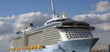
Cruise Liners
Short Sea Ferries
Isle of Wight ferries
Warships in and out of Portsmouth
The VTS system is operated primarily by the Port of Southampton, but accounts for all shipping in the area other than simply what is departing from or arriving at the Port of Southampton, including oil tankers using the Fawley facility, and the vessels serving both Portsmouth and the Isle of Wight and thus local to the Solent.
The Port of Southampton is one of the largest ports in the South of England, and ranks alongside the Port of Felixstowe in the volume of container traffic handled. It is also home to numerous cruise ships. On the electronic chart display, updates can be input on a regular basis, unlike the need to completely reprint manual versions. Such systems thus allow the VTS operator to monitor the vessel’s movement along a channel, and to identify courses appropriate for the safe navigation of that vessel. Where the channel narrows and becomes more restrictive, there is a greater need for the close monitoring of the vessel concerned, especially as it will be pursuing a course allowing for safe passage away from other vessels in the vicinity. The VTS Operators on shore are able to communicate with any of the vessels shown on the diagram using the appropriate VHF Channel, and can guide them through the channels as well as enabling them to maintain course with relation to other vessels in the vicinity. Information for mariners concerning maritime conditions can also be obtained from the VTS system using the appropriate VHF Channel.
The VTS system enables the shorebased operator at the Port of Southampton to closely monitor and regulate all commercial maritime traffic anywhere within the scope of the VTS system, although such regulation is still seen as advisory, rather than mandatory. The master of the vessel may still take decisions based on their own perception of their course and location, regardless of the information conveyed by the VTS operator. The main function of the system, however, is to endeavour to control maritime traffic in the area in much the same way that an air traffic control system controls aircraft movements into and out of an airport. The VTS operator may not be able to engage visual contact with a vessel for some time, as the vessel is well out of range, hence the need for the extensive radar coverage of the area as shown in the diagram below of the VTS scope for the Southampton, Portsmouth and Isle of Wight areas.
The above system concerning the VTS system in the Southampton area can be compared with a similar system used in the Firth of Forth by the Forth Ports authority. The system used by Forth Ports was a uniquely-designed system designed to encompass all shipping activities in the whole of the Firth of Forth, from the Port of Grangemouth, Scotland’s largest port, at the western extremity of the Firth, along the Firth to the Port of Rosyth, which handles naval vessels, cruise ships and the Ro-Ro service operated from Rosyth to the Port of Zeebrugge in Belgium, and thence to the Port of Leith, adjacent to the City of Edinburgh. Other, smaller ports such as Burntisland and Methil, are located further down the Firth, on the south coast of the Kingdom of Fife. The eastern extremity of the VTS system is at a line between Tantallon Castle, to the east of North Berwick on the East Lothian Coast, to Fife Ness, the most easterly extremity of the region of Fife. Particular hazards are the two Forth Bridges, and several islands, particularly Inchkeith and Inchgarvie, located to the east of the bridges, as well as the Isle of May and Bass Rock, located on the north and south sides respectively in the entrance of the Firth of Forth.
The Forth VTS system is controlled from the Port of Grangemouth, and deals with all shipping entering any of the above ports. The AIS system, which is not based in the region itself but on the overall satellite system, monitors marine traffic in the Firth, but only on a passive basis given the status of the vessel’s AIS equipment at the time. However, the system only monitors these movements, and does not provide an interactive communication with the vessel. The user of the AIS monitoring system can therefore only monitor the movement of a specific vessel with relation to other vessels in the vicinity, but cannot intercept those vessels in any way.
The VTS system operates through a series of communication and electronic links between the shore-based operator and the vessel. The vessel’s transponder transmits a signal via satellite, which is in turn linked by electronic means to both the VTS monitoring system and the AIS system.
The position of the vessel is logged in the VTS system and is shown on the monitor screen of the Operator Workstation in the VTS operations room. The AIS system also picks up the vessel’s position and shows it on the AIS monitor, along with the vessel’s identification characteristics. The operations room VTS can translate the information to a simulator or other systems as required. The system is supported by the communications system using specific VHF frequencies, allowing the shore-based VTS operator to communicate with the vessel’s master to verify speed, course, and any other information required to ensure the safe arrival of the vessel at port or its departure from port and exit into the open sea. The system also allows the masters of various vessels to maintain contact with each other as well as with the VTS operator while sailing within the VTS-controlled area.
However, not every port uses or is equipped with VTS facilities, on the grounds of simplicity of navigation through channels on the approach to the port, or because the port is not deemed large enough to necessitate the use of VTS. The lack of such control systems makes vessel reporting activities less efficient and inevitably means that less control may be exercised over vessel movements within the vicinity. Furthermore, the lack of VTS facilities in some areas means that there may be a lack of communication between vessels sailing within such waters, especially where Port Controls are concerned. It becomes more evident that with the number of vessels, both commercial and pleasure, plying both international seas and territorial waters, as well as their increasing size and, for that matter, the maritime synergy between all types of commercial and leisure vessels, there is a greater need for the implementation of VTS facilities in every UK port to allow for greater controls over maritime traffic movements close to all UK ports. In the case of the Vessel Traffic Monitoring Directive, such reporting systems are mandatory for larger ports and those with restricted channel access.
What has become evident is that despite a rigorous maintenance of Collision Regulations as well as clearly-defined Rules of the Road, accidents still occur within territorial waters, and these are often avoidable if systems such as VTS were more widely used, especially by not only the ports themselves but also by small and pleasure craft hitherto not covered by the regime. At present, VTS is largely limited to commercial vessels and does not generally apply to pleasure craft such as cruisers and yachts, although on the larger pleasure cruisers VTS may be installed for safety purposes. It is, however, becoming increasingly essential that small craft of the leisure variety, as well as other marine craft under the 300 gross registered tonnage threshold used for more commercial purposes such as fishing, should report into ports where commercial activity takes place. It is clear that the presence of such craft can impose as much of an obstacle or inconvenience to larger commercial ships as those craft exceeding 300grt, and that such movements can result in severe accidents occurring where incorrect sailing and navigation procedures were not obeyed or carried out, thus contravening the Rules laid down by the 1996 Merchant Shipping Act as well as the VTMD and in more general terms by the International COLREGS.
While VTS operates between ports and vessels within the boundaries of waters close to the port jurisdiction, that boundary will refer to a finite area a certain distance from the coastline. VTS does not operate in open seas, and therefore cannot apply where ships are in open waters. Should an incident between two or more vessels occur outside the geographical jurisdiction of the VTS regime, the port cannot be seen as being in control of such a situation, and therefore has no control over the consequences of any such incident.
A further limitation of the VTS system is that it refers to vessel traffic management insofar as movement within designated shipping lanes is concerned. It does not refer in any way to the vessel’s cargo nor its passenger or crew complement. Thus if an incident or accident occur within the jurisdiction of the VTS regime, the nature of the vessel’s cargo or the stowage of that cargo aboard vessel will not be questioned or investigated unless it were found that incorrect stowage of cargo, particularly of a hazardous or dangerous nature, were found to have contributed in some way to the resulting catastrophe, especially of an environmental nature. And since there is no perceived direct correlation between the nature of the cargo and the handling of the vessel by its crew, the two issues remain mutually exclusive, unless the accident or collision contributed in some way to the damage to the cargo aboard vessel and hence to a potential environmental catastrophe. A recent case of the collision of a vessel with a support of the Road Suspension Bridge over the Storebaelt in Danish waters highlighted the fallibility of the VTS system. For some reason, the VTS system failed to foresee and identify a navigation problem aboard the vessel which led to the collision. However, this is an infrequent case.
In general, the VTS regime gives the port or national maritime authorities a reasonable amount of control over shipping movements in the area, and enables the authority concerned to maintain contact with vessels passing through the area at any time.
Comments
Sorry, comments are closed for this item