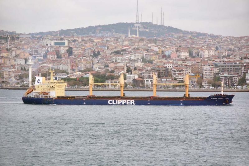
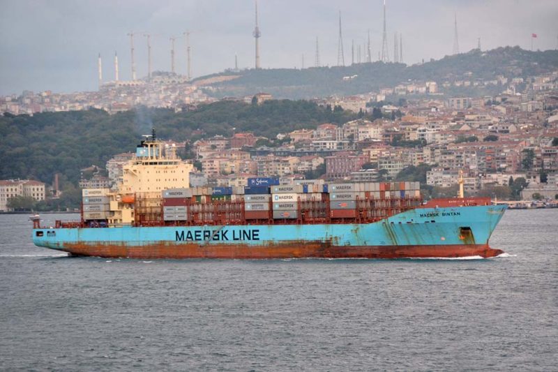
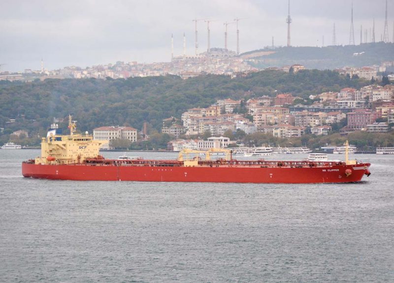
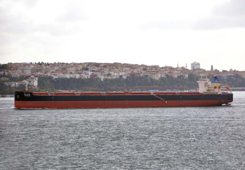
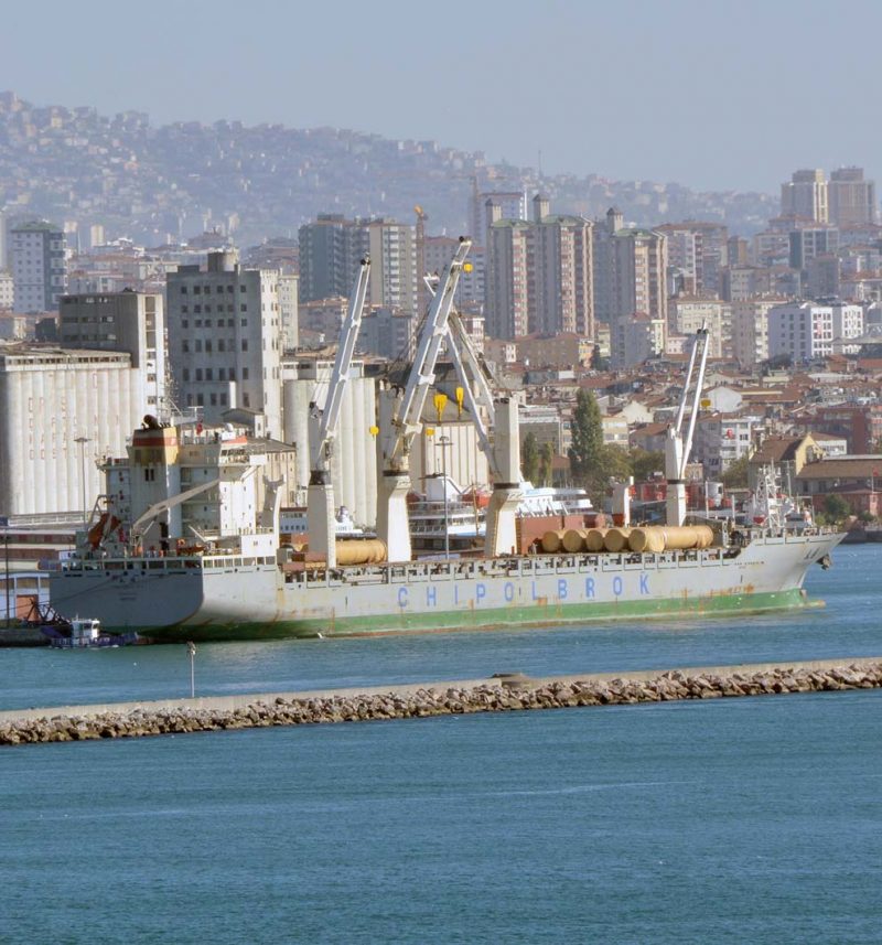
![]() Istanbul has a big population of fifteen million people, and has the difficult balancing act of facing both eastern and western cultures to embrace the best of both. The Port of Istanbul lies at the extreme southern end of the narrow Bosphorus waterway that links the Sea of Marmara (Marmara Denizi) in the south to the Black Sea (Karadeniz) in the north. The Bosphorus is one of the busiest waterways in the world with over two hundred million tonnes of oil passing southwards through the strait each year from the big oilfields of the eastern area of the Black Sea. The Bosphorus is nineteen miles long with the width varying from seven hundred metres to two miles, with the current flowing from the Sea of Marmara into the Black Sea usually at a rate of six kilometres per hour.
Istanbul has a big population of fifteen million people, and has the difficult balancing act of facing both eastern and western cultures to embrace the best of both. The Port of Istanbul lies at the extreme southern end of the narrow Bosphorus waterway that links the Sea of Marmara (Marmara Denizi) in the south to the Black Sea (Karadeniz) in the north. The Bosphorus is one of the busiest waterways in the world with over two hundred million tonnes of oil passing southwards through the strait each year from the big oilfields of the eastern area of the Black Sea. The Bosphorus is nineteen miles long with the width varying from seven hundred metres to two miles, with the current flowing from the Sea of Marmara into the Black Sea usually at a rate of six kilometres per hour.
Istanbul has the central port area based on the Golden Horn waterway with the Karakoy Cruise Terminal opposite the busy Bosphorus passenger ferry terminals at Eminonu in the Bazaar Quarter, from which small passenger ferries run across the Bosphorus to Uskudar, Harem, Haydarpasa and Kadikoy. It also has three further ports, including the Port of Haydarpasa on the Asian side of the Bosphorus with cargo operations dating back for well over a century. The traditional cargo port of Haydarpasa has been and still is a very busy port, but shipping trade movements in the future will leave it running at low capacity and with plans to decommission the port. Trade will move to the Port of Ambarli, 26 kilometres south southwest of Istanbul, which has increased from a standing start in 1993 to handle 1.5 MTEU of containers in 2007 and around three million containers currently per year. A much smaller Port of Zeytinburnu lies halfway from Istanbul to the Port of Ambarli.
History Of Istanbul
The historic peninsula of Istanbul was first settled in the seventh millennium before Christ in Neolithic times, but the civilised history began in 660 BC when Greek settlers from Megara established Byzantium on the European side of the Bosphorus. The settlers built an acropolis adjacent to the Golden Horn waterway on the site of the early Thracian settlements. After a brief occupation by the Persians, the Greeks continued in control of the area until the year 73 AD when it became part of the Roman Empire. Constantine the Great became the Roman Emperor in the year 324 AD, and he immediately set out plans for a new capital to be called Constantinople, which was proclaimed the capital of the Roman Empire in the year 330 AD. On the death of Emperor Theodosius I in the year 395 AD, the Roman Empire was split into two halves, with Constantinople the capital of the Eastern Roman (Byzantine) Empire, and Rome the capital of the Western Roman Empire.
The great cathedral of Hagia Sophia was built between the years 532 to 537 AD as the greatest cathedral the world had ever seen and remained so for the next one thousand years. The imperial capital of Constantinople continued as such for almost sixteen centuries during the Roman Empire (330-1204), the Byzantine Empire (1261-1453), and the Ottoman Empire (1453-1922). The Ottomans conquered the city in 1453 and transformed it into an Islamic stronghold and the seat of the Ottoman Caliphate and Sultans.
The Fall of Constantinople had been due to a decline of the city after it was sacked and pillaged in 1204 during the Fourth Crusade, and the city subsequently became the centre of a Latin era, created by Catholic crusaders to replace the Orthodox Byzantine Empire, with Hagia Sophia converted into a Catholic church. The Byzantine Empire was restored in a weakened state in 1261 and the population dwindled to only 100,000 from half a million previously. In the mid 15th century, the Ottoman Turks began a policy of taking smaller towns in an attempt to cut off Constantinople from its supply routes and thus strangle the city. On 29th May 1453, after an eight week siege during which the last Roman Emperor Constantine XI was killed, Sultan Mehmed II captured and conquered Constantinople and declared it as the new capital of the Ottoman Empire.
An Imam proclaimed the Islamic faith from one of the minarets of Hagia Sophia, and despite setbacks, the population was restored to half a million with the population drift from Anatolia. Islamic foundations were established to construct ornate imperial mosques, and the Ottoman Dynasty claimed the status of Caliphate in 1517, with Suleiman the Magnificent being the first ruler from 1520 to 1566. He began a great period of artistic and architectural achievement and the Ottoman arts, ceramics, glass and calligraphy flourished as the best in the world.
The Ottoman Empire stretched from the Danube to the Persian Gulf, from the Crimea to Morocco. Russia captured the Crimea in 1774, and two bridges across the Golden Horn waterway on the European side of the Bosphorus were constructed from 1845 onwards. The great Trans European Orient Express railway linked Istanbul to the capital cities of Western Europe from 1899. Modern water supply networks, electricity, trams and telephones made Istanbul the equal of other European cities before the First World War.
The Ottomans sided with Germany during the war, and defeated an invading British and Anzac force at Gallipoli in 1915. British, French and Italian forces occupied Istanbul at the end of the bloody war, with Lawrence of Arabia and an Arab camel mounted army having harried the Ottoman forces retreating on the Hejaz Railway all the way from Mecca to Damascus. The Arab rulers wanted to establish an Arab State in Syria at the end of the war, but a French and British deal gave Syria to the French to the great dismay of the Arabs, with war and bloodshed continuing on the southern border of Turkey to the present day.
The final Ottoman Sultan, Mehmed VI, was exiled from Istanbul in November 1922, with the occupation of the city ended in 1923 on the signing of the Treaty of Lausanne and the recognition of the new Republic of Turkey declared by Mustafa Kemal Ataturk (1881-1938). Ataturk is known as the ‘Father of the Turks’ and the Turkish War of Independence and the expulsion of Greeks from Western Turkey in 1922/23 was instigated by his hand. He died in the Dolmabahce Palace on 10th November 1938. Ankara was selected as the capital of the new Republic to distance the country from its long Ottoman history. The name Istanbul derives from the Islam word ‘Islambol’ or ‘Plenty of Islam’, but the city was only commonly referred to as Istanbul after Turkey adopted the Latin alphabet in 1928 and urged other countries to recognise the change of name. In the late 1940s and early 1950s Istanbul acquired new grand public squares, boulevards and avenues. The population began to increase and employment was found in new modern factories producing cotton garments, cement, chemicals, textiles, machinery, paper and foodstuffs and beverages.
The area the immigrants chose to settle in was Beyoglu, which is separated from the old Byzantine and Ottoman city by the Golden Horn. The area is uphill and to the north of Karakoy, and was known in the Middle Ages as Pera (‘Across’ in Greek), with the first luxury hotel named as the Pera Palace in 1892, seven years before the Orient Express railway line was completed. The hotel was built for the comfort of the luxury minded clientele of the railway, which included Agatha Christie, and the room where she wrote ‘Murder on the Orient Express’ is today preserved as a museum for all who stay there to visit.
Beyoglu is today the beating heart of modern Istanbul with hotels, cinemas, shops, galleries and restaurants, some open 24 hours a day. The decline of Beyoglu was accelerated during the 1950s and 1960s and reached a crisis point in 1974 with the departure of the large Greek population during the Cyprus conflict and fuelled by Turkish residents of Beyoglu. In the 1980s, many of the then empty grandiose Neoclassical and Art Nouveau buildings of the late Ottoman Empire became home to countless immigrants from Anatolia and neighbouring countries. The Rue Francaise has excellent panoramic views over the Golden Horn and the Hagia Sofia, Topkapi Palace, Blue Mosque (Sultan Ahmed Mosque) and the Galata Tower. The main thoroughfare of Beyoglu is Istiklal Avenue with historic red trams running down the centre of the avenue and a magnet for throngs of international tourists.
The Port Of Istanbul
The first Istanbul-Bosphorus Suspension Bridge for road traffic was opened on 30th October 1973 and is situated three miles within the Bosphorus Strait to connect Europe to Asia between Ortakoy (Europe) and Beylerbeyi (Asia), and is near the ornate Ortakoy Mosque. The Second Bosphorus Suspension Bridge opened on 3rd July 1988 and is located five kilometres to the north of the first bridge between Kavacik and Histarustu, while a third Bosphorus bridge was later opened at a site to the north, but it is located on land under military control on both sides near the Black Sea entrance to the Bosphorus.
There are also three bridges across the Golden Horn waterway in the Galata Bridge between Eminonu in the Bazaar quarter and Karakoy, and the Ataturk Bridge between Unkapani and Azapkapi, with both low level bridges opened in the morning to allow vessels to access the inner Golden Horn cargo berths. The Galata Bridge was the first bridge across the Golden Horn when completed in 1845, and the one that is seen today is the third reincarnation erected in the late 1980s and completed in 1992. One can cross the Galata Bridge from Karakoy Ferry Terminal to Eminonu on foot, with Karakoy Cruise Ship Terminal just to the east of the ferry terminal. The third bridge is the Halic Bridge which does not obstruct shipping. The colourful Golden Horn waterway is usually a busy cavalcade of small cargo ships, ferries, lighters and small craft on both the Ferikoy and Beyoglu side and the opposite Carsamba and Bazaar Quarter side of the waterway.
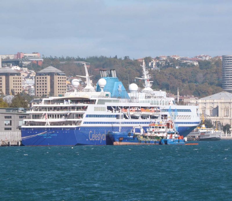
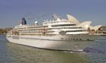
The main Istanbul Cruise Terminal is at Karakoy International Maritime Terminal opposite Eminonu with white hulled Bosphorus passenger ferries leaving from the Ferry Terminal. Cruise ships of Princess Cruises, Norwegian Cruise Line, Silversea Cruises, Seabourn Cruises, Celebrity Cruises, Crystal Cruises, Holland America Line, Cunard Line, Costa Crociere, MSC Cruises, Royal Caribbean International (RCI), Star Clippers, Louis Cruises, Hapag, Phoenix Reissen, P. & O. Cruises, Oceania Cruises and Regent Seven Seas Cruises, and many other international cruise lines were to be seen at Karakoy Pier, Salipazari Pier near the Dolmabahce Palace and at Sarayburnu Pier (Seraglio Point). Sadly, due to current safety issues, most major cruise lines have ceased to call at the port.
The Istanbul Port Regulations allow free anchorage for all cargo and passenger ships, with five mooring buoys off the coast at Besiktas to the north, four mooring buoys between Galata and Sarayburnu, and another two buoys in the Golden Horn. The anchorage for tankers and vessels carrying explosives is between Yenikapi and Yedikuls, and vessels can anchor off Haydarpasa and at the edge of the middle part of the Bosphorus area of the Port of Istanbul after obtaining permission from the Port of Istanbul Authority.
The loading, discharging and transhipment of cargo on the Golden Horn berths are carried out by electric cranes, with the Karakoy and Salipazari installations having twenty electric cranes of up to 25 tonnes capacity. Lighters are also used in this busy area to load and discharge alongside ships with the Istanbul Port Authority having 160 lighters available. Floating cranes of one hundred tonnes lift capacity are available for heavy lifts on to the 170,000 square metres of open storage and warehouses. The big Kurucesme Coal Terminal to the north of the first Istanbul-Bosphorus Suspension Bridge uses three coal transporters each of sixty tonnes capacity.
Port working is around the clock, with harbour tugs of up to 5,000 bhp available for vessel berthing. All Port of Istanbul berths have fresh water, and provisions and bunker tankers are available. The lengths of the quays at Karakoy are of 500 metres, at Salipazari of 590 metres, at Galata of 600 metres, at Sarayburnu of 240 metres, and at Kurucesme of 390 metres. There are five passenger boarding piers at Eminonu for Bosphorus trips to Uskudar, Kadikoy, Besiktas passing the impressive Dolmabahce Palace, Harem, and Haydarpasa, and other further destinations including the Prince Islands located just to the south of the southern extremity of the Bosphorus, as well as for shorter trips up the Golden Horn waterway to Eyup via Kasimpasa, Haskoy, Ayvansaram, and Sutluce.
There are three dry-docks at the Golden Horn to carry out any kind of ship repair, and of dimensions 600 feet by 63 feet, 388 feet by 72 feet, and 280 feet by 62 feet for vessels up to 30,000 dwt. At Fener (Golden Horn) and Haskoy (Golden Horn) are several small graving docks for coastal vessels up to 800 grt. There are two floating docks at Istinye, with dimensions of 632 feet by 98 feet, and 500 feet by 71 feet, for medium sized tankers and cargo vessels.
The Port Of Haydarpasa
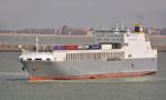
The Port of Haydarpasa Limani or Haidar Pasha is a general cargo port with ro-ro and container handling facilities on the Asian side of the southern entrance to the Bosphorus. The Topkapi Palace, the Blue Mosque, and the great cathedral of Hagia Sofia lie directly across the Bosphorus on the European side from the port. The port is operated by Turkish State Railways (TCDD) and serves a wide hinterland stretching across the whole of Turkey. It is the fourth biggest port in Turkey after Mersin, Ambarli and Izmir. Port construction began by the Anatolian Railway on 20th April 1899 and it was a railway owned port until the newly established Republic of Turkey purchased it on 24th May 1924. The administration of the port was handed over to the Turkish State Railways on 31st May 1927, the national railway being part of the Ministry of Public Works and Settlement.
The port is protected from the powerful currents swirling through the Bosphorus by three long breakwaters, two of which are detached to protect against bad weather from the west and southwest. The port entrance is to the north of the northern detached breakwater. The port has a quay length of two kilometres with depths alongside from 23.0 feet to 33.0 feet. Extensions to the port were completed in 1954 and 1967 to give twenty berths alongside two large piers. There are container gantry cranes on the five container terminals ranging from 295 to 350 metres in length, two ro-ro terminals of 141 and 165 metres in length, two bulk dry cargo berths each of 430 metres in length, and eleven general cargo berths of up to 334 metres in length. Ships dock with the aid of tugs of up to 3,000 bhp and towage is compulsory for all vessels above 2,000 grt.
The port has excellent rail and road connections as well as large warehouses and open storage areas. The grain silos have a capacity of 70,000 tonnes and belong to the Turkish Grain Board (TMO) with conveyor belt connection, and two quays have oil pipe connections, with 34 shoreside cranes to serve the quays of 25 tonne capacity and a floating crane of 250 tonnes capacity. The dry bulk cargo berths operate around the clock, with the general cargo berths operating in two shifts. The ro-ro berths handle 130,000 cars and trucks per year with a fortnightly ro-pax ferry service to Ilichivisk in the Ukraine.
The container terminals handle in excess of 750,000 TEU per year with open storage for 15,000 TEU on 313,000 square metres of ground. A rail freight station of 3,600 square metres stands behind the quays, and a covered area for containers of 21,000 square metres, with a container land terminal outside the port at Goztepe for stacking empty containers with a maximum capacity of 52,800 TEU. Container movements around the berths are carried out by 18 rubber tyred transtainers of forty tonnes capacity, nine reach stackers of the same lifting capacity, six mobile cranes of up to 25 tonnes capacity, and 38 forklifts. Provision is available for reefer containers, and there are two container weighbridges for checking for overloaded containers.
Regular passenger ferries, and three rail ferries operating from a rail terminal that each carry fourteen rail carriages, cross the busy Bosphorus Strait every day from Haydarpasa to Sirkeci on the Golden Horn waterway. The Port of Haydarpasa will be left inactive after all of its cargo operations transfer to the Port of Ambarli, and after the Marmaray rail commuter project comprising a rail tunnel under the Bosphorus and five new stations is complete. The existing suburban rail lines along the Sea of Marmara from Halkali on the European side to Gebze on the Asian side will also be modernised. The first phase of Marmaray (‘Ray’ in Turkish means rail) opened on 29th October 2013 with standard gauge rail connections between all European cities and Asian cities now operational. There are three other rail systems in Istanbul in the Metro, Tunel Funicular, and Kabatas-Taksim Funicular.
Freight rail cargo can now travel across Europe and through the Marmaray tunnel on a revival of the old Silk Road route to China via Northern India. Similarly, another northerly route to Yiwu in China was opened up on 27th April 2017 when a DB freight train left London Gateway via Russia and Mongolia on the Siberian Express railway with many containers full of Scottish whisky, English soft drinks, and other British exports. These two new rail freight routes are faster than sea transport and cheaper than air transport to trade with China.
Port Of Ambarli
Ambarli is a very modern and recent port, with permission given on 9th September 1992 by the Turkish Ministry of Transport to establish the State owned Altas Ambarli Port Facilities Trade Co. Inc and go ahead and build a new port. The first digger spades hit the ground during 1993 after the Port of Ambarli layout plan was approved, with a further port layout plan for larger ships and more terminals approved on 2nd September 1998. The container terminal and container storage areas planning was approved on 15th September 2006, and the port now has the following important client terminals:-
- Kumport Port Services and Logistics Trade Co. Inc.
- Marport Container Terminal Operators S.A.
- Mardas Marmara Maritime Management Co. Inc.
- Limak Cement Group
- Akcansa Cement Trade Co. Inc.
- Total Oil Turkey Inc.
- Arpas Ambarli Pilotage and Tug Services Trade Co. Inc.
- Beylikduzu Municipality Authority.
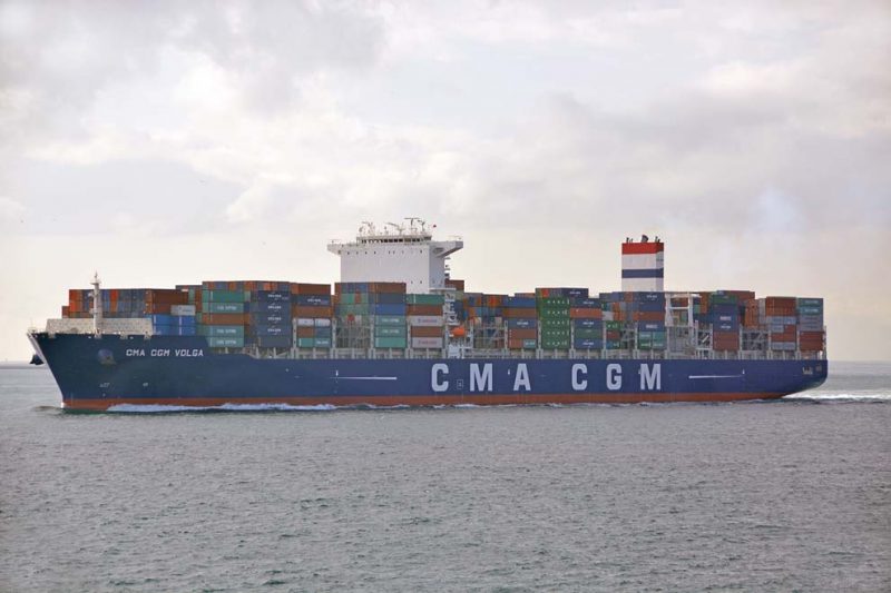
The port stretches along the northern coast of the Sea of Marmara and from west to east comprises a large ‘L’ shaped terminal for the Total Oil Company and the Marport West Terminal, then the Limak Cement Terminal, the Marport Main Container Terminal, the Arpas Terminal, the Mardas Terminal, the Akcansa Cement Terminal, the Beylikduzu Municipality Authority Terminal, and the Kumport Terminal. The Port of Ambarli is situated 26 kilometres south southwest of Istanbul, and has increased its capacity from a standing start in 1993 to handle 1.5 million TEU of containers in 2007 and around three million containers currently per year, with port traffic growing by 12.3% between 2014 and 2016 to handle over 60% of the total box traffic of Turkey.
Altas Ambarli Liman Tesisleri Tic. A.S. is the general management, joint service and co-ordination company of the Port of Ambarli, with responsibilities for the overall general management, infrastructure, planning, geology studies, security, and environmental arrangements of port areas used by the eight terminals. The Port of Ambarli is currently the second largest port in Turkey, with planning approved to make it the largest port in the country.
Marport Container Terminal Operators handle two million TEU of containers per year as the main container operator, with the Marport Main Terminal of length 800 metres, Marport West Terminal of length 760 metres and seventeen hectares in area, and Marport East Terminal which in fact is Piers 1,2 and 3 of the neighbouring Limar Kumport Terminal. The terminals also offer reefer plug services, hazardous cargo, container stuffing and destuffing, labelling and container covering and inspection facilities. There are six gantry cranes at the Marport Main Terminal, three gantry cranes at the Marport West Terminal, with a whole array of shoreside container equipment including rubber tyred cranes, mobile cranes, reach stackers, top lifters, and spreaders. Rail and truck access freight stations are impressive for their size and area.
Mardas Container Terminal (Mardasport) belongs to a group of companies known internationally as Mardeniz (Marsea), owning and chartering vessels worldwide. The terminal handles containers, steel products, and break bulk cargo. It has two berths of a total length of 910 metres (one of 520 metres and the other of 390 metres) with a maximum capacity of 650,000 TEU per year. It has the usual shoreside equipment of outreach gantry cranes, mobile cranes, rubber tyred cranes, stackers and terminal tractors with 450 reefer plugs. There are 52.6 hectares of storage areas, and twenty hectares of customs bonded storage.
Kumport Terminal has a total of 2,200 metres of quay length and has the capacity to handle 1.7 million TEU. Pier 1 is 450 metres in length, Pier 2 and Pier 3 are each of 422 metres in length, Piers 4 and 5 are each of 370 metres in length, and Pier 6 is 166 metres in length. Alongside depths of up to fourteen metres and modern container handling equipment are available including three gantry cranes with an outreach of 22 containers, three gantry cranes with an outreach of 18 containers, two gantry cranes with an outreach of 17 containers, and two gantry cranes with an outreach of 14 containers. There are a dozen rubber tyred cranes, four reach stackers, 21 terminal tractors, several empty container stackers and many forklifts. COSCO and China Merchants completed the purchase of Kumport Terminal in November 2015, other shipping lines calling include OOCL, Zim Line, MOL, MSC, APL, UND Ro-Ro of Turkey, Italian Ro-Ros via SeaLines.net, Gulf Navigation, and Seatrade of Groningen.
Kumport Port Services and Logistics also handle dry bulk cargo, ro-ro and rolling units, and project and general cargo at seven further berths in addition to the six described above. These berths are each of 250 metres in length, and the other private berths in the Port of Ambarli belong to the Limak Cement Group, the Akcansa Cement Group, and the Total Oil Company. The oil terminal has a 200 metre long pier with alongside depths ranging up to 45.9 feet and can handle tankers up to 40,000 dwt. The terminal handles clean petroleum products e.g. gasoline, diesel oil, kerosene, LPG and lubricants. The total tank farm storage at the oil terminal is 300,000 cubic metres of liquid bulk. A mobile heavy lift crane of 140 tonnes capacity is available for project cargo, over sized cargo, and heavy lift cargo e.g. yachts throughout the port.
Port Of Zeytinburnu
Zeyport was established in 1999 and currently has five piers with a total of 3,300 feet of quay space to dock ten vessels at any one time. A project to enlarge the port was approved in 2006 in a 16.5 million Turkish lira tender by Turkish companies Ronesans and Kochan for a cruise port and a yacht marina. However the State Council for the Zeytinburnu district annulled the project due to height concerns of buildings planned for the cruise berth, some were of 50 metres high. Despite reducing the height of the buildings to 15 to 25 metres high, the project was abandoned as the level of building construction detracted hugely from its main purpose as a cruise port.
However, the Turkish Environment Ministry approved the controversial project in March 2015 for a cruise port and yacht marina on 1.47 million square metres of land, and with the cruise buildings only 5.5 metres high. Land will also be reclaimed to extend the port, three other high skyscrapers of 36, 32 and 27 storeys high have also caused controversy near Zeyport as they were clearly visible in the panorama behind the Suleymaniye Mosque on the historic peninsula of Zeytinburnu.
Bosphorus Ferries
Passenger ferries have traversed the waters of the Bosphorus for hundreds of years, and until the opening of the first Bosphorus Suspension Bridge in 1973, they were the only way to cross between Europe and Asia. They continue to serve the commuter needs of the people of Istanbul, although the water taxis of IDO (Istanbul Deniz Otobusleri) and the Marmaray Rail Tunnel and the three Bosphorus bridges have partially replaced the traditional Bosphorus passenger ferries. Bosphorus ferries carried 98 million passengers and seven million vehicles during 2007.
The passenger ferries serve a dozen routes crossing east to west and west to east over the Bosphorus, as well as north towards the Black Sea and south to the Prince Islands lying between seven and fifteen miles off the southern entrance of the Bosphorus. The first wooden private steam ferry (‘vapur’ in Turkish) crossed the Bosphorus in 1837, propelled by paddles. The Istanbul City Authority formed a Sirket i Hayriye (Boat Company), later renamed in 1945 as Sehir Hatlari Isletmesi (Istanbul Lines).
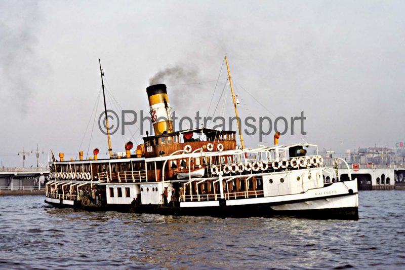
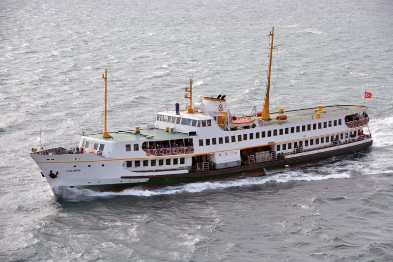
Clyde and Tyne built steam ferries figured in the fleets before World War I, with Guzelhisar and Kalendar of 453 grt and 152 feet in length from the Hawthorn, Leslie & Co. Ltd. yard at Hebburn in 1911. The Fairfield yard built several of these coal burning examples including Bogazici of 434 grt in 1910 and Halas of 584 grt in 1915. The drawback to these coal burners was the enormous dense pall of black smoke that drifted across the Bosphorus, which ended their careers as the Istanbul Metropolitan Authority in the 1980s wanted no more smoke pollution. Bogazici was withdrawn in 1982 and converted into a floating restaurant before sinking after a collision off Emirgan in 1992. Halas is still in service as a smart black hulled, black funnelled floating restaurant after withdrawal in 1983 and a conversion three year later that improved her appearance and gave her clean burning diesel engines.
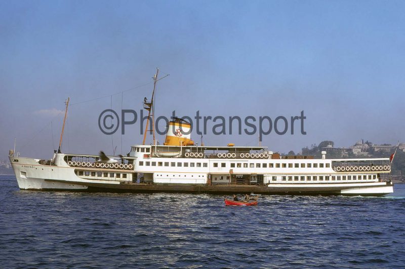
A large fleet of 84 steam and motor ferries was being operated in 1973, including a series of nine identical steam ferries built by Fairfields of Govan, each with a passenger certificate for two thousand passengers and powered by double compound steam engines. They were all completed in 1961 of 781 grt and were named Anadolu Kavagi, Atakoy, Harbiye, Ihsan Kalmaz, Inkilap, Kanlica, Kuzguncuk, Pendik and Turan Emeksiz. They had white hulls and raked bright yellow, white and black funnels with the Turkish Maritime Lines logo on the white band, as the Bosphorus ferries and tugs, as well as the Turkish deep sea liners crossing to New York, were all State owned. The series of nine ferries had two passenger decks with square windows opening out from the interiors, and a bipod navigation mast in front of the funnel, and a smaller mast forward and lit for navigation at night.
Most of these classic steam ferries crossed the Bosphorus for the last time in 2003, with several laid up until converted to floating restaurants. A new generation of motor ferries, designed by Fairfield but built in Istanbul, came into operation at this time to replace the older members of the eighty vessel ferry fleet in 2003. The average age of the fleet was decreased to twenty years after the introduction of the new motor ferries. A quartet of the Fairfield built steam ferries lasted in service until withdrawn in 2005, these were Inkilap, Kanlica, Ihsan Kalmaz, and Turan Emeksiv. Pendik had unfortunately been destroyed by a terrorist bomb and fire in 1992 and the damage was so severe she was scrapped during the following year.
Two Denny built motor ferries dating from 1953 were of similar design to the nine Fairfield built steam ferries. Dolmabahce and Fenerbahce of 994 grt had dimensions of length 76.8 metres, moulded beam of 11.6 metres and draft of 2.7 metres, and were powered by twin Sulzer diesel engines of a total of 3,000 bhp to twin propellers giving a service speed of 17 to 18 knots. They served on the Kadikoy to Yalova and Prince Islands routes, Fenerbahce taking up her route on 14th May 1953 and serving for 55 years until making her last voyage on 22nd December 2008. Many dignatories were on her bridge for her last historic voyage, including the Istanbul Metropolitan Mayor and Rahmi Koc, President of Koc Holdings and owner of the Rahmi Koc Museum dedicated to transportation, where Fenerbahce became a star exhibit. She will also make occasional Bosphorus voyages in the summer months and is open to the public, her sister Dolmabahce was withdrawn and broken up in 1993.
The oldest Bosphorus passenger ferry still operating in 2014 was Pasabahce built in 1952 at Taranto by the Cantiere Navale di Taranto spA. She is of 1,042 grt with a passenger certificate for 2,100 and dimensions of length 74.46 metres, moulded beam of 11.27 metres and draft of 3.85 metres. She is powered by twin Sulzer diesel engines each of 1,600 bhp to give a total of 3,200 bhp and a maximum speed of 18 knots when new but a service speed of 12 knots at her advanced age of 62 years. She sailed daily in 2014 from Kabatas pier adjacent to the Dolmabahce Palace to Buyukada in the Prince Islands, but may have since been withdrawn for preservation.
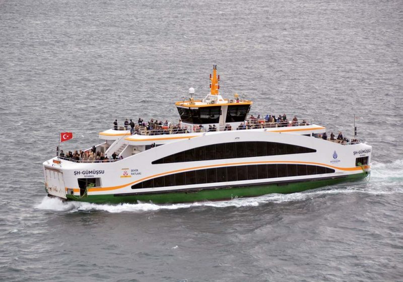
The newest class of conventional Bosphorus ferries was built in Turkey in 2009/10 as a class of five. They are of 747 grt with a passenger certificate for 1,800 passengers and are named Fatih, Beyoglu, Sariyer, Beykoz and Kadikoy, the names being chosen in a competition by the citizens of Istanbul. Their features include sophisticated fire alarms and fire fighting systems, comfortable interior decoration with panoramic view windows, and with natural wooden seats preferred to soften their streamlined lines. They are of length 68.0 metres, moulded beam of 13.0 metres and a draft of 2.65 metres, and are powered by Volvo Penta diesels driving Schottel combined rudder and propellers. They have bow thrusters for docking, and their ‘midships funnels have the traditional yellow, white and black bands with the Turkish Maritime Lines logo on the white band. Five conventional ferries have a summer passenger certificate for 2,100 passengers in Ahmet H. Yidrim (built in 1973 as Bostanci), Baris Manco (built in 1973 as Inciburnu), Emin Kul (built in 1989 as Bahcekapi), Fahris S. Koroturk (built in 1989) and Prof. Dr. Aykut Barka built in 1973 as Sedefadasi.
The long route south to the idyllic setting of nine islands known as the Prince Islands, named during the Byzantine Empire, as Princes and other royalty were exiled on the islands. Five Byzantine Empresses named Irene, Euphrosyne, Zoe, Theophano, and Anna Dalassena also lived in exile in a convent on Buyukada. The four largest islands are Buyukada, Heybeliada, Burgazada and Kinaliada, and the total area of these and the other five small islets is 6.5 square miles. The current population is 14,552 mostly Turkish residents, although one of the more famous residents was Leon Trotsky, who lived on Buyukada for four years from 1929 in exile after his deportation from the Soviet Union. In contrast in 1912, the islands had 10,250 Greek residents and only 670 Turkish residents, and the islands are notable for a multinational community of Turks, Armenians, and Greeks living harmoniously throughout their long history.
The Bosphorus ferries cross to the Prince Islands from Bostanci (six daily) on the Asian side of the Bosphorus, and from Eminonu (nine daily), Besiktas (four daily) and Kabatas (four daily) on the European side, and call only at the four largest islands. Voyage times range from forty minutes for fast ferries and ninety minutes for slower conventional passenger ferries. Cars are banned from all nine of the Prince Islands, making them a haven for peace and quiet, with the only transport being horse and carriage, cycling or walking, and are thus similar to Sark and Herm in this respect in the Channel Islands.
The routes covered by the 28 passenger ferries, with 21 of these being conventional ferries, currently operating on the Bosphorus, and their voyage times are as follows:-
- Karakoy-Haydarpasa-Kadikoy (15 to 20 minutes)
- Eminonu-Kadikoy (20 minutes)
- Kabatas-Sarayburnu-Kadikoy (25 minutes)
- Besiktas-Sarayburnu-Kadikoy (25 minutes)
- Eminonu northwards through the Bosphorus (2 hours)
- Sariyer-Rumeli Kavagi-Anadolu Kavagi (15 minutes)
- Besiktas-Kucuksu (30 minutes)
- Istinye-Cengelkoy (45 minutes)
- Kabatas-Kadikoy-Bostanci-Buyukada (90 minutes)
- Maltepe-Buyukada-Heybeliada (40 minutes)
- Uskudar-Karakoy-Eminonu-Eyup (55 minutes)
The long voyage northwards up the Bosphorus to the entrance with the Black Sea is even more rewarding with views of majestic palaces, green parks, and ornate mosques and huge mansions on both sides of the Bosphorus. The second last port of call northwards is the village of Anadolu Kavagi with a ruined 14th century Byzantine fortress on a hill above the village. The last port of call is Rumeli Kavagi, as from here the Bosphorus widens out to meet the Black Sea and the land on both sides is under Turkish military control. Some of these small Bosphorus ports have roots deep in mythology and history e.g. Istinye is one of the places where Jason and the Argonauts rested during their epic voyage from the Black Sea, and Sarayburnu is the promontory where the waters of the Bosphorus join those of the Golden Horn to flow into the Sea of Marmara. It is reputed to be the place where Byzas the Megarian and his followers landed in 658 BC to found the city of Byzantium, later Constantinople and renamed Istanbul in 1923.
The Bosphorus ferries sail from five busy piers at Eminonu with their destinations clearly marked up on boards at each of the five piers. Those ferries heading south sail round Seraglio Point, which is a wooded hilly promontory with the Topkapi Palace at its summit, and turn southwards past the Sultanahmet district, where Hagia Sofia and the Blue Mosque face each other across a leafy square, on the European side and the Port of Haydarpasa on the Asian side of the Bosphorus.
The summer smooth water crossings to the peace of the Prince Islands are the most idyllic, with gorgeous Ottoman era white or pink painted mansions formerly owned by rich merchants to view on Buyukada (Big Island) either on foot, cycle or horse and carriage. A ‘round the island’ sightseeing tour on a horse drawn phaeton would be worthwhile to see all of the churches and monasteries, hills and valleys, with the tiny church of St. George (Ayia Yorgi) perched high up on the top of a hill. The island of Heybeliada (Saddlebag Island) has the large Naval Cadet School overlooking the ferry jetty, while Burgazada (Fortress Island) named after a follower of Alexander the Great built a large fort (‘Burgaz’ in Turkish means fort) here. The fourth large island is Kinaliada (Henna Island) so named because of its reddish colour from the iron and copper that was mined here, and has a population that is 90% of Armenian descent.
Postscript
The Istanbul Port Authority, Turkiye Denizcilik Isletmeleri A.S., with a Head Office at Salipazari Pier dates back 173 years to its formation in 1844. Crossing the Bosphorus from the European side to the Asian side has progressed from wooden coal burning steam ferries to much more modern diesel powered versions, with long distance travellers now much more likely to use the two suspension road bridges or the Marmaray rail tunnel today. The Port of Ambarli has already become the big main freight port of the Istanbul area, and will increase in importance in the future, as it has large container, ro-ro, general cargo and cement unloading and loading piers and facilities with very good offshore anchorages.

Comments
Sorry, comments are closed for this item