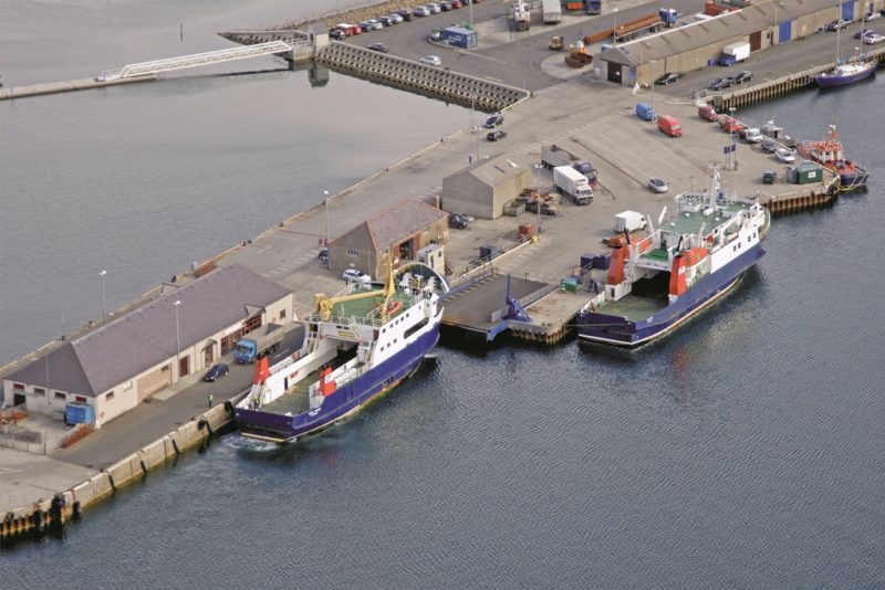
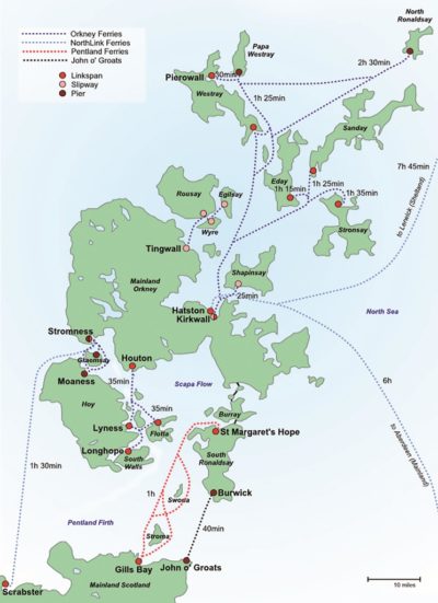
The Orkney islands are separated from the North of Scotland by the cold and often treacherous waters of the Pentland Firth, with very many ships lost in the whirlpools and tempestuous seas near Stroma and Swona islands and the rough rocks of Muckle Skerry and the Pentland Skerries. The eight man crew of the Longhope lifeboat was lost in 1969 trying to rescue the crew of a ship in difficulties off South Ronaldsay. The Orkneys are slightly closer to the Arctic Circle than to London, and number 68 islands with 29 inhabited and a small population of only 22,190. The main islands are Hoy, Mainland and bigger than all of the other islands put together, Rousay, Shapinsay, Stronsay, Westray, Eday, Sanday, South Ronaldsay and North Ronaldsay. Hoy is connected to South Walls island by a causeway which runs just to the north of the Longhope lifeboat station. Kirkwall Airport is several miles to south east of Kirkwall, with Tankerness peninsula 13 kilometres south east of Kirkwall and one kilometre east of the airport, its name derives from the Viking personal name of Tannskari.
The two towns and ports of Kirkwall and Stromness are the only communities of any size, with Kirkwall having a population of only 9,290 souls in a capital whose name is derived from the Viking name Kirkuvagr. The oldest part of the bustling harbour town of Kirkwall has narrow streets with a distinctive Viking atmosphere overlooked by the magnificent St. Magnus Cathedral, the finest of all two dozen Viking buildings or ruined settlements in the island group that have been partially or fully excavated. This is a reminder that Orkney did not become part of Scotland until the Norsemen gave it away in 1468 as a dowry. Scapa Flow is of 125 square miles in area and holds one billion cubic metres of seawater making it the second largest natural harbour in the world.
NEOLITHIC, VIKING and WARTIME HISTORY of ORKNEY
The hunter gatherers of the Neolithic period in Orkney had followed the slow retreat of the ice age glaciation, and the rapid spread of their culture up the western seaways of Scotland brought early farming and Megalithic culture. The use of the local sandstone found ready split on the foreshores of the predominantly flat islands, except for Hoy with its high ground and highest point of Ward Hill at 1,565 feet, provided the materials for this period of villages, brochs, underground chambers, chambered cairns and standing stones. The Knap of Howar on the small northern island of Papa Westray was occupied from 3,500 BC to 3,100 BC, with the word ‘Papa’ reminding us of the priests that once lived there. This is the oldest house still standing in Northern Europe, with walls intact to a low eaves height, and very useable stone furniture. At Skara Brae on Mainland, by far the biggest island in the group, passageways connect similar houses into a village dating from 3,000 BC to 2,500 BC.
The Standing Stones at Stenness, close to the exceptional Maeshowe passage grave type chambered cairn on Mainland date from the same period. The nearby Ring of Brodgar circle of standing stones was one of the first Neolithic village to be used for astronomical purposes, and another Neolithic village has been unearthed in the vicinity of Barnhouse Settlement. The early inhabitants used quern stones for the grinding of corn, tools for weaving, and simple pottery ware, and spoke a form of Gaelic. The Romans were aware of and probably circumnavigated the Orkneys, which they called Orcades, with their ruler one of the eleven tribal chiefs that paid tribute to Claudius following his invasion in 43 AD.
The Picts regained power in Scotland after the Romans left in 414 AD until disposed by the Norsemen in the 9th century. The onset of Viking raids in Northumbria in AD 793 on the Church of St. Cuthbert on Lindisfarne sent shock waves through Europe with murder, rape and pillage. These raids were earlier than when the Vikings came to the Northern islands, the lands nearest to Norway, to settle in the late 9th century as the available flat land in their homeland had been exhausted. New Viking generations chose the nearest islands of Shetland and Orkney to set up farmsteads, and one key requirement for establishing a Viking farm was proximity to a shoreline where their longships could be landed. Shetland has over 50,000 Viking place names with Orkney not far behind, incorporating words or elements such as ‘bu’, ‘bister’, ‘skail, ‘pund’ or ‘quoy’ with their farms ending with ‘ster’, ‘gard’, or ‘garth’.
Harold Harfagre (‘Fair Hair’) subdued the local population and annexed both Orkney and Shetland to Norway in AD 875. The islands remained under the rule of Norwegian jarls or earls until 1171 when the death of Sweyn Asleifson at Dublin meant that the independent Viking power was drawing to a close. In 1193, a fleet manned by Vikings from Orkney and Shetland invaded Norway but they were heavily defeated at the Battle of Florvag in 1194 near Bergen by King Sverre Sigurdsson. The lands of those involved were confiscated by the Norwegian Crown, and a Royal Sysselman appointed to collect taxes and administer the islands on behalf of the King of Norway, with direct rule from Norway. Earl Harald Maddadson, three quarters Scottish by birth, died in 1206, and the first Scottish Earl, albeit with strong Viking connections, was appointed in 1231, when the Earldom of Caithness was granted to Magnus II, second son of the Earl of Angus, whom the King of Norway confirmed in this title.
The earliest Viking settlements in Orkney include those at Buckquoy on Westray, the Brough of Birsay on Birsay, Pool on Sanday, Westness on Rousay, Skaill in Deerness, the Broch of Gurness at Evie in the north of Mainland, Midhowe Broch on Rousay, St. Magnus Kirk on Egilsay, and Saevar Howe on South Ronaldsay. There are another one hundred brochs on Orkney, some others were built on top of earlier Pict settlements, with burials providing much information about Viking culture, and the evidence is much stronger in Orkney than in Shetland. Major Viking cemeteries exist at Pierowall on Westray and at Westness on Rousay, with also many other isolated graves. Boat burials using small vessels, not long distance longships, included grave goods e.g. weapons of various sorts and tools for making textiles. The eventual acceptance of Christianity by the Vikings stopped the burying of grave goods.
The Viking Parliament was at St. Magnus Kirk on Birsay, with St. Magnus martyred at Dingieshowe on the island of Egilsay, a small island off the east coast of Rousay. Orphir on Scapa Flow was built next to a Viking farmstead, with Viking farms supporting multiple households in separate but adjacent dwellings, while others were single household farms. Clusters of farmsteads led to villages being formed, with ongoing excavations providing much more evidence in Orkney. King Christian I of Norway pledged Orkney and Shetland in 1468 as collateral for a dowry payment for the marriage of his daughter Margaret to King James III of Scotland. The money was never paid and the Crown of Scotland took them in perpetual ownership from that date, with William, Earl of Orkney, confirmed by Act of Parliament as ruler on 20th February 1472, when all of Orkney and Shetland were annexed to Scotland.
The magnificent Viking St. Magnus Cathedral in Kirkwall was commenced by Earl Rognvald in 1137 in memory of his martyred uncle Magnus and is by far the most spectacular Viking structure in Orkney. The cathedral has magnificent stained glass windows and carved stone faces decorate the sides of the tower. The nearby Bishop’s Palace in Kirkwall is part of this same Viking period of building, and both were desecrated by Oliver Cromwell during his siege of the Cathedral in 1651 with the building damaged and used as a barracks for his men and as a stable for his horses. On the Union of Scotland and England in 1707, the islands were granted by the Crown to the Earl of Morton and later in 1766 to the Earls of Zetland. The Viking Norsemen were by far the best shipbuilders and seafarers of all the early voyagers with their long distance ‘longships’, sturdily built for the Northern seas, reaching by good navigation across the North Atlantic to Labrador and Newfoundland on Belle Ile Strait, and to the Black and Caspian Seas via the Baltic and the Russian lakes and rivers.
During World War I, Scapa Flow became the Northern base for the Royal Navy in a strategic move to base a large battleship fleet there to counter any German plan to break out of the North Sea, and with a fast battlecruiser squadron based in the Firth of Forth under Admiral Jellicoe. The Battle of Jutland was fought in the North Sea on 31st May 1916 off Jutland in Denmark against the German High Seas fleet commanded by Admiral Scheer. British losses were more severe than those of Germany, but the result was a ‘strategic draw’.
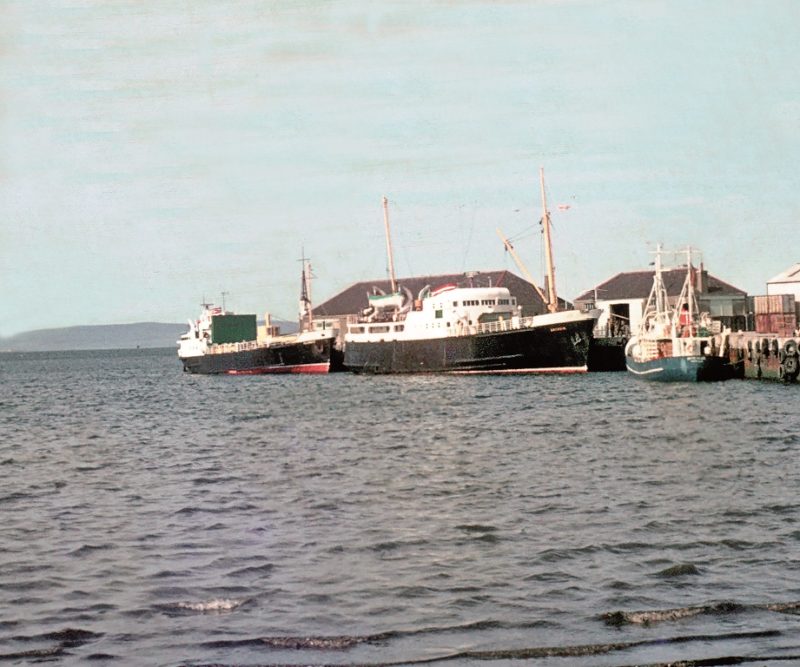
The cruiser Hampshire set out from Scrabster in 1916 for Russia with Lord Kitchener and £10 million of gold bullion on board, but the warship struck a mine off Marwick Head off the West Coast of Mainland of Orkney with the loss of almost the entire crew and Lord Kitchener. There is a memorial to Lord Kitchener and the crew of the Hampshire on Marwick Head. The British battleship Vanguard was temporarily anchored in Scapa Flow during World War I when her magazines overheated and exploded killing all but two of her 845 crew. After the capitulation of Germany in November 1918, the 74 units of the German High Fleet were ordered from their bases to Scapa Flow, with all being sunk there by their crews in 1919. Salvage took many years for the big battleships and some were towed upside down to scrapyards on the Firth of Forth.
A daring raid on Scapa Flow was made by Gunther Prien and U47 in October 1939 when he penetrated the supposedly impregnable defences of Scapa Flow and sank the battleship Royal Oak. There was a large loss of life, and an oil slick continued to come to the surface from her oil bunker tanks near the wreck marker buoy for over forty years until remedial measures were put in place. This embarrassment led to the construction of the Churchill Barriers later in the war by a series of causeways carrying a road from Mainland to Burray and South Ronaldsay to block off the eastern entrance to Scapa Flow. The naval base was called H.M.S. Proserpine during the war, with Italian prisoners of war housed in camps around Scapa Flow during the war, and of the two larger Nissen huts for their leisure use, one was decorated by the prisoners as a chapel with artistic flares including a roof painting in the style of the Sistine Chapel in the Vatican City, and today it is maintained as a heritage site for all to visit, including the surviving Italian prisoners of war.
KIRKWALL and ORKNEY HARBOUR AUTHORITY
The Orkney Harbour Authority took over the work of Orkney Harbour Commissioners in 1975 when Orkney Islands Council was established by the Local Government (Scotland) Act of 1973, and later amended by Scottish port regulations of the mid 1990s. Today, the harbour authority uses a sophisticated Vessel Traffic System (VTS) to watch over the island seaways, and it also looks after the ports of Kirkwall, with the cruise terminal of Hatston Pier on the west side at the entrance to the Bay of Kirkwall, Stromness port, and the oil terminal at Flotta in west Scapa Flow, and the oil rig decommissioning facility at Lyness, a former Royal Navy base on the island of Hoy with the tiny island of Fara separating Hoy from the island of Flotta. Kirkwall is situated at 59°00′ North, 2°58′ West and is the capital of the Orkney, with the Bay of Kirkwall approached by a seaway to the south of the island of Shapinsay with its magnificent Balfour Castle and gardens. A southerly course is then followed past Hatston Pier on the west side of the Bay of Kirkwall until the small port of Kirkwall is reached. Scapa Flow lies to the south of Kirkwall after a journey of only a few miles over slightly rising land.
The Bay of Kirkwall is a natural harbour and is wide and free of dangers in the fairway and leads to the Port of Kirkwall. Tidal heights are 2.9 metres at mean high water springs, and 2.2 metres at mean high water neaps, with no appreciable tidal stream near the jetties of Kirkwall.
Pilotage is necessary for all vessels, and there is a safe anchorage for large ships in fourteen metres of water one mile from the harbour, with small vessels able to anchor half a mile north of the harbour in 4.9 metres of water.
Kirkwall Harbour consists of a curved area with a very narrow entrance of only 18.5 metres in width between the longer west breakwater and the main pier, which projects in a NNW direction for 300 metres and provides two berths with alongside depth of 3.7 metres. The harbour is exposed to very strong northerly winds, but the sea state is usually moderate and vessels can safely tie up along the west breakwater within the small harbour. Warehouse facilities are provided as well as mobile cranes equipped with a grab or hook. The working week is from 0800 hours to 1700 hours Monday to Friday as well as Saturday mornings, but there is no repair yard for repair work, but a small slipway is available for hauling fishing boats out of the water. Supplies of fresh water and fuel are available, and much of the harbour near the main pier is now given over to a yacht marina. Kirkwall harbour has a total of 970 metres of quay including the basin area with a depth of 6.0 metres of water.
Hatston Pier is located on the west side of the deep water entrance to the Bay of Kirkwall and is used by large and small cruise liners on its long outer berth, and by ro-ro vessels on its smaller inner berth, and by coastal tankers and oil rig supply vessels. Hatston Pier has the longest commercial deep water berth in Scotland, and was opened in 2002 with an extension of length 160 metres completed in 2013. The outer berth is 385 metres in length with alongside depth of 10.5 metres, with a total of 884 metres of quayside and an important ro-ro berth available on the inside berth for multi-purpose use. Electricity for the port is provided by a 300 metre high wind turbine, and there is a 500 tonne fresh water facility for delivering fresh water at 50 tonnes per hour, and fuel oil facilities are also available.
John Jolly Shipbrokers of 21 Bridge Street in Kirkwall were established in 1902 as registered shipbrokers, stevedores, shipping and forwarding agents, and Lloyd’s agents. The cable address of ‘Jolly Kirkwall’ was well known and operated in Kirkwall for 117 years until acquired on 1st May 2019 by Denholm Port Services. They have continued operating as an independent agency for cruise ships, oil and gas tankers, bulk and general cargo ships, and as project cargo specialists for the oil industry, and as stevedores in Kirkwall.
The marine supply chain to Orkney encompasses expertise in several fields e.g. shipping agents, ferry and freight forwarders, heavy lift specialists, marine engineers and consultants, towage and survey work, environmental specialists and ship’s chandlers. Global Energy Group (GAC) offers oil and gas installation construction and maintenance solutions to oil and energy customers including wind turbine, wave and tidal energy.
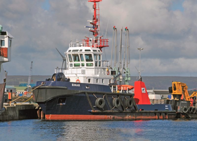
The Orkney Towage Co. Ltd. was formed on 21st April 1976 to provide towage services at the Flotta Oil Terminal of Occidental Oil, and today uses three powerful tugs named Einar, Erlend and Harald of 411 grt and commissioned between 1989 and 1992, with a bollard pull of 55 tonnes, and they also assist cruise ships at Hatston Pier if necessary in windy conditions, and also vessels if a danger to other shipping, and in oil pollution response work. Orders for two more powerful tugs were given to the Sanmar shipyard in Turkey, and are currently due in service with the names Odin of Scapa and Thor of Scapa of 32.0 metres in length, to remind everyone of the Viking heritage of Scapa Flow.
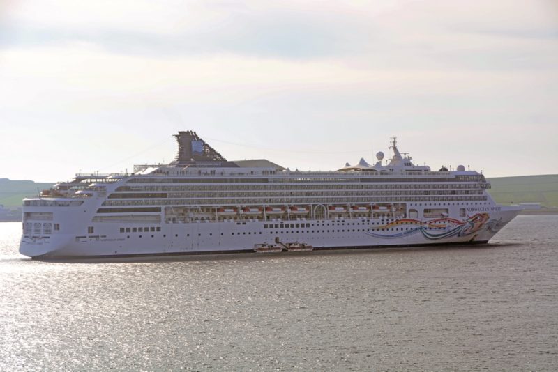
Hatston Pier played host to 140 cruise ship calls in 2018 and to 170 cruise ship calls in 2019, with 71 cruise ships carrying fewer than 400 passengers and only half a dozen carrying more than 3,000 passengers. Two smaller cruise ships or one much larger one can be comfortably berthed at Hatson Pier on the longer outside berth, with the inner shorter berth for ro-ros. Smaller ‘Expedition’ type cruise ships are also calling to the north of Scapa Flow at bays around Sanday and Westray with their long magnificent sand dunes, ideal for walking holidays, with Noltland Castle on Westray built in the 16th century and open to visitors.
STROMNESS
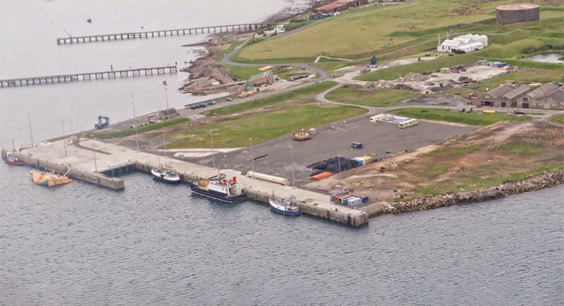
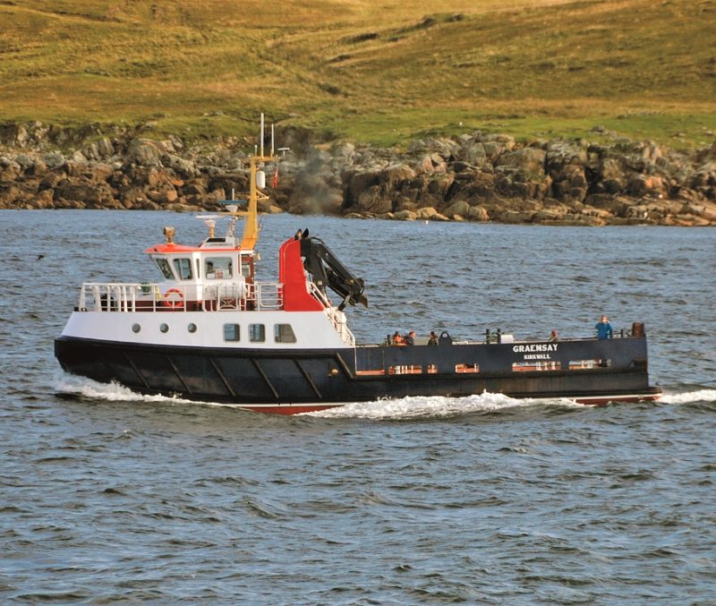
Stromness dates from the 17th century and owes its existence to its excellent harbour. Stromness Pier is the base for the daily ro-ro passenger and freight service of Serco Northlink Ferries from Scrabster across the Pentland Firth on the north coast of Scotland. There are two other piers in the port, and another smaller pier is located to the south of the RNLI lifeboat slip. Ferries and other vessels approach the port in a northerly direction after turning to port from Hoy Sound, separating this Mainland port from the island of Hoy. The ferry pier is of length 148 metres with an alongside depth of 5.5 metres on the west side of the harbour. The ferry to Hoy from Stromness is named Graemsay, around which island it travels to Hoy. The very famous high ‘Old Man of Hoy’ stack is reached on the west side of Hoy after a three mile walk as there is no road to the stack. There is another similar stack on the west side of Mainland island at Yesnaby Castle Sea Stack.
A regular weekly steamer service calling at Stromness from Liverpool to Leith was operated by Matthew Langlands & Sons between 1871 and 1920 for most of the year except severe winter conditions. Their coastal passenger and cargo ships had names such as Princess Royal, Princess Louise, Princess Maud, and Princess Alice and called at Oban, Stornoway on the route to Stromness and on to Aberdeen, Dundee and Leith. There were also more leisurely summer yachting cruises to Stromness, where Langlands had an office on The Wharf. The round voyage from Liverpool to Leith via Stromness took eleven or twelve days, and it was also extended later into a ‘Round Britain’ service via the South Coast. The fleet was taken over in September 1919 by Coast Lines of Liverpool for £400,000, with the share purchase sealed on 17th October 1919 and became effective after obtaining the consent of the Ministry of Shipping and the shareholders. Coast Lines then continued only summer yachting cruises from Liverpool to Stornoway and Stromness during the inter-war years and in post-war years up to 1956.
Stromness and Lyness, both ports on Scapa Flow, and Tarbatness named after a ness near Tain on Dornoch Firth, were the names of three Royal Fleet Auxiliary (RFA) store ships built on the Tyne by Swan, Hunter & Wigham Richardson Ltd. during 1966/68. Stromness and Lyness maintained close links with schools in Kirkwall and Scapa Flow and made several visits to their ‘home’ area. The trio were perhaps the most successful of all RFA stores ships ever built, with one serving as an Air Stores Support ship carrying over 80,000 items of aircraft stores for use by aircraft carriers and their escorts, while the other pair carried 40,000 different items of general naval stores including food, water, clothing, mess gear and medical supplies.
Trawlers from Stromness sail for the rough waters of the North Atlantic to catch white fish, while smaller inshore fishing boats catch prawns, crab, lobster and scallops. There are several fish farms in Scapa Flow to export salmon to the quality restaurants of the main cities of the U.K. and Europe. There are a total of three big marinas in Orkney located at Stromness, Kirkwall and Westray. Renewable energy in all of its many forms is big business today in Orkney, with wind turbines, wave and tidal energy systems having all been tested in Scapa Flow. The European Marine Energy Centre at Stromness have been working on these big challenges by developing harbour infrastructure for wave and tidal energy, and this has also taken place at Lyness, Hatston Pier at Kirkwall as well as at Stromness with £22 million spent on research. This research was funded by Orkney Islands Council, energy company ERDF, and primarily by the Scottish Government, who want to pioneer this type of industry. Smaller ‘Expedition’ type cruise ships also call at Stromness, which is expanding its role into many other sectors including aquaculture, diving and marine tourism.
FLOTTA and LYNESS

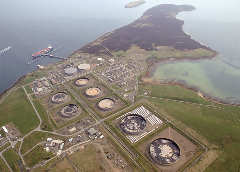
American oil baron Dr. Armand Hammer and his Occidental Oil struck oil in 1972 around 135 miles south east of Orkney at the Piper Field, followed shortly afterwards by the Claymore Field. Oil workers for these two oil platforms boarded fast high speed launches at Houton, with local ferry links to Lyness on Hoy, on the north shore of Scapa Flow and headed south through the Sound of Hoxa between Flotta island and South Ronaldsay. Occidental Oil, known as ‘Oxy’, had been a long time resident in Orkney, and after initially shipping oil from a North Sea terminal to Norwegian and Scottish refineries, decided to lay a pipeline to the island of Flotta and build a loading terminal there. After several decades of loading Aframax tankers, Oxy sold Flotta terminal and its oil berths to Repsol Sinipec Energy (U.K.) Ltd. for use by other oil and gas companies.
Deep sea tankers arrive at the ‘T’ shaped Flotta oil jetty trimmed no more than three metres deep by the stern and with propellers fully immersed in the water. Terminal pilots and mooring masters use six hawsers, three at the bow and three at the stern, with four ‘midships strops to keep these mammoth tankers safely tied to the jetty on the west side of Scapa Flow. There are also two dolphins, one at each end of the jetty, for use in tying up smaller LPG gas tankers. The minimum alongside depth is 20.12 metres and very large tankers of up to 170,000 dwt are routinely used for the shipments of crude oil. Pumping ballast water from tankers directly into Scapa Flow is strictly prohibited and is pumped ashore instead. A harbour tug is permanently attached to the stern of tankers for the whole length of time of loading operations, with the ‘midships tanker manifold connected to the four crude oil loading arms (or the two LPG loading arms or one ethane loading hose). A large tank farm is located on the shore immediately to the south of the loading terminal, and two Single Point Moorings (SPM) are located approximately 1.5 miles to the north of the northern coast of Flotta, but are not presently in use.
Ship to Ship (STS) oil and gas transfers have taken place in Scapa Flow since 1980, with over 420 STS transfers of oil made between the six hundred tankers involved. The first commercial transfer of LNG liquid methane occurred in 2007, with the CMB of Belgium owned huge gas tankers Excalibur and Excelsior transferring 132,000 cubic metres of LNG. The first transfer of LPG gases took place in March 2016. All tankers arriving in Scapa Flow for STS transfers must have their propellers fully immersed and a trim of no greater than four metres by the stern. A trim must be maintained to allow the tankers to be manoeuvred by three tugs without difficulty during the whole of their stay. The Orkney STS operations have an Oil Transfer Licence from the Maritime and Coastguard Agency (MCA), a Ballast Water code of practice from the Orkney Islands Council, and also comply with the Oil Companies International Marine Forum (OCIMF) protocols. This sensitive environmental area is thus well protected from spillage and pollution.
Lyness on Ore Bay was protected during World War II by a series of anti-aircraft guns built on the top of stone cairns, one of which has survived and is an exhibit in the Scapa Flow Museum at Lyness. The Lyness Royal Naval cemetery is nearby to the museum, and commemorates the many fallen Royal Naval personnel of two World Wars in Scapa Flow. Hoy means ‘High Island’ and is a beautiful but rugged west coast Orkney island with the narrow coast road passing the massive ‘Dwarthie Stane’, a huge Neolithic tomb carved from solid rock. The road ends at Rackwick, and from there one walks to the impressive ‘Old Man of Hoy’, a rock stack of 450 feet in height, and on to the vertical cliffs of St. John’s Head of 1,100 feet in height with breeding colonies of guillemots, puffins, razorbills and many other types of seabird. Ward Hill at 1,565 feet is the highest point in Orkney with commanding views over Scapa Flow. These stack features of the West coast of Hoy can also be clearly seen from the Scrabster to Stromness ferries.
Decommissioning of oil rigs at the former Royal Navy base of Lyness has been established at a £3 million facility on a 300,000 square metre site of ‘brown field’ land at Lyness pier and the nearby Golden Wharf pier. The quay at Lyness has an alongside depth of 8.0 metres for large barges carrying the redundant oil rigs to berth at and pointing into the dismantling yard. New quay edges, laydown areas, fendering and services have been provided, and the rigs are pulled from the barges on ‘skids’ by powerful winches in winch houses at the rear of the dismantling area. Reinforced skid zone offloading areas, heavy lift and processing areas, mechanically operated environmental barriers, additional decks supported by steel grillage, helicopter pad, site welfare offices and medical facilities are just some of the features of the yard.
ORKNEY FERRIES
NORTH of SCOTLAND, ORKNEY & SHETLAND STEAM NAVIGATION Co. Ltd.
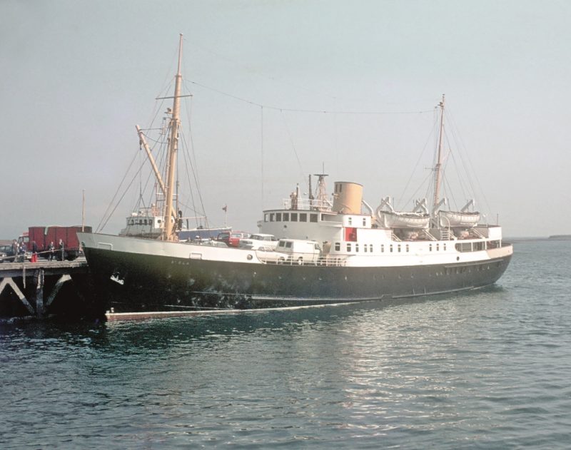
The ancestor company of the North of Scotland, Orkney and Shetland Shipping Co. Ltd. was formed as long ago as 1790 for services to the Northern Isles from Leith, Aberdeen and Scrabster. These coastal ferries sailed from Leith Harbour and Matthew’s Quay at Aberdeen to Wick, Thurso, Caithness, Stromness and Kirkwall in Orkney, and Lerwick in Shetland. The North of Scotland, Orkney & Shetland Steam Navigation Co. Ltd. ferry company was formed in 1875 from the Aberdeen, Leith and Clyde Shipping Company, the latter having a coastal East Coast of Scotland service between 1810 and 1820 entirely with sailing packets, with two steamers, Brilliant and Velocity, added in 1821. A few years later the service was extended to the Moray Firth, Caithness, Orkney and Shetland. In 1838, the steamer Sovereign was given the important contract to carry the mails to and from Shetland. St. Sunniva of 1887 expanded the company portfolio into cruising to Norway, becoming the first purpose built cruise ship in the world. The company withdrew completely from cruising in 1908, with its steamers used in World War I as tenders to the Grand Fleet based at Scapa Flow and on the regular service to Kirkwall and Lerwick, with two vessels unfortunately lost to enemy action and many company personnel decorated for service or bravery.
A fleet of nine steamers was being operated in 1920 in St. Clair of 1868, St. Fergus of 1913, St. Margaret of 1883, St. Ninian of 1895, St. Ola of 1892, St. Rognvald of 1901, St. Sunniva of 1887, the Earl of Zetland dating from 1877, and the cargo only Cape Wrath built in 1900, but St. Sunniva of 1887 was lost in dense fog when she struck a rock off Mousa Island and sank in 1930, fortunately without loss of life, and very unusual as there is nearly always much loss of life in the dangerous and mountainous seas in shipwrecks experienced in these high latitudes.
A fleet of ten steamers was being operated in 1932 with a new St. Magnus in 1924, St. Clement in 1928 and the clipper bowed St. Sunniva of 1,400 grt in 1931 from the Aberdeen yard of Hall, Russell & Co. Ltd. with a white hull. Thirteen steamers were operated at the beginning of World War II, with St. Clair of 1,641 grt completed by the same yard in 1937 with a black hull and accommodation for 200 First Class passengers and 100 in Second Class. The fleet maintained the services to Kirkwall and Lerwick with almost clockwork regularity in some of the heaviest seas experienced around the coastline of the British Isles. A fleet of seven steamers and motorships with yellow funnels was being operated in 1960, including two twin screw motorships in St. Ninian of 2,244 grt from the Caledon yard at Dundee in 1950 with accommodation for 272 berthed passengers and 344 deck passengers, and St. Clair of 3,303 grt with accommodation for 314 berthed and 200 deck passengers.
The company was taken over by Coast Lines in 1961 with 57 shillings and sixpence paid for each share, with the title of the company then the North of Scotland, Orkney and Shetland Shipping Co. Ltd. with the Head Office at Matthew’s Quay in Aberdeen. The cargo only City of Dublin was purchased from Palgrave Murphy of Dublin and renamed St. Magnus in 1965. The motor vessel Earl of Zetland of 548 grt completed in 1939 by the Hall, Russell & Co. Ltd. yard in Aberdeen is still in existence today from this period as a restaurant in the Albert Edward Dock at North Shields. She gave 36 years of service in the Northern Isles, and was sold for use as a survey ship in 1965, before arriving later in the Tyne.
P & O. FERRIES
P & O. ran the Orkney and Shetland services from Aberdeen from 1971 until 2002, with the title changed to P. & O. Scottish Ferries in 1989. The twin funnelled car ferry St. Ola of 2,571 grt was completed by Hall, Russell & Co. Ltd. at Aberdeen in 1974 for the Scrabster to Stromness route. She was later fitted with stability sponsons and carried 600 deck passengers and 85 cars loaded via bow and stern ramps at a service speed of 14 knots until she ended her service in 1992. At the end of their operations in 2002, the company had four vessels on the Orkney and Shetland services in the passenger ferries St. Sunniva (3) built as Djursland in 1972 and renamed St. Sunniva on 27th March 1987 after a £6 million refit at the Hall Russell yard in Aberdeen with accommodation for a large number of berthed and deck passengers and 210 cars or lorry and car combinations, St. Clair (5) built at Bremerhaven in 1971 as Travemunde with accommodation for 406 berthed passengers and 160 cars, the freight only St. Rognvald (4) built as Rhonetal and chartered to North Sea Ferries as Norcape in 1970 for Hull to Continental service, becoming St. Rognvald in 1989, and the smaller St. Ola (4) built as Svea Scarlett in 1971 for the Scrabster to Stromness services in Orkney.
NORTHLINK ORKNEY & SHETLAND FERRIES
The subsidised island ferry services were put out to tender in 1999, with a joint venture between Caledonian MacBrayne and the RBS Group winning the contract and began operating in October 2002. However, higher than expected operating costs and other factors contributed to financial difficulties, with Transport Scotland making additional subsidy payments of £600,000 per annum and also agreed to restructure the dates of the subsidy payments. The NorthLink passenger ferries completed in 2002 had white hulls and twin pale blue funnels and a black top and with a logo featuring a stylised white ‘N’ on a dark blue disc when delivered, but now have an image of a Viking warrior in full battle dress on a white hull stretching from the waterline to the white funnel with a black top.
NORTHLINK FERRIES Ltd.
Three ferry companies in Caledonian MacBrayne, Irish Continental Ferries, and V Ships all made bids to run the Northern Isles ferry services on 19th July 2005.
Irish Continental Ferries withdrew their bid in October 2005, and of the remaining two bids, that of Caledonian MacBrayne was the lower bid and thus won the contract. NorthLink Ferries began operating the ferry service to Lerwick again on 6th July 2006, with the six year contract of Caledonian MacBrayne ending in July 2012 and a new contract was won by Serco NorthLink Ferries Ltd. to last for six years at a value of £243 million, with an 18 month extension agreed in July 2018.
One of the Northlink ferries travels direct between Aberdeen and Lerwick, while the other calls in at Kirkwall (Hatston Pier) late in the evenings on certain days of the week.
The Aberdeen to Kirkwall (Hatston Pier) service of 1700 hours takes six hours northbound, and arrives at its destination at 2300 hours on Tuesday (except in winter), Thursday, Saturday and Sunday nights, and sails for Lerwick at 2345 hours.
One of the Lerwick to Aberdeen ferries, not the direct sailing, calls at Hatston Pier southbound on Monday (except in winter), Wednesday and Friday nights before sailing on to Aberdeen.
The current fleet comprises two twin funnelled passenger ro-ros in the sisters Hrossey and Hjatland of 11,720 grt completed in 2002 by Aker Finnyards at Rauma in Finland on dimensions of length 125.0 metres, moulded beam of 20.0 metres, and a draft of 5.4 metres.
Hrossey means ‘Horse Island’ and is the old Norse name for Orkney, while Hjatland means the ‘shape of a sword’ and is the old Norse name for Shetland. They have accommodation for 600 passengers of which 356 are berthed in outer and inner cabins sleeping four persons, and their car decks can take 140 cars or a mixture of cars, lorries and trailers. They have service speeds of 24 knots from four MaK diesel engines each of 5,400 kW power, and have two rudders, two CP propellers and two bow thrusters for manoeuvring in port.
There are currently also two sister freight ferries running in Hildasay and Helliar of 7,606 grt and 5,758 dwt built by Astilleros de Huelva S. A. as Leili and Lehola for the Estonia Shipping Company of Tallinn. They were chartered from the Clipper Group in 2010 and have service speeds of 17 knots from twin Wartsila diesel engines of 9,900 bhp. They carry lorries, trailers and livestock with accommodation for a dozen lorry drivers. The pair replaced the ro-ro ferries Hascosay of 6,136 grt built in 1971 and Clare of 5,617 grt built in 1972 and out of service in 2010/11.
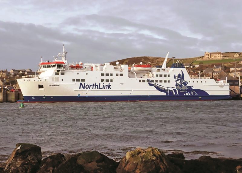
The Scrabster to Stromness link across the Pentland Firth is operated by the ferry Hamnavoe of Serco North Link Ferries of 8,780 grt and built in 2002 by Aker Finnyards at Rauma in Finland at a cost of £28 million. She has accommodation for 600 passengers and 450 lane metres of space on her car deck for 95 cars. She operates a twice daily service on all weekdays, and on Saturdays and Sundays but at different times from weekday sailings, in all but the roughest sea conditions.
Sailings from Stromness into the exposed stretch of water in the Sound of Hoy to the north of Graemsay island, can give a very rough passage butting into severe westerly Atlantic gales on occasion, before Hamnavoe is able to change course to the south to reach Scrabster.
ORKNEY ISLANDS COUNCIL
FERRIES
The history of inter-island passenger services in Orkney dates back to 1864 when Capt. Robertson sailed his purchased small steamer Quarry Maid from Liverpool to Orkney, renaming her Orcadia on arrival. The Orkney Steam Navigation Company was formed in 1868 and a larger steamer Orcadia (2) was purchased that year and served the Northern islands of the Orkney group for 68 years until 1931. Three further small ferries entered the fleet between 1892 and 1928 to replace earlier vessels, and then Earl Thorfinn of 345 grt began her service in 1928 built by the Aberdeen yard of Hall, Russell & Co. Ltd. Earl Sigurd of 221 grt followed from the same yard in 1931.
In 1961, the replacement of Earl Thorfinn was necessary but was beyond the capital resources of the company, and thus a new company was formed backed by a Government subsidy to continue the services. The new Orkney Islands Shipping Co. Ltd. was able to run the new Orcadia (3) of 896 grt built in 1962 and the smaller Islander of 250 grt built in 1969 on the Northern Islands services. The company took over the services from Mainland to the South Islands of Orkney and a second Government subsidy was approved on 2nd April 1974. The total subsidy was £135,000 per year of which £22,000 was to run the Southern Islands services, which were taken over from that date from the Bremner Company of Stromness, whose directors Capt. Hourie and Capt. Gray wished to retire. The ferry Hoy Head and the smaller Watchful were operated at this time to the South Orkney islands.
These vital ferry links run from Mainland to thirteen outlying islands in Orkney, and were taken into public ownership in 1987, and in 1995 the Orkney Islands Shipping Co. Ltd. changed its name to Orkney Ferries Ltd. The services are absolutely essential to the daily life of people living on these northerly Orkney islands. A total of over 20,000 sailings per year are operated by a fleet of nine small ferries carrying 320,000 passengers and 82,000 vehicles per year. The company opened a new office in September 1995 in Shore Street in Kirkwall, and the services are:-
Outer North Isles Service Ferries
Earl Sigurd of 771 grt completed by McTay in November 1990 with a service speed of 12 knots, her sister Earl Thorfinn from the same yard in August 1990, and Varagen of 928 grt built by Cochrane Shipbuilders in 1988 and entered island service in August 1991 with a service speed of 15 knots.
Westray and Papa Westray Service
Large launch Golden Mariana of length 50 feet built in 1973 by the Bideford Shipyard with a service speed of 10 knots.
Stromness to Graemsay and Hoy
Ferry Graemsay of 58 grt completed in June 1996 by Ailsa Troon with a service speed of 10 knots.
Inner Isles to Shapinsay Service
Ferry Shapinsay of 219 grt completed by Yorkshire Dry Docks at Hull in July 1989 with a service speed of 11 knots.
Inner Isles of Rousay to Egilsay and Wyre Islands Service
Ferry Eynhallow of 104 grt completed by David Abels in August 1987 with a service speed of 11 knots.
South Isles Service
Ferry Hoy Head (2) of 482 grt completed by Appledore Shipbuilders in April 1994 with a service speed of 11 knots.
There is also the relief ferry Thorvsoe of 385 grt built at Campbeltown with a service speed of 11 knots, ready to take over any of the above services in case of breakdown.
POSTSCRIPT
In addition to all of the passenger services outlined above, many coastal tankers bring in petrol, diesel oil, fuel oil and home heating oils to Hatston Pier at Kirkwall. There is also an essential container service from Aberdeen to Kirkwall and Lerwick run by the Streamline Shipping Group since 1984, carrying some of the island required goods in their own brand of containers. The container ship Daroja of 4,155 dwt, built at the Pattje yard at Waterhuizen in Holland in 1997, with a blue hull and a white funnel with a central logo operated this service from 2006 to 2017, and then the company utilised the overnight service of the Hildasay and Helliar ro-ro freight network to increase their level of available cargo from Aberdeen with freight consolidation at Aberdeen, Glasgow and Humberside. Daroja is now operating from Northern European ports to Pasajes, Lisbon, Casablanca and Mediterranean ports.
A wide range of shipping can be seen today in Scapa Flow including big Aframax tankers of the Teekay, Knutsen and Greek fleets, the shale gas carriers JS Ineos Insight, JS Ineos Ingenuity, JS Ineos Inspiration and JS Ineos Intrepid of 27,500 cubic metres capacity with their first shipment of shale gas having arrived at Grangemouth on 27th September 2016 shortly after the last of the quartet was delivered. The anchor handling tug Ievoli Black of 2,283 grt was built in 2010 and is on long term charter to the U.K. Coastguard for emergency towage duties around Northern Scotland, Orkney and Shetland. The fish carrier Ronja Superior of 1,460 dwt berths at the Lober Fish Farm in Orkney to load live fish.
The cruising trade to Kirkwall and Orkney is very valuable to the community with many Orcadians now almost dependent on the cruise ships arriving. The long Neolithic, Viking and wartime history of the islands, their supreme beauty and quietness on still sunny mornings are the pleasures that draw people here, with the added attractions of whale watching, diving activity in Scapa Flow, ferry voyages to the many small outlying islands, the Churchill Barriers and a good road to Burray and South Ronaldsay from Mainland, with the southernmost point of Brough Ness overlooking the Pentland Firth. A replica Viking longship called Sea Stallion was launched at Denmark in 2004 and was named by Queen Margrethe II of Denmark. The longship made a voyage from Roskilde in Denmark to Dublin in 2007, with a call at Kirkwall in mid July. The weather in Viking times was better than our summers and winters today and greatly helped their long roving voyages.
I wish to sincerely thank Bernard Shephard for his help, and several excellent websites including those of Orkney Harbours, Northlink Ferries, Streamline Shipping Group, Orkney Ferries and others.



Comments
Sorry, comments are closed for this item