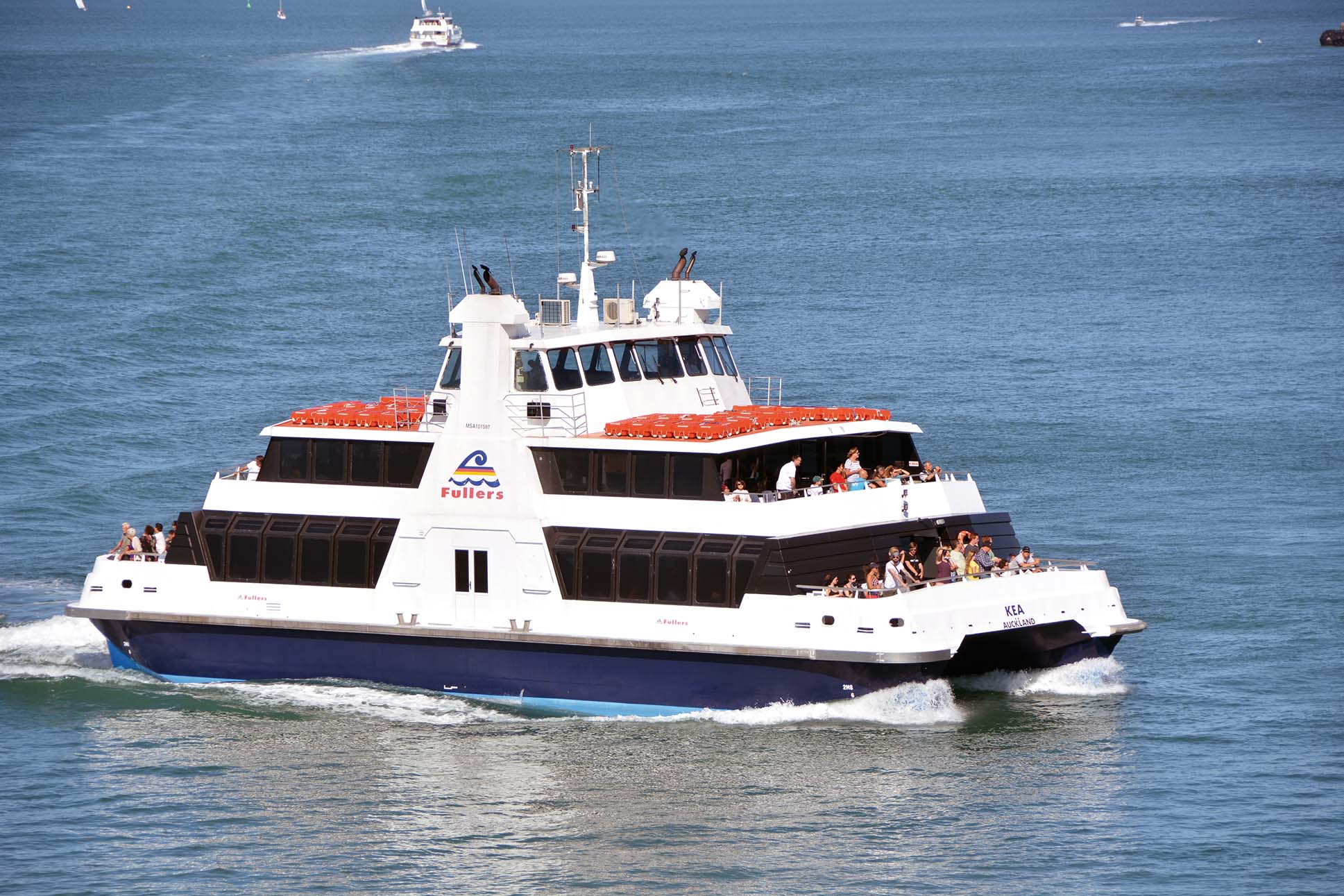
![]() The skyline of the beautiful harbour of Auckland is dominated by the Sky Tower, the tallest building in the southern hemisphere at 1,076 feet in height. The best places to view the shipping in the port are from the observation deck of the Sky Tower, or on a Fuller’s harbour cruise from the Ferry Building on Quay Street, which runs behind the many quays of the port. If arriving by sea, one passes through the 47 islands of the Hauraki Gulf including Browns Island, and Rangitoto Island which is linked by a thin land bridge link to Motutapu Island, both nature reserves, and Waiheke Island with 8,730 permanent residents. The Rangitoto deep draft channel then leads to the port approach channel.
The skyline of the beautiful harbour of Auckland is dominated by the Sky Tower, the tallest building in the southern hemisphere at 1,076 feet in height. The best places to view the shipping in the port are from the observation deck of the Sky Tower, or on a Fuller’s harbour cruise from the Ferry Building on Quay Street, which runs behind the many quays of the port. If arriving by sea, one passes through the 47 islands of the Hauraki Gulf including Browns Island, and Rangitoto Island which is linked by a thin land bridge link to Motutapu Island, both nature reserves, and Waiheke Island with 8,730 permanent residents. The Rangitoto deep draft channel then leads to the port approach channel.
On entering the port approach channel with North Head to starboard and Hobson’s Bay to port, the Port of Auckland lies dead ahead on the south side of the channel. Auckland Harbour Bridge and Viaduct Basin lie immediately to the west of the quays, and beyond lies the remainder of the big natural water area of Waitemata Harbour. Great Barrier Island, just outside Hauraki Gulf, has 700 inhabitants, but Haratonga Bay on the island was the setting for a BBC series of Castaway, purporting to show shipwrecked survivors on an inhospitable and uninhabited island.
History Of Auckland
The Maori, the native people of New Zealand, settled the Waitemata harbour area in the 1300s, living a settled tribal existence under their many Chiefs. The land around this area and the islands in the Gulf of Hauraki are formed from 48 extinct volcanoes. The Maori gave the harbour the romantic name of Tamaku-makau-rau or ‘Land of a hundred lovers’ whereas the British simply called their new settlement after an Admiral. There were around five hundred minor tribal battles and skirmishes known as the ‘Musket Wars’ between the Maori and British and French troops as well as whalers and sealers during the period 1805 to 1840.
On 6th February 1840, the Treaty of Waitangi was signed in the Bay of Islands off the east coast of North Island, establishing a British Governor of New Zealand, and recognising Maori ownership of their lands and properties. After the initial signing at Waitangi, copies of the Treaty were taken around New Zealand and over the following months, the Chiefs of 530 Maori tribes signed the Treaty. However, the Maori and British interpretations of the Treaty differed, and a further two thousand Maori were killed in battle between 1843 and 1869. Capt. William Hobson, Lieut. Governor of the new British colony of New Zealand chose Auckland as its first capital. A population of three thousand people in 1843 quadrupled over the next thirty years, all dependent in some way or other on the first Queen Street Wharf of 1853 and the five hundred feet long Wynyard Pier in Official Bay completed in 1851.
The Auckland Harbour Board was established in 1871 by an Act of Parliament with thirteen members, and further wharves were added and massive reclamation works of the many mudflats were undertaken. Mechanic’s Bay and Freeman’s Bay lost their natural shoreline, while Commercial Bay, the site of much of the present Auckland waterfront, was totally lost to history in these first reclamations. The newly reclaimed land allowed the construction of a railway wharf and new dockyard facilities. New docks were also built on the other side of the harbour at Devonport, with the Calliope dry-dock at five hundred feet the largest dry-dock in the southern hemisphere when opened in 1888. Much of the dredging and reclamation was done by the twin screw bucket hopper dredger Hapai of 867 grt built in 1909 by Fleming & Ferguson Ltd. on the Clyde, which sailed out to New Zealand shortly after the twin screw tug Te Awina of 220 grt, named after a Maori, arrived from the same shipyard for the Auckland Harbour Board.
Auckland Ferry Terminal Building
William Henry Hamer (1869-1940), Chief Engineer of the Auckland Harbour Board, recommended in 1904 that a purpose built ferry landing terminal be built at the end of Queen Street with a ferry basin immediately in front of it, the latter completed in 1907. A four storey symmetrical brownish red and yellow building with a tall central clock tower in the ‘Imperial Baroque’ style was begun in 1910 and completed two and one half years later in 1912. The base consisted of Coromandel granite and it was faced with Pyrmont stone, a Sydney (NSW) sandstone. It was modelled closely on the Port of San Francisco’s Embarcadero waterfront ferry building. All of the building was leased out to the various ferry companies that served Bayswater, Birkenhead, Chelsea, Devonport, Kohimarama, Northcote, Orakei, St. Heliers and Stanley Bay districts from Auckland with steam ferries. The building served its function well until 1982 when it did not comply with new seismic requirements and fire codes. A renovated and upgraded building was re-opened on 5th November, 1988 by Sir Paul Reeves (1932-2011), Governor-General at a cost of NZ$8M. The building, between Prince’s Wharf and Queen’s Wharf, has Fuller’s booking office on the ground floor, and their ferries operate constantly to the Hauraki Gulf islands and nearby districts from the ferry terminal. The Fuller’s harbour cruise only briefly calls at Devonport on the other side of the harbour, but if one takes a day excursion there one can visit the nature reserves of North Head and Mount Victoria.
Western Reclamation Scheme
Refrigerated export of meat had begun from New Zealand in 1882, and by the turn of the century or shortly afterwards many British cargo and passenger lines had regular services. These included P. & O. (1840), Federal Line (1895), New Zealand Shipping Co. Ltd. (1873), Shaw, Savill & Albion Co. Ltd. (1858) and many others. Auckland became a busy port with services to Sydney (NSW), San Francisco and London. The New Zealand coastal services of the Northern Steamship Co. Ltd. of Auckland operated between 1881 and 1974 using coasters with Maori names e.g. Moanui and Tainui from a headquarters building on Quay Street. The pressure from these companies for new wharves led to the Western Reclamation Scheme and Western Wharf extensions, which continued throughout the 1920s until they were completed in 1931. The Auckland to Whangarei railway line was completed in 1925, and was followed by the line to Tauranga two years later. After the Japanese attack on Pearl Harbour on 7th December 1941, part of the American Battle Fleet was stationed at Auckland necessitating further expansion of the harbour facilities. No fewer than 104 warships and 284 troop transports arrived in Auckland during 1943 on their way to the battles in the Southern Pacific.
Auckland Harbour Bridge
Auckland Harbour Bridge was completed in April, 1959 with Dorman Long of Middlesbrough and the Cleveland Bridge and Engineering Company of Teesside as the main contractors. It is an eight lane box truss motorway bridge joining St. Mary’s Bay in Auckland with Northcote in North Shore City. It is 3,348 feet long with a main span of 243.8 metres and rises 43.27 metres above high water, allowing deep sea ships access to the wharf of the Chelsea Sugar Refinery, one of few such wharves to the west of the bridge. The Auckland Harbour Board tug William C. Daldy was used to tow the barges with the main spans onboard, and held one barge in position for 36 hours in stormy weather and high winds. The bridge was opened on 30th May, 1959 by Lord Cobham, Governor-General of New Zealand. In 1969, two-lane box girder clip-on sections were added to each side, doubling the number of lanes to eight. The clip-on sections were manufactured in Japan by IHI, and shipped to Auckland where they were unloaded with the Holm Shipping Co. Ltd. (1880-1975), whose coastal ships had green funnels with a black top and ‘Holm’ prefixes to their names, acting as ship’s agents.
New Types Of Shipping
In post-war years, pallets were introduced in the 1950s to make cargo handling easier by fork lift into and out of the sheds. The Bledisloe, Jellicoe and Freyberg wharves were all in full operation by 1961. Auckland Harbour Board was operating four tugs by 1972, the steam tugs William C. Daldy 346/35 and Aucklander 454/58, and the diesel powered tugs Te Awhina 220/68 and Tamaki 215/72, as well as the floating crane Hikinui delivered in 1963. New cranes and machinery turned the labour intensive trades of the stevedores into faster loading and discharge rates. Bulk carriers, ro-ros and container ships began to appear in Waitemata harbour, berthing at the Capt. Cook Wharf, Jellicoe Wharf and the new Fergusson Container Terminal from 1971. The structure of the port management changed in 1988 with the Port Companies Act and the formation of Ports of Auckland Ltd. (POAL). The land and assets of the Auckland Harbour Board were purchased for a mixture of cash and equity amounting to approximately NZ$250 million. Shares in the company were then listed on the New Zealand Stock Exchange with 80% equity held by Auckland Regional Authority and 20% by Waikato Regional Council.
In 1989, the newly formed POAL carried out an extensive review of its assets, and one of these was the pilot service. A fast 30 knot craft named Waitemata with an aluminium alloy hull was ordered from the McMullen & Wing yard on the Tamaki river. The design was based on the Stolkraft craft developed in Queensland with a hull of 12.9 metres in length, of trimaran form forward, reducing to catamaran aft, thus building up an air cushion on which the craft rides at speed. She was launched complete with her M.A.N. diesels in place on 16th July 1990 and entered service for POAL during the same day. There have been many pilot cutters and service craft named Waitemata down the years in use at the port.
The heaviest load ever transported in New Zealand took place in October 1996 from the Bledisloe Wharf to the Glenbrook mill of BHP New Zealand, southwest of Auckland. A 148 tonne generator was moved on a 144 wheel, eighteen axle platform trailer and took six hours to reach its destination. Three new tugs, each of 51 tonnes bollard pull and 4,460 bhp from twin sixteen cylinder Caterpillar diesels, entered service during Millennium year from the Whangarei yard of North Port Engineering Ltd. Takahiwai, Waipapa and Waka Kume of 330 grt then operated alongside the older tug Tamaki 221/72. The North Port Engineering yard did not build any more vessels after the completion of the tug order.
The local Council owned port introduced further measures to improve productivity and efficiency e.g. new twin lift container cranes, straddle carriers, and better rail and road access to the port to better serve customers. The deepened approach to Fergusson Container Terminal for Post Panamax container ships was ready by August 2007, and an extension of 9.5 hectares to the area of the container terminal was completed later in two stages. The throughput of the port increased and in 2012 the port handled 3.871 million tonnes of bulk and break bulk cargo, 169,098 vehicles, and around 850,000 TEU of containers. A record month in March, 2014 saw 79,492 TEU of containers handled, up 10,305 TEU over March, 2013.
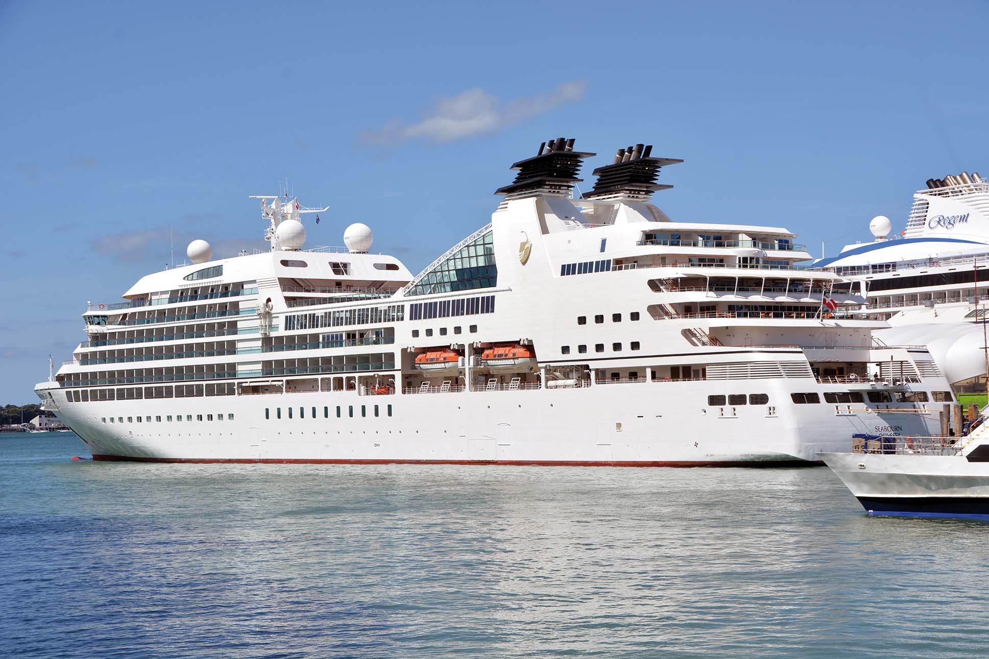
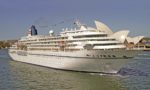
A renewed focus has recently been made on using rail access as well as Wiri inland port to reduce the pressure on the road system. Rail use in the port had gone up by over 50% during the year of 2014. Some ninety cruise ships were scheduled to call at the port between May 2014 and May 2015 including those of Royal Caribbean International, Princess Cruises, Celebrity Cruises, Crystal Cruises, Cunard Line, Hapag-Lloyd, NYK Cruises, P. & O. Australia, P. & O. UK, Oceania Cruises, Costa Line, Holland America Line, Silversea Cruises, Seabourn Cruises and other lines. Several of these lines are offering Round the World cruises, but the most frequent calls are from Sydney (NSW) or Brisbane to Noumea, Suva, Tonga and the South Pacific islands.
Port Of Auckland Facilities
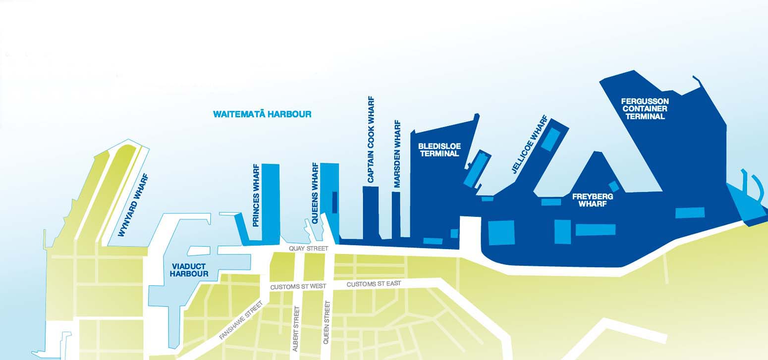
The port today employs 550 people on 55 hectares of wharves and storage areas for containers, cars and break-bulk cargo on reclaimed land in the former Commercial Bay, Official Bay and Mechanics Bay areas. The main entrance to the port is the Tinley Street Gate, located half way along Quay Street. The main wharves from west to east are:
WYNYARD WHARF specialises in bulk liquid cargo including chemicals, minerals, fish, vegetable oils, bulk sand, petroleum products with fuel oil bunkering facilities to the west of Viaduct Basin. It has 486 metres of berths and one hectare of operating area. The wharf and area is being developed into a mixed use development and residential park within the next five to ten years.
PRINCE’S WHARF was originally built as a cargo wharf and named after the Prince of Wales when he named it on his visit to New Zealand in 1921. Prince’s Wharf is Auckland’s secondary cruise berth, also a dual-purpose facility as when it’s not being used for cruise visits it forms part of the Hilton Auckland Hotel’s function and event space.

QUEEN’S WHARF was originally a wooden wharf and was replaced by the present ferro concrete wharf during 1907. The two sheds on the wharf were built in 1941, one as a cool store for the port, and the other for vehicle inspections. It is used for vehicle imports, timber, fruit and vegetables. Since 2013, Shed 10 on Queen’s Wharf has been Auckland’s primary cruise berth. Shed 10 operates as a dual-purpose facility, available for functions and events when not required for cruise visits. Prior to a visit, the open area of the upper level is transformed into check in, customs and x-ray screening area. All equipment is then cleared away after passenger processing.
The cruise industry has a significant and growing economic importance to Auckland and New Zealand. The 2014-2015 cruise sector was worth NZ$436 million in value added to the New Zealand economy, and is forecasted to grow to NZ$543 million in the 2015-2016 season and as a back up berth for cruise ships. One of the sheds is earmarked as an event facility for the cruise industry.
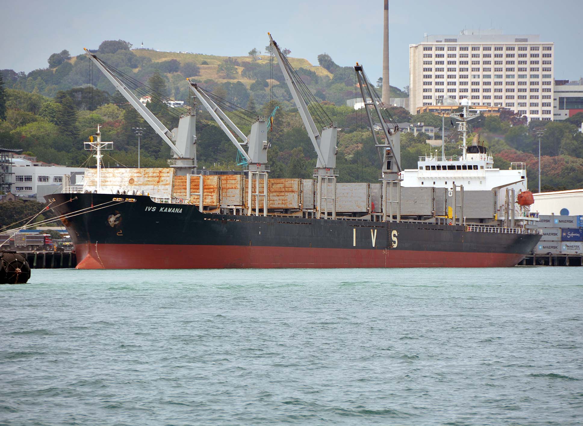
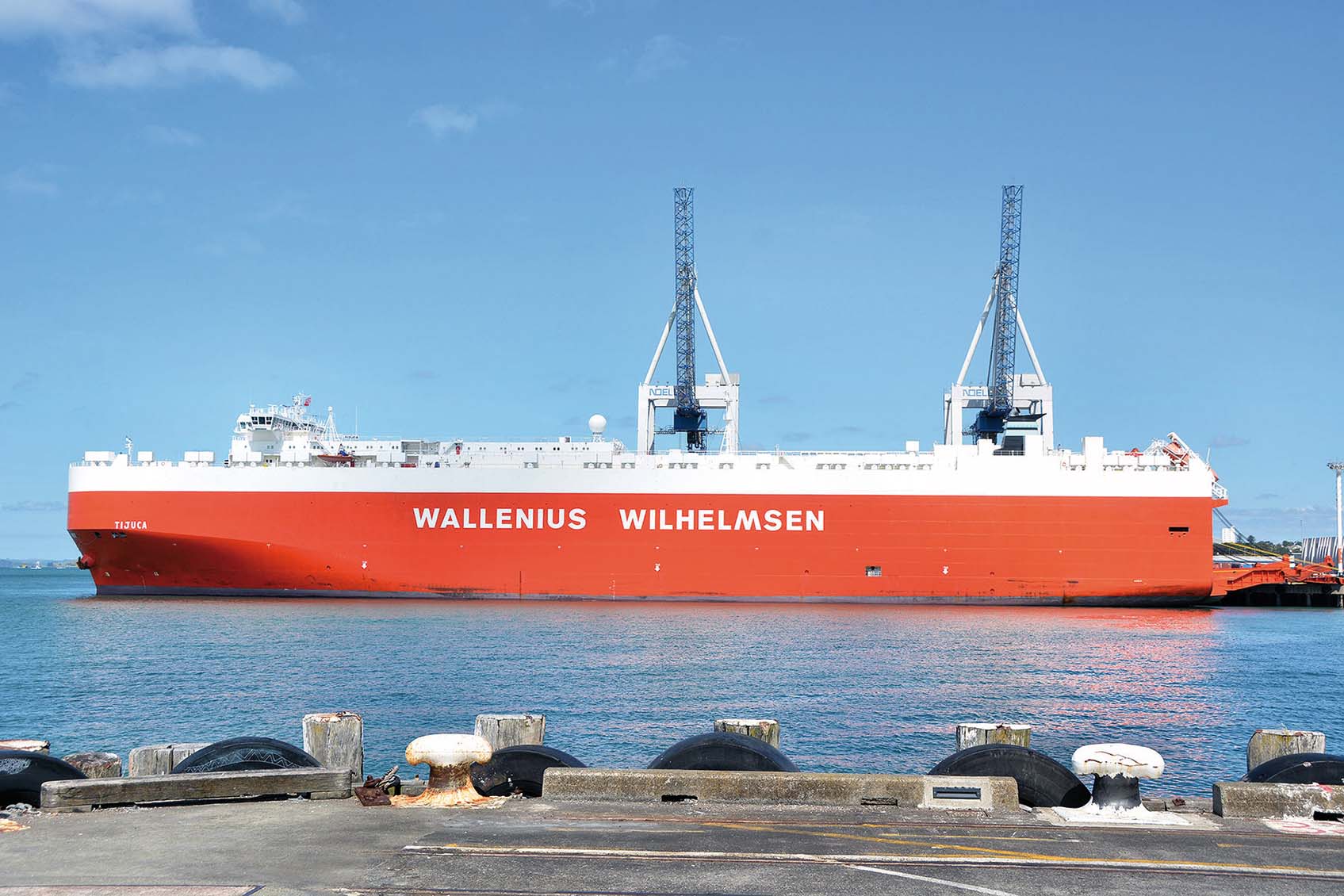
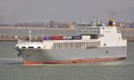
CAPT. COOK WHARF is dedicated to vehicle imports, with 478 metres of berths and 2.2 hectares for vehicle storage. It is named after the famous British explorer Capt. James Cook who first sighted land in New Zealand at the Bay of Poverty on 9th October 1770 on the east coast of North Island. He circumnavigated North Island and then went through the Cook Strait between North Island and South Island (and he named it after himself) before sailing down the east coast of South Island and up its west coast before crossing the Tasman Sea to Australia. The wharf named after him was built in 1922, and an iconic ‘Red Fence’ running around the Customs border of the southern edge of this wharf was erected during 1913/23. Today, this large wharf is used by ro-ro and car carriers to handle car imports from Japan.
MARSDEN WHARF was completed during the two years between 1909 and 1911, and is a small wharf used by fishing vessels and as an overflow car storage area for imported vehicles at the adjacent Capt. Cook Wharf. The Greenpeace converted trawler Rainbow Warrior was berthed here in July 1985 when a limped mine was attached to her hull by French Secret Service officers. The ensuing explosion sank the vessel with the loss of one of her crew. The wharf has 398 metres of berths and one hectare for vehicle storage.
BLEDISLOE WHARF area was originally developed during the two decades from 1904 to 1924. The permanent wharf was built during the period 1937 to 1948 for the export of frozen cargo, but upgraded in 1985 to become the second container terminal in the port. One operational berth of 260 metres in length handles 240,000 TEU of containers per year. It is equipped with three Noell container cranes, all twin lift capable, with two of them transferred from the Fergusson Container Terminal when it received new Japanese built ZPMC cranes. The wharf is also equipped with five hundred power plug outlets for refrigerated containers, and has 260 metres of berths and 14.5 hectares of container storage. There is also 8,000 square metres for storing dry export cargo such as timber and paper products.
JELLICOE WHARF was opened in 1952 as a main import facility for bulk and break bulk cargo. Bulk cargoes such as wheat, gypsum for making wallboards, silica sand for making glass are handled, with break bulk cargoes such as steel wire rolls and swan timber imported on pallets. It has 670 metres of berths and 8.2 hectares of container storage, and is a general purpose wharf.
FREYBERG WHARF was opened in 1961 and is a small triangular shaped wharf used by Pacific Island traders carrying copra, break bulk cargo, as well as containers for food and island supplies. It has 426 metres of berths and 5.8 hectares of operating space.

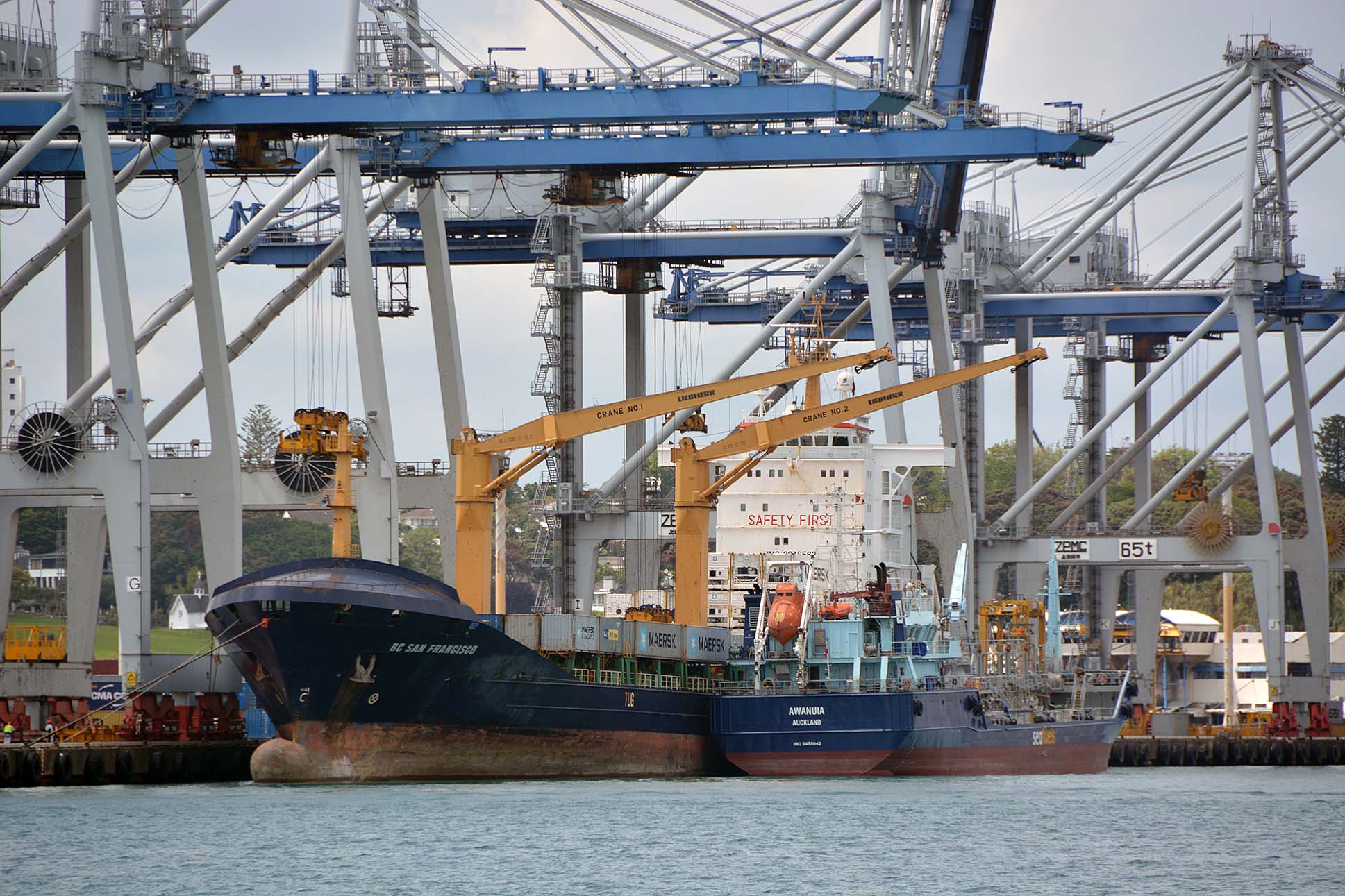
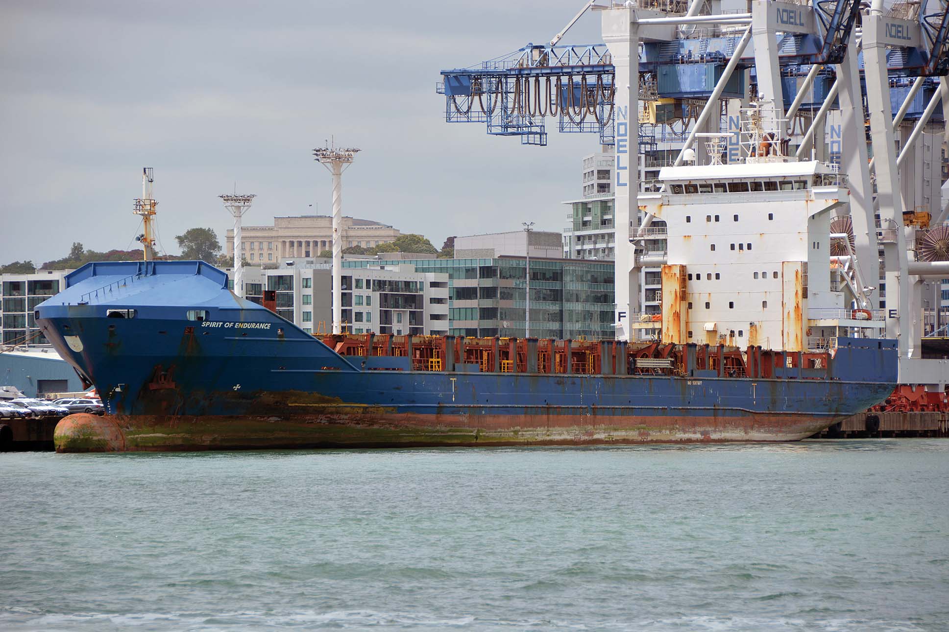
FERGUSSON CONTAINER TERMINAL was completed in 1971 with the container ship Columbus New Zealand of the German owned Columbus Line as the first ship on the berth on 23rd June 1971. A walkway on the eastern side allows visitors to the port and residents of Auckland to walk around the berth to take in the sea view, port operations or do a spot of fishing. The walkway is accessed from Solent Street near the Mikano Restaurant. Three large new Chinese container cranes costing NZ$27 million were installed in 2006 to join two older container cranes purchased in 2001. The cranes weigh in at 1,250 tonnes each, and are the largest in New Zealand at 103 metres tall with a 56 metres boom length and the ability to handle two containers simultaneously. The total berth length is 610 metres and it has 32 hectares of container storage space, with all five cranes mounted on rails so that they can be moved along the berth to line up with the ship being worked on. The immediate approaches to the container terminal were dredged during the last decade to handle ‘Post Panamax’ container ships.
The Ports of Auckland Ltd. headquarters building is at the head of the terminal, and houses its corporate, administrative, marine, control and planning departments. The building was originally an engineering workshop for Teal Airways, now Air New Zealand, which operated passenger carrying seaplanes at Mechanic’s Bay between the 1930s and 1950s. International flights to the west coast of United States began in the 1930s with refuelling stops in the Pacific islands by Pan American Airways seaplanes, which landed in the harbour.
CHELSEA WHARF This wharf is not part of the Ports of Auckland Ltd. facilities but serves the Chelsea Sugar Refinery, which has operated in North Shore City to the west of the harbour since 1884. Ships arrive with unrefined sugar from Australia for this nine hectare facility every six weeks.
Port Of Onehunga
The second Auckland harbour is a smaller facility near Onehunga on Manukau Harbour to the south west of Auckland city. It is part of the Port of Auckland Ltd. facilities and is close to the industrial areas of southern Auckland and Manukau City. It has a busy wharf serving the Holcim cement silos. The shallow entrance of Manukau Harbour and its few facilities gives it much less significance than the main port to the east, and is used mostly for coastal reshipment e.g. import of cement from Westport on South Island.
British emigrants first settled in Manukau Harbour in 1835, with their little community surrounded by a strong fence and patrolled by soldiers due to the danger from hostile Maori. Onehunga became a frequent port of call for coasters operating along the west coast of North Island in the 1890s. In 1913, responsibility for Manukau harbour and Onehunga port was transferred from the Marine Department to Auckland Harbour Board. Manukau Harbour has a large water area of 394 square kilometres but has a very shallow and restricted entrance. The loss of the 1,700 tonne steam corvette HMS Orpheus at this entrance on 7th February 1863 with only seventy survivors from her crew of 250 was the worst maritime disaster in New Zealand history.
The Holm Shipping Co. Ltd. began trading into Onehunga with their coasters with names with the prefix ‘Holm’ in 1957, and a significant but still small tonnage was handled at Onehunga by the mid 1960s. The port handled its first container in 1982, and dredging began in 1992 of Manukau harbour to allow larger ships to use Onehunga Port. POAL opened its first inland port at East Tamaki in 2002 on the Tamaki river estuary, and another three years later at Wiri, an inland port in South Auckland of 15 hectares, which functions as a rail exchange terminal between the main port and the national rail freight network.
Port Prospects
The Port of Auckland is the largest and most important seaport in New Zealand, handling 37% of the country’s total seaport trade, and 31% of all trade including airports. It handles 36% of the country’s container trade and 60% of the upper North Island trade. Market projections for economic growth by 2020 and 2030 from the current value of $26.4 billion of trade are for port trade to grow to an estimated $54 billion value by 2030. A series of long running stevedore strikes have damaged the reputation of the port in recent years, and a series of measures with the agreement of the stevedore union and the people of Auckland, as this is a Council owned port, are in the process of ratification. The population of Auckland is over one million and is swelled during their summer season by tens of thousands of tourists. A visit to the Voyager New Zealand Maritime Museum on Prince’s Wharf and near to the America’s Cup Village and Marina, is a must as it has everything from Maori war canoes to models of container ships.
Container throughput was up for the six months ending 31st December 2013 at 476,333 TEU, a big increase from 413,884 TEU in the same period of the previous year. A new tug was then ordered of 68 tonnes bollard pull from the Damen yard at Changde in China for delivery in 2014. Two new straddle carriers were also ordered at a total cost of $12 million, with CEO Tony Gibson reporting that the new tug was urgently needed because of the increased number of large container ships calling at Auckland. Net profit for the same six months was also 70% up over the previous six months at NZ$26.4 million.

POAL creates millions of NZ dollars in revenue for the economy, creating thousands of jobs outside the port in the region in associated industries that depend on the port for imports and exports. It makes a vital contribution to New Zealand trade and tourism by strengthening connections with the rest of the world. The beautiful and charismatic harbour at Auckland is the ‘gateway’ to New Zealand, with 70% of all visitors to the country arriving as cruise passengers or at Auckland International Airport (AIA), which opened for domestic and Trans-Tasman flights in 1966 and for overseas destinations in 1977. The airport is situated in south Auckland on reclaimed mudflats and was publicly owned by the New Zealand Government until 1988 when shares were offered and a majority 51.6% of shares was sold off. POAL began a project in 2004 to dredge up to one million cubic feet from the commercial shipping lane in Rangitoto Channel in order to widen the tidal window for deeper draft container ships.
Auckland is the largest city and seaport in New Zealand, and is one of the few cities in the world with harbours on two different water bodies. POAL operate the most sophisticated intermodal rail exchange system in New Zealand, composed of four 500 metre parallel rail links that can handle 128 wagons at a time, with heavy lift machinery to transfer containers to rail. POAL provides free public boat tours on Waitemata harbour, taking visitors and residents alongside the container terminals and weaving in and out of the commercial wharves while an informative commentary explains the use of each wharf. These tours and those for school groups leave from Pier 4, Ferry Building on Quay Street and must be booked in advance. I wish to thank the Ports of Auckland Ltd.
Comments
Sorry, comments are closed for this item