The first British colonists to New Zealand in 1810 subsisted on crops of potatoes and other vegetables as well as their animals that they had brought with them e.g. pigs. They also exported cargoes of flax, timber, firewood, sealskins and large quantities of whale oil as there were many whaling stations on the coasts of Southland and Otago on South Island, and on the Cook Strait separating North Island from South Island. The estimated population of New Zealand when James Cook arrived in 1769 was 100,000, all Maori. In 1820 still about 100,000 of whom about 200 were Europeans.
Inter-tribal warfare, the ‘musket wars’, 1807-1837 cost between 20,000 and 40,000 lives, many more in the later land wars.
Britain annexed in 1840 the whole Maori territory of New Zealand by the Treaty of Waitangi after fierce fighting with the native Maoris, who had arrived from Polynesia a thousand years before. The territory amounted to 43,911 square miles of North Island, 58,090 square miles of the bigger South Island, 674 square miles of Stewart Island lying across the Foveaux Strait from Bluff, and the Chatham Islands of 375 square miles to the east of South Island. A few small groups of islands of the Three Kings and the Kermadecs lie to the north, while Campbell Island, the Auckland islands, the Antipodes Islands, and the rocky Snares, Solander and Bounty islands lie to the south of Stewart Island and contribute many more square miles. The whole area of New Zealand is thus slightly greater than the area of the United Kingdom.
South Island was almost untouched by the Maori Wars, and was prospering at that time from the wool and meat trade, and gold was discovered in 1861. South Island was the home to most of the white population, particularly emigrant Scottish people settling at Dunedin, the old name for Edinburgh. The stable white population had trebled to 770,000 by the end of the century, by natural increase and selected assisted immigration. New Zealand exported mostly wool from sheep farming up to around 1882, when refrigerated meat ships opened up new possibilities. Thus, the transport of meat and dairy products from New Zealand to the U.K. became big business for Houlder Brothers from 1900, Blue Star Line from 1911, and Shaw, Savill and Albion Co. Ltd. from 1882.
HISTORY OF BLUFF HARBOUR
Bluff Harbour is part of the Southland region of South Island, between the majestic peaks of Fjordland to the west, and the lush plains of the Otago peninsula to the east and north. The Southland region has a rainfall of forty inches or more per annum, and is ideal for the growing of the millions of acres of grassland and the bunched robust red and fescue tussocks and other species of tussocks that sheep can thrive on. The low grassland areas with tussock species were in place when the first Polynesian boat of the Maoris landed on some New Zealand shore. There were 17 million acres of tussock clad grassland in the Southland Region of New Zealand in 1840, consisting of tall and vigorous tussocks interlocked with no bare ground between.
The hinterland area around Bluff has plains, downland and low hill country, that soon specialised in the long established intensive orcharding of apples, pears, cherries, apricots, kiwi fruits and peaches. Very vigorous ploughing on lower ground had removed the tussock by shortly after 1860 in five million acres to grow arable crops and rotation harvests. The remaining elevated acres were too broken for the plough, and by means of fire this reduced the tussock grazing land to make it more ideal for the millions of sheep of the region. The Southland and Otago peninsula regions became almost totally dependent on sheep, with cargoes of fine wool, and later meat from 1882, were exported back to Britain.
The wool and meat economy of Southland together with the growing of mixed crops of wheat, oats, barley, turnips, swedes, rape, kale, chou, peas and potatoes continued for a century until in 1964 it was estimated that South Island had 82% of the wool, meat and the mixed crops economy, while North Island had only 18% of the total New Zealand output.
The large dairy herds of cattle also support the Southland products of milk, cheese, condensed milk and baby foods. In 1966, there were more than 53.8 million sheep and 7.2 million cattle in New Zealand, more or less evenly distributed in both South Island and North Island.
There are also scattered outcrops of coal with the output of the Southland region being of lignite coal, with many small mines operated by groups of miners working co-operatively, each with an output of only a few thousand tonnes per annum. The west coast area of Westport and Greymouth of South Island was very different, with deep seams of coal that led to large cargoes of coal being sent coastwise to the cities of North Island or exported to Australia. Westport was the largest coal producer in New Zealand in 1905, until the Westport Coal Company ended mining at Millerton colliery in the late 1960s. Open cast mining is the only coal production today.
However, New Zealand has no oil, and imports of crude oil cost more than NZ$60 million in the 1950s to the new Marsden Point tanker terminal and refinery at Whangarei on North Island for her way of life of using petrol and oil products for cars, tractors, railways and in the many light industries and factories of the nation. Natural gas has proved to be a boon after its discovery at Taranaki in 1961 on North Island producing over 30 million cubic feet of gas per day, with gas condensate shipped to Marsden Point and producing one fifth of the oil consumption of the nation.
Bluff was previously known as Campbelltown and is often referred to as simply ‘The Bluff’. Invercargill (18 kilometres north of Bluff) and Bluff are towns and seaports with a resident population of 59,000 people in 2020 in the Southland region of the southern coast of South Island. Bluff is the southernmost town of Mainland New Zealand, and despite Stewart Island and Slope Point being further south, Bluff is colloquially used to refer to the southern extremity of the country.
Bluff is the oldest continually occupied European settlement in New Zealand, and home to the world famous Bluff oyster, eaten in huge quantities during Bluff Festival. Nearby Stirling Point has walking tracks and a famous signpost marking distances to far off places, and similar to that at John O’ Groats.
Bluff is the start of State Highway 1, which runs all the way up South Island to Cape Reinga at the northern extremity. The first timber wharf, or Town Wharf, began construction back in 1863 as Bluff is the closest harbour to Australia. Most English and Scottish settlers made their first landfall in the country at Bluff or Dunedin and Port Chalmers on beautiful Otago peninsula and harbour. Bluff Maritime Museum has fascinating historical information regarding the many shipwrecks in these very challenging southern waters and coastlines, as well as northwards and eastwards to the Catlin Coast to Dunedin. Bluff Hill (Motupohue in Maori) with a height of 265 metres has a network of walking tracks for nature lovers searching for the abundant flora and fauna.
The first immigrant ship at Bluff was the Perseverance of London in 1820, with immigrants searching for flax trading possibilities. The first settlers arrived at Bluff in 1823/24 a few years later. Bluff was renamed Campbell-town in 1856, became a borough in 1878, and regained its name in 1917. Bluff is part of Invercargill District at location 46°36′ South, 168°20′ East, with the bigger town of Invercargill only twelve miles north of Bluff.
Across the entrance channel to Bluff Harbour lies Tiwai Point, home to the only aluminium smelter in New Zealand, with alumina shipped from Australia for smelting. Manapouri Power Station in nearby majestic Fjordland National Park supplies electricity to Bluff and Invercargill. Bluff has a twice daily catamaran ferry to Stewart Island, lying 37 miles across the Foveaux Strait, and both Bluff and Stewart Island are the main gateways for many research ships and expeditions sailing for Antarctica.
THE PORT OF BLUFF HARBOUR
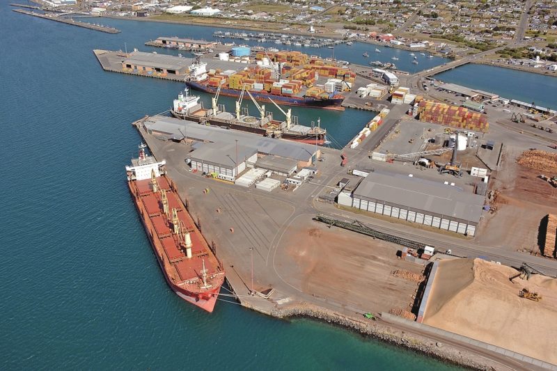
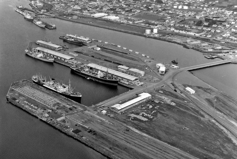
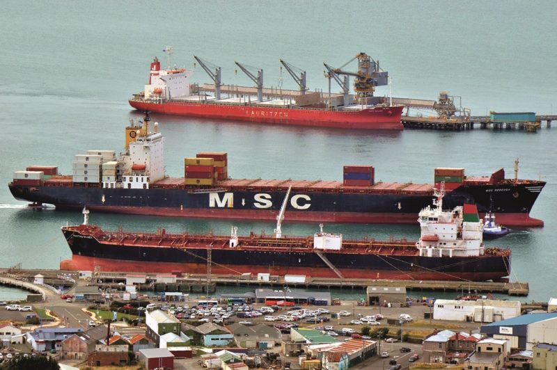
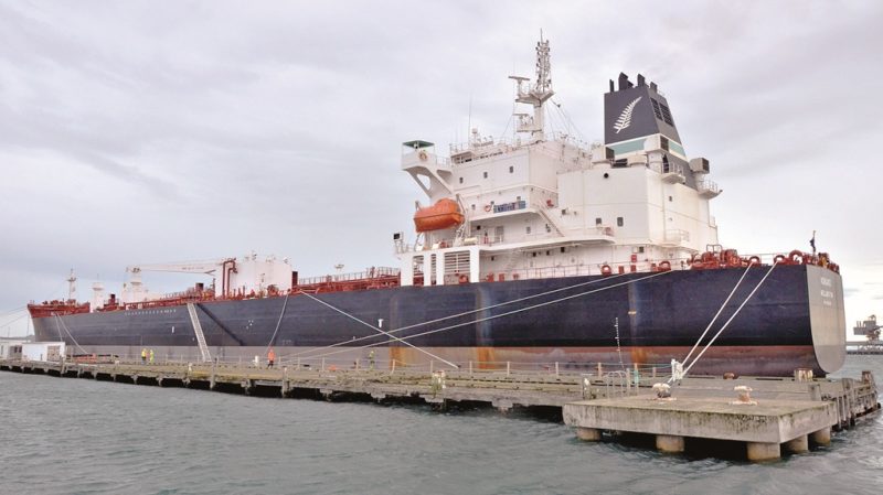
This harbour has a Town Wharf, a very large reclaimed Island Harbour, and the nearby Tiwai Point discharging jetty for alumina for the Rio Tinto (New Zealand) aluminium smelter. The port began in earnest in 1875 with the construction of Town Wharf, closest to the mainland and used by the new Union Steamship Company of New Zealand (USSNZ) formed on 1st July 1875 for a service from Dunedin to Bluff, Greymouth, Nelson, Picton and Wellington, and later for services to Australian and Tasmanian ports. Town Wharf is today used for petroleum product imports, and for servicing coastal bunkering tankers. South Port was established in 1988 and took over all of the assets and liabilities of the former Southland Harbour Board.
The reclaimed man-made Island Harbour is of 40 hectares or 100 acres in size and imports and exports commodities such as aluminium, timber, logs, acids, cement, fish, dairy products, apples and fruit, meat, wood chips, basic stock foods, cement, fertilisers and petroleum products. Cargoes of over one million apples are not uncommon at the port, loaded into cooled fruit ships for transit to Northern Europe. The Jade Container Terminal computer software schedules container related items and heavy project cargo.
The reclaimed Island Harbour has ten berths, with Town Wharf having Berths 11 and 12 for coastal and imported petroleum products. The construction starting in the 1950s of the Island Harbour was done in two stages over several decades at a total cost of NZ$255 million in today’s money. This remarkable 1950s engineering project turned a barely visible sandbank in Bluff Harbour into a thriving area with ten wharves, and loaded a record consignment of 35,800 tonnes of wood chips in October 1996 onboard the bulker Prince of Ocean of 41,600 dwt. The total trade throughput of Bluff Harbour today is just under 4.0 million tonnes of cargo per year. The port has 120 employees and 6 directors sit on the Board. The full list of Port Berths is as follow :-
Berth Length Draft Covered Area m2 Open Area m2 Apron Width
- 1 160 7.0 2,000 200 11.5
- 2 190 7.7 1,400 11.5
- 2 Cross Berth 70 6.0
- 3 213 9.7 11,200 650 16.0
- 3A 153 9.2 12,600 1,800 15.0
- 4 213 9.7 30,000 15.0
- 5 213 9.7 Cool Dairy Products 15.0
- 6 135 7.75 1,500 500 15.0
- 7 100 8.0 15.0
- 8 230 9.7 Woodchips (10,000) 15.0
- 11 210 9.7 Town Oil Wharf 15.0
- 12 210 9.7 Town Oil Wharf 15.0
- Tiwai Wharf 200 11.0 Alumina/aluminium 10.0
The Tiwai Wharf was completed in April 1971 and is owned by Southland Harbour Board and leased to NZAS (New Zealand Aluminium Smelters) and operated on behalf of Rio Tinto. NZAS is 79.36% owned by Rio Tinto and 20.64% by Sumitomo Chemical Company of Japan and produced aluminium in the form of ingots, billets and rolling block.
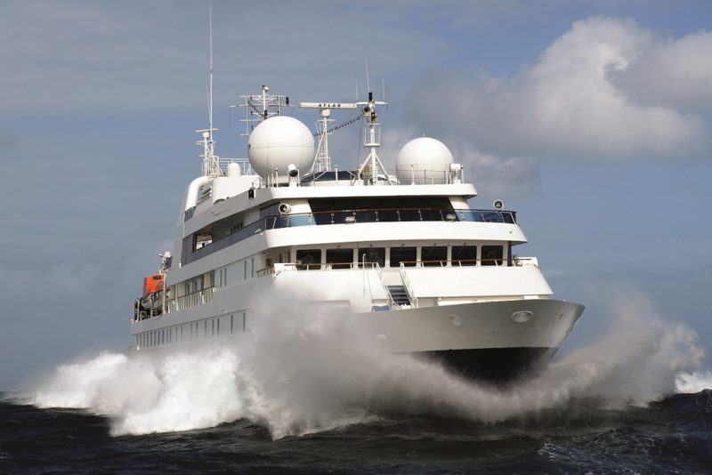
Alumina is supplied to the plant from the Yarwun and Queensland Alumina refineries at Gladstone in Queensland. NZAS contributes NZ$406 million to the Southland economy each year, with around 90% of production exported generating NZ$600 million each year.
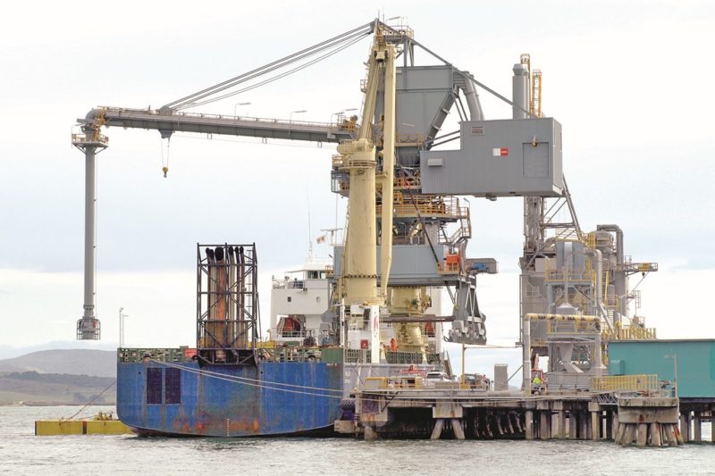
The first bulker to arrive at Tiwai Point with alumina was Shinyo Maru on 22nd April 1971, with the Jebsen owned bulker Bulknes then taking over the trade and remembered for her unique funnel adornment of a kiwi on one side and a kangaroo on the other recognising her mixed New Zealand and Australian crew.
In 1983, the bulker TNT Alltrans with a discharge rate in excess of 1,000 tonnes per hour replaced Bulknes on the import of alumina.
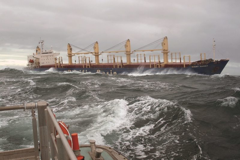
Partnered by the twin gantry crane Southland Maru exporting ingots to the Far East, TNT Alltrans had carried 10.6 million tonnes of alumina to Tiwai Point by the time of her last arrival on 20th June 2008, with bulkers of Pacific Basin Shipping then taking the majority of this trade to the present time.
The Bridge that connects the mainland to the ten Island Harbour berths has an axle weight restriction for heavy project cargo, available on request, but recently 122 tonne transformers were carried across the bridge.
Tiwai Wharf has an axle weight restriction of eight tonnes, while the Town Oil Wharf has an axle restriction of 4.5 tonnes. Fishing trawlers and oyster trawlers can be accommodated with ease in all weathers, and the berths are equipped with substantial bollard numbers and fendering systems.
The following plant and equipment and services are available at Bluff Harbour:-
Mobile Harbour Container Cranes – Two Liebherr Mobiles of 100 tonnes lift on a minimum outreach of 10.5 metres and a maximum outreach of 43.0 metres at reduced lifting capacity, and with a spreader for 40 feet containers.
Loaders & Forklifts – Mobile equipment for all manner of smaller lift cargoes.
Wood Chip Stockpile Loader – Storage capacity of 150,000 tonnes with a loading rate of 700 tonnes per hour.
Bulk Oil Tanks – Storage capacity of 4,775 tonnes, loading rate 400 to 500 tonnes per hour.
Tiwai Wharf Pneumatic Unloader – 600 tonnes per hour with load out conveyor belts.
Intermodal Freight Station – A rail marshalling yard with a 4,000m2 warehouse with rail connection to the Southland and Otago regions from the Invercargill Kiwi Rail railhead and the port.
Vehicle Import Washdown Shed – MPI Approved.
Mobile Wharf Hoppers – Four hoppers each of 40 tonnes capacity.
Electrical Systems to approved high – tension distribution, with lighting available in all areas with capacity upgrades as demand arises. All systems on the Island Harbour are owned, operated and maintained by South Port.
Synchrolift Dry Dock – Located on Island Harbour with two covered berths and a maximum of only one vessel in the six operational areas.
Bunkering – Road bunkering is only available in theIsland Harbour area, vessels wishing to bunker or transfer oil must obtain permission from South Port before beginning the operation.
Quarantine Waste – Waste containers are only supplied for galley waste, collected daily, weighed and charged to the vessel. The local agent should be contacted regarding other waste e.g. bottles, cans, engine room waste.
Repair work and moorings – Shore engineering services or vessels making own repairs are allowed subject to notification to South Port. Vessels are to use their own hawsers and moorings throughout the port. Hot working of welding or flame cutting need a special permit application from the South Port.
Fresh Water – Available on all berths, hoses are available from South Port.
Fumigation Shed
Log Trailer Hoist
Weighbridge
Good road and rail access
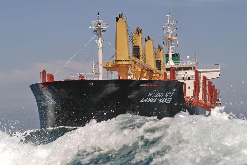
Pilotage is compulsory for all vessels over 500 grt, with pilots boarding vessels in the Approach Channel between 1.5 and two miles south of Bluff Entrance Light at 30 minutes before High Water (HW) Slack or 45 minutes before Low Water (LW) Slack. Outward bound ships depart up to one hour before High Water (HW) Slack and on or immediately after Low Water (LW) Slack. Vessels over 20 metres in length may be restricted by wind and tidal conditions. Applications for the services of pilots, tugs and shore linesmen must be made at least three hours before required during normal working hours, and out of hours requirements must be made by 1530 hours on the last working day prior to port weekends or holidays.
All vessels must inform ‘Bluff Harbour Radio’ at least four hours before arrival to confirm ETA. Pilotage is also available for the Stewart Island Pilotage District, and for the Fjordland cruise ship pilotage provided by South Port.
Approach Channel Boundaries are well delineated by leading lines, buoys and beacons, all with appropriate day marks and lighting. The approaches are in two channels, a south channel with a minimum depth of 12.5 metres at mean low water spring tides, and a north channel with a minimum depth of 7.2 metres at mean low water spring tides. The entrance channel has a length of 800 metres and a maximum width of 107 metres.
The maximum sizes and drafts of vessels are 225.0 metres length and 34.0 metres beam with a maximum draft of 9.7 metres at ordinary high water and up to 10.0 metres at high water spring tides.

Low water maximum draft varies from 7.0 metres up to 8.0 metres at neap tides, vessels of greater lengths may be allowed to enter dependent on type of vessel and reason for entry.
The Port of Bluff Harbour is a tidal port with the tidal flow in the entrance channel varying from 2.0 to 2.6 metres per second (4 to 5 knots) on ordinary tides and 3.6 metres per second (7 knots) on high spring tides. The Annual South Port Tide Timetables should be consulted before entry.
The vast majority of vessels can be shifted within the port at any stage of the tide, dependent on weather conditions and the maximum draft of the vessel at the time of the move. The Port of Bluff operates 24 hours for 364 days per year.
The last steam tug owned in the port, the Awarua, was the most powerful tug in New Zealand at the time. She was built to replace the motor-tug Southland built for the Bluff Harbour Board in 1926 as a dual purpose harbour tug and Stewart Island ferry, in the latter role having accommodation for 285 passengers. Several tugs were used to maintain the ferry service to Oban, Stewart Island, including the original paddle tug Awarua of 1884 which began a weekly service in 1885. She was followed by the screw tug Theresa Ward which served on the ferry service from 1900 until 1927, replaced in turn by the motor tug Southland. In service the Southland was a disaster, constantly breaking down and only lasted until 1930 when the Theresa Ward came out of retirement to replace her. The Harbour Board, unsurprisingly, reverted to steam for its replacement tug Awarua, which arrived in 1932 and acted as a relief ferry into the 1950s. She was scuttled in Foveaux Strait as a diving attraction but the strong tidal flow has probably left little to attract divers.
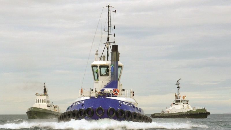
At present the port has three tugs, the Voith tugs Hauroko of 35 tonnes bollard pull and Te Matua with 40 tonnes BP joined this year by the azimuthing tractor drive (ATD) Rakiwai of 70 tonnes BP.
CIVIL ENGINEERING PROJECT TO CREATE ISLAND HARBOUR
At a special meeting of the Bluff Harbour Board, which became the Southland Harbour Board in 1958, on 17th April 1952, it was agreed to proceed with a plan devised by the Bluff Harbour Engineer, D. E. S. Mason, to build a man-made island for port expansion, and taking advantage of a submerged sandbank.
Sir John Coode, who was employed on proposals for expanding Australian and New Zealand harbours a century before had come up with a similar plan to use the sandbank. The Island Harbour was to be created with eight berths and 44.5 hectares (110 acres) of land for storage yards, rail yards etc at a cost of £4 million. It was later agreed to proceed with the plan in two stages:-
Stage 1: 5 berths on 34 hectares (84 acres) at a cost of £3.536 million
Stage 2: 3 berths completed in the 1980s and 1990s at further cost
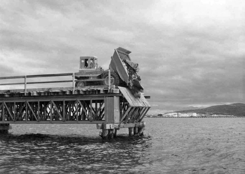
The New Zealand Government of the day passed the Bluff Harbour Improvement Bill on 3rd October 1952, but refused to help with the cost of the project. A subsequent poll of ratepayers favoured the raising of a loan, and after two years the target of £3.536 million was raised with 90% of the loan subscribed by local Southland residents. Tenders were called for Stage 1 on 4th August 1955, and ten months later a tender for £3.221 million was accepted from the French company Societe National de Travaux Publics (SNTP). Work began in September 1956 with the construction of a temporary bridge to the future island. Rock was dumped off the sea end of the bridge, and the start of the rubble retaining walls began, which would spread out laterally to outline the perimeter of the island.
Protective steel pilings were driven in around the berths, and sand was then pumped by a cutter suction dredger into the area enclosed by the retaining walls and pilings. As work progressed, coffer dams held back the sea while the quay walls were concreted. These were later removed and the berths flooded.
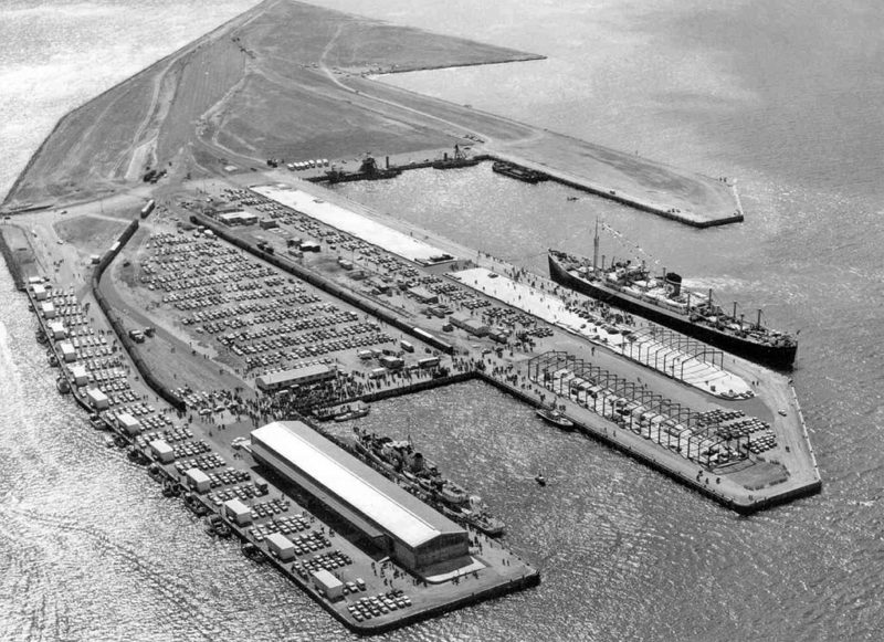
On 24th June 1960, the first contract for the construction of Island Harbour was completed after four years of difficult work. At this stage, there were no buildings on the island, which followed five months later by the completion of Number 1 Cargo Shed by P. Graham & Son Ltd. of Christchurch in time for the official opening on 3rd December 1960. Viscount Cobham, Governor General of New Zealand, performed the opening ceremony, with the New Zealand frigate HMNZS Lachlan at Berth 1, and New Zealand Star of Blue Star Line at Berth 5 loading apples.
The construction of the port office building, transit sheds, and the meat loaders at Berth 5 were completed in the 1960s and served for 30 years until decommissioned in the 1990s. The first export shipment of wheat from the new wheat installation on Island Harbour was made in the late 1960s. Caltex Brussels of 17,376 dwt and overall length of 182.0 metres was the longest vessel in port when Queen Elizabeth, the Queen Mother, visited the port at this time.
The bucket dredger Murihiku was sold for scrap after 70 years of service in the 1970s, and a new purpose-built pilot boat arrived on station. The approach channel to the harbour was deepened and widened in the 1970s, and Bluff Harbour was used as base by Hunt Petroleum for exploration of the Great South Basin, with a tallow cargo loading berth also constructed on Island Harbour.
A NZ$450 million upgrade of the NZAS smelter on Tiwai Point was completed in the 1990s, as well as an extension of 4,500m2 to Number 3 dry warehouse.
The first Liebherr mobile crane made an appearance at the port in the 1990s, and investments in non port activities later brought financial gains when they were sold off. A listing on the New Zealand Stock Exchange was obtained in the 1990s to obtain finance for improvements to container handling, with the Jade Master Terminal IT data system introduced in 2004.
Balance Agri-Nutrients constructed a 12,000 tonne bulk liquid tank on Island Harbour during the decade after the Millennium, and Marstel Terminals also established a bulk liquid plant at that time. Shed 4 warehouse was constructed in this decade, and a second Liebherr mobile crane and a second pilot boat also arrived. The largest ships to enter Bluff Harbour during 2009/10 were the car carrier Positive Passion of 43,810 grt under the flag of Panama and built in 2009 by Mitsubishi Heavy Industries at Kobe for Eastern Car Liners of Tokyo and managed by Sandigan Ship Services of Manila, and the container ship MSC Brasilia of 43,270 dwt and 3,220 TEU capacity built in 1986 by Daewoo Shipbuilding and Heavy Industries at Koje Island in South Korea.
Bluff Harbour has much experience in handling heavy lift project cargo for the southern region of South Island. Twin crane lifts of 122 tonne transformers, wind turbine farm components of maximum lift of 80 tonnes, the Manapouri Hydroelectric Power Station tailrace equipment, mining equipment including bucket wheel excavators and dump trucks, tallow liquid tanks, and small coastal vessels and fishing trawler lifts, including on the Synchro Lift Dock.
By 2010, significant growth in the forestry products trades had been made with logs, wood chips and swan timber. A new 35 year licence agreement for the alumina unloading wharf at the Tiwai Point aluminium smelter plant was entered into with NZAS in 2010. A record number and tonnage of ships in the port on 7th August 2010 was ten ships of 139,538 gt, with the port handling 1.336 million tonnes of imports and 0.832 million tonnes of exports in 2010 to give a total throughput of 2.168 million tonnes of cargo. In year 2018/19, Bluff Harbour was improving port facilities below:-
- A NZ$2.7 million paving upgrade to a log storage area was completed in this year
- A Major Upgrade to Town Wharf began in this year
- Island Harbour Cold Stores was being upgraded to improve handling efficiency by new load-out and load-in areas and the installation of a blast freezer
- Log trade was 671,000 tonnes, an improvement of 20% over year 2017/18
- Wood chip exports were 343,000 tonnes, a 21% increase over year 2017/18
- Bulk and breakbulk cargo amounted to 87% of all cargo handled, with also 24,200 TEU of containers
- Total Cargo of 3.44 million tonnes was a new record for the port and 13% higher than in year 2017/1
Decade Imports Tonnes Exports Tonnes Decade Total Tonnes
1960-1969 2,851,932 1,857,499 4,709,431
1970-1979 6,979,846 3,308,230 10,288,076
1980-1989 8,934,266 5,534,456 14,468,722
1990-1999 10,292,938 6,438,298 16,731,236
2000-2009 13,642,319 6,996,459 20,638,778
2010-2020 21,569,095 8,888,436 30,457,531
A comparison between the ten most important ports in New Zealand in 1966 and fifty years later in 2016 is most interesting. New Zealand in 1966 conducted a greater per capita volume of world trade than most other countries except for the Arab oil states in the Persian Gulf and the bigger countries of Western Europe. Traditionally, New Zealand overseas trade had been conducted from the five ports of Auckland, Wellington, Lyttelton, the Otago ports of Dunedin and Port Chalmers, and Bluff, with Napier, New Plymouth and Timaru performing minor roles.
However, by 1966, with changes in the New Zealand economy, 99% of trade volume was handled by the five ports of Whangarei, Auckland, Wellington, Lyttelton and Tauranga, with Whangarei handling big oil cargoes and together with Auckland handling nearly half of all trade.
Tauranga handled multi-purpose and container cargoes, while Westport on the west coast of South Island shipped coal coastwise to North Island and Australia. Westport coal was similar to anthracite coal of the Rhonda Valley and South Wales collieries, and burned with less smoke than Australian coal. This coal was judged good enough back in 1883 by the Admiralty for the boilers of Royal Navy warships, which would otherwise have to be replenished with coal brought all the way from Cardiff and South Wales. The percentage figures of import and export totals of the ten biggest ports in 1966 and 2016 for New Zealand total volumes of cargo were:-
1966 2016
- Whangarei 29.4% Tauranga 26.0%
- Auckland 20.5% Auckland 15.2%
- Wellington 11.0% Lyttelton 12.1%
- Lyttelton 8.0% Whangarei 11.5%
- Tauranga 8.0% Bluff 9.5%
- Bluff 7.0% New Plymouth 8.5%
- Otago 7.0% Nelson 6.8%
- Napier 4.0% Napier 4.0%
- New Plymouth 3.0% Otago 3.5%
- Westport 2.1% Wellington 2.9%

There were five ships in port of Bluff Harbour on 18th October 2021 bringing in or departing with cargoes of logs, sulphuric acid, alumina, food in containers, with a large trawler under repair. A further fifteen ships were scheduled for arrival up to mid November 2021, with cargoes of urea, containers, potash, fish, wood chips, metal products, food stocks, alumina, pitch, oil fuel, sulphur, DAP phosphates, and automobiles.
The ice strengthened Russian expeditionary ship Professor Khromov was due to make five scheduled cruises to the Ross ice shelf in Antarctica. She was built in 1984 for Russia as Professor Khromov of 1,759 grt on dimensions of overall length of 71.0 metres, moulded beam of 13.0 metres with a draft of 4.7 metres, and uses the marketing name of Spirit of Enderby for Heritage Expeditions. This company began cruises to Antarctica from Bluff with the similar Russian expedition ship Akademik Shokalskiy in 1994.
TIWAI POINT
Bulk carriers arriving with alumina during October and November 2021 included Darya Mira of 61,087 dwt built in China in 2021 on dimensions of 200.0 metres and moulded beam of 32.24 metres and equipped with four cranes of 30.5 tonnes capacity for cargo handling of five holds. She is owned by Chellaram Shipping of India, founded by Kissinchand Chellaram with a textile business in Madras in 1916. The shipping business began in 1979 in Hong Kong with three managed vessels, and has grown by 2021 into a large Chellship fleet of sixteen bulkers of 0.798 Million dwt making 117 voyages, 333 port calls, and carrying 5.072 million tonnes of cargo per year. These bulkers ranged in size from Handysize of 38,500 dwt to Kamsarmax of 80,500 dwt.
Corio Bay of 31,895 dwt and built in 2008 was discharging alumina on 18th October 2021, and is part of the same fleet as the regularly calling bulker named after the aluminium smelter of Tiwai Point. This bulker is of 32,689 dwt and was built in 2009 for Pacific Basin Shipping of Hong Kong. Port Pegasus of 32,773 dwt and built in 2004 is another regular Pacific Basin bulker calling, and is named after the port on Stewart Island. This company was founded in 1987 by Paul Over and Christopher Buttery with Mark Harris as Chief Financial Officer. A fleet of six second hand bulkers from that time has grown into a very large fleet trading around the world of 115 owned bulkers and 173 long term and short term chartered bulkers. The largest bulker is Eastern Glamour of 115,400 dwt built in 2011, trading alongside 37 Supramax bulkers of between 64,000 dwt and 52,500 dwt, and 77 Handysize bulkers of between 37,700 dwt and 28,200 dwt. The Pacific Basin bulker fleet took over the majority of the Tiwai Point alumina import trade in June 2008.
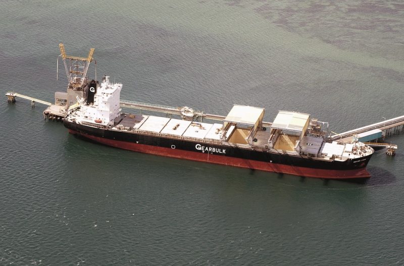
The twin gantry OHGC (Open Hatch Gantry Crane) bulker Plover Arrow of 51,421 dwt and built in 1997 arrived at Tiwai Point on 27th October 2021 to load a full cargo of aluminium ingots. She is owned by G2 Ocean, previously known as the Gearbulk consortium, and had been carrying cargoes of forestry products to ports such as Qingdao in China between the end of June 2001 and her arrival at Tiwai Point.
TOWN WHARF and ISLAND HARBOUR
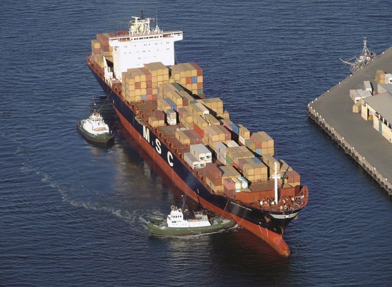
The container ships of MSC, the second biggest container line in the world, including MSC Langsar and MSC Corinna, and the chartered Nordpacific of Klaus Oldendorff of Cyprus, all call at Bluff Harbour. The MSC Oceania Express Service links Australia and New Zealand to Central and North America via the hub port of Tauranga, with MSC container ships of 3,300 TEU capacity having a weekly link from Bluff to Tauranga via the existing MSC Capricorn Service.
The smaller feeder container ships of Kokopo Chief, Warnow Chief, Coral Chief and Lihir Chief of Swire Shipping of Hong Kong also call regularly with containers. These ‘Chief’ container ships operate on five routes that connect the Pacific Islands to New Zealand and Australia, and also on a direct Trans Tasman service from three ports in Australia to Auckland, Tauranga, Lyttelton, Napier, Nelson, Timaru and Bluff Harbour. New Zealand ports import bananas from Samoa, and oranges and tomatoes from the Cook Islands in reefer containers. Tankers calling at Bluff Harbour included Golden Sagittarius of 12,700 dwt discharging sulphuric acid, Kokado of 19,500 dwt discharging oil fuel, and Bit Redo of 8,800 dwt discharging pitch.
Dry bulkers included the five hold La Guimorais of 39,700 dwt owned by Louis Dreyfus Shipping of France discharging urea, Daiwan Leader of 33,925 dwt discharging stock food and built in 2018 for Wisdom Line, Seamelody of 75,950 dwt discharging grain, Bunun Miracle of 37,600 dwt and built in 2020 discharging urea, African Grouse of 37,658 dwt and built in 2015 for MUR Shipping B. V. of Amsterdam discharging potash, the Japanese World Swan II of 49,603 dwt built in 2006 loading wood chips, Sendai Sprit of 49,520 dwt loading wood chips, Rivertec of 32,922 dwt and built in 2008 discharging stock food, African Finch of 38,500 dwt discharging potash and sulphur, Ken Ann of 37,500 dwt discharging DAP phosphates. The big Chinese logger Run Cheng 2 and Clipper Iwagi of 28,190 dwt of the Clipper Group loaded logs at Berth 2, while the small trawler Ocean Pioneer (Registration number ZM2582) and the tuna trawler Leila Jo discharged fish at berth 3A.
The big Supramax bulker of 62,500 dwt, IVS Hayakita, called at Bluff Harbour to discharge a bulk cargo of buccra in November 2021. She is owned by Island View Shipping (IVS) of Singapore, a subsidiary of Grindrod Shipping of South Africa with a fleet of 32 bulkers, sixteen Handymaxes of up to 48,000 dwt and sixteen Supramaxes of 62,500 dwt, the latter with dimensions of overall length of 200 metres and moulded beam of 32.0 metres with a loaded draft of 6.8 metres.
STEWART ISLAND FERRY
A white catamaran sails three times daily in summer and twice daily in winter from Foreshore Road in Bluff to Oban on Half Moon Bay. The 37 mile one hour crossing features whale watching, and soaring albatrosses and seagulls.
Stewart Island is triangular in shape, and is named in honour of William W. Stewart, First Officer of H.M.S. Pegasus, which visited in 1809. He chartered the waters and the large South East harbour that now bears the ship’s name of Port Pegasus. He made plans for a timber, flax and trading settlement on the island, and returned to live here in 1826.
POSTSCRIPT
The barque England’s Glory was wrecked on 7th November 1881 near the entrance to Bluff Harbour after a six month voyage from Britain, via Nelson, with a cargo of iron rails. Standing in to pick up her pilot she got too close inshore, grounded and became a total loss. She is remembered through the Glory Track which leads up Bluff Hill from the vicinity of her loss.
he steamer Konini, newly built for the Union Steam Ship Company of New Zealand, was on her maiden voyage from Britain when she went aground on South West Point, Bluff Hill, at 01.33 on 22nd December 1924. She struck the rocky shore doing about 9 knots and the swell caused her to pound on the rocks fracturing numerous hull plates. She became known locally as the ‘Christmas Ship’ and it is said that many Bluff homes had a particularly merry Christmas thanks to the bounty delivered by her general cargo. She also gave her name to a primary school in Bluff.
South Port New Zealand is owned 66.5% by the Southland Regional Council, composed of a Chairman, Deputy Chairman and ten councillors, all of whom work closely with the management team of South Port New Zealand. The operating revenue of the Council is NZ$19.6 million, of which NZ$7.1 million came from rates revenue. Sir Joseph George Ward (1856-1930) was a well known Mayor and Leader of the Town Council of Bluff, Chairman of Bluff Harbour Board, and Prime Minister of New Zealand on two occasions.
However, Rio Tinto have stated several times that the Tiwai Point aluminium smelter would be closing at some point in the future, with the loss of over 1,000 directly employed and another 1,600 jobs indirectly affected.
The Southland Regional Council and the Government of New Zealand are not directly trying to overturn the decision of closure, as Rio Tinto has been trying to close the aluminium smelter for a decade due to a glut of aluminium production worldwide and the high cost of electricity used in the smelting of aluminium from alumina.
A process is underway to develop a greater understanding of the specific actions that are needed to ensure that the NZAS site is remediated to the required level upon its eventual closure.
The Editor is very grateful for the help given by Chris Howell in the production of this article.




Comments
Sorry, comments are closed for this item